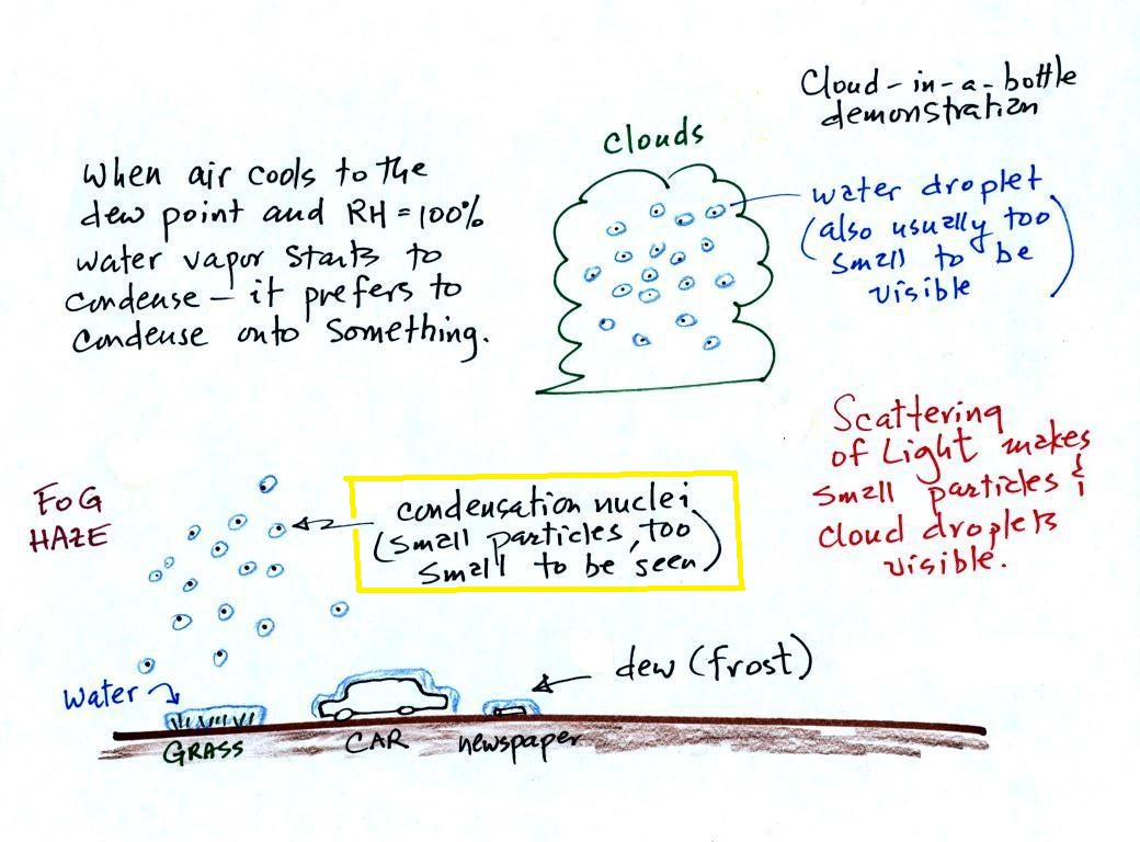
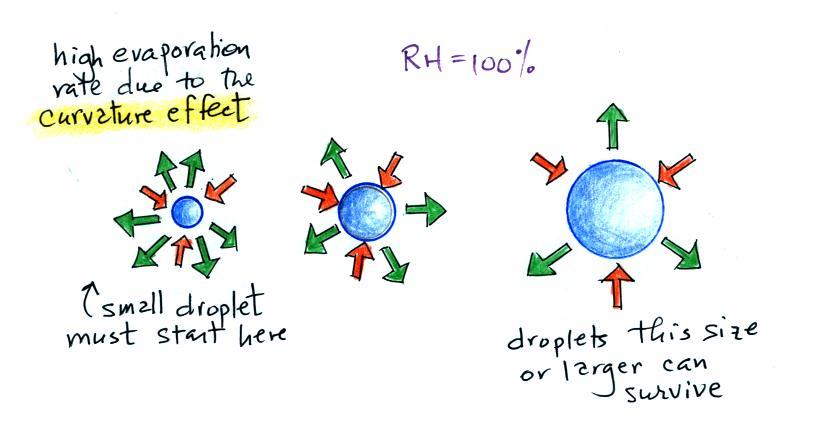
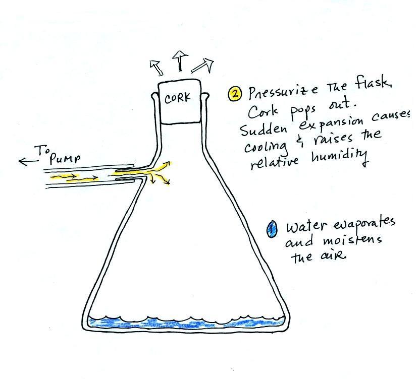
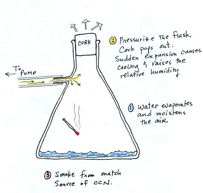
Tuesday Oct. 27, 2015

Music selections from the following before class today: Black Prairie "Taraffa", "Nowhere Massachusetts", Crooked Still "American Tune", Iron and Wine "Lion's Mane" ), "Upward Over the Mountain", Punch Brothers "Sometimes".

The 1S1P Causes of the Seasons reports have finally been graded.  Sorry about the almost month long delay in getting them back to you.  I'll try to have the revised Expt. #1 reports graded by Thursday this week.

The Humidity Variables Optional Assignment was collected today.  The In-class Optional Assignment from a week ago was returned today.  You could earn up to 0.4 pts of extra credit on that assignment.  Here are answers to the questions on that assignment.

I forgot to remind you that the Expt. #3 reports are due next Tuesday.  Some cloudy weather is being forecast for the end of the week so you might think about collecting your data now rather than waiting too much longer.  Once you've collected your data return the materials so that you can  get a copy of the Supplementary Information handout before having to write your experiment report.

The 1S1P Ultraviolet Light and Rainbows/Mirages/Green Flash reports are due Thursday this week.  A couple of new 1S1P Assignment #3 topics are now available.  Those reports are due by Tuesday Nov. 10.

Even though Quiz #3 isn't until Thursday Nov. 5, the Quiz #3 Study Guide is now available in a somewhat preliminary form. 


Here is a picture of Hurricane Patricia as it approached the west coast of Mexico (I haven't been able to track down the original source of this photograph).  Sustained winds intensified from 85 MPH to 200 MPH in a 24-hour period (Oct. 23-24).  Minimum sea level pressure in Patricia dropped to 879 mb, a new record for the Western Hemisphere.

The storm made landfall last Friday evening.  At that time sustained winds were estimated at 165 MPH, still a Category 5 storm on the Saffir Simpson Scale.  The hurricane missed the large cities of Manzanillo and Puerto Vallarta.  The intense center of the hurricane was pretty small (about 15 miles in diameter).  Because the storm was moving quickly and weakened once it have moved past coastal mountains in Mexico the hurricane caused much less damage than had been feared.

Here is an interesting report about Hurricane Patricia and 7 other hurricanes that made landfall in the US or Mexico as Category 5 storms.


Condensation nuclei and the formation of dew, frost, haze, fog, and clouds
Here's a visual summary of a part of what we'll be covering today.


A variety of things can happen when you cool air to the dew point and the relative humidity increases to 100%.  When moist air next to the ground becomes saturated (RH reaches 100%) water vapor condenses onto (or, in the case of frost, is deposited onto) the ground or objects on the ground.  This forms dew, frozen dew, and frost. 

When air above the ground cools to the dew point, it is much easier for water vapor to condense onto small particles in the air called condensation nuclei.  It would be much more difficult for the water vapor to condense and form small drops of pure water.  Both the condensation nuclei and the small water droplets that form on them are usually too small to be seen with the naked eye.  We can tell they are present because they scatter sunlight and make the sky hazy.  As humidity increases dry haze turns to wet haze and eventually to fog.  We'll try to make a cloud in a bottle and you'll be able to better appreciate the role that condensation nuclei play. 

In the second half of the class we will begin to learn how to identify and name clouds.


But first, a demonstration that makes use of evaporative cooling and the fact that saturation mixing ratio (saturation vapor concentration) depends on temperature.

The drinking bird
Evaporative cooling and saturation are involved in the "drinking bird".


I'm very proud of the bird I found online.  It is about twice as big as what you normally find.  The bird is filled with a volatile liquid of some kind (ether?).  Initially the bird's head and butt are the same temperature.  The liquid inside the bird evaporates and saturates the air inside with vapor.

Next you get the bird's head wet.  Instead of water I cheat a little bit and use isopropyl alcohol (rubbing alcohol) because it evaporates more rapidly than water.  The evaporation of alcohol, just as with water, cools the bird's head.

As we saw last week, the saturation mixing ratio (saturation vapor concentration) of water depends on temperature.  Warm air can contain more water vapor than colder air.  The same applies to the ether vapor in this case.  The head is still saturated with vapor but there is less vapor in the cool head than there is in warm saturated air in the bird's butt.


The differences in amounts of vapor produce pressure differences.  The higher pressure at the bottom pushes liquid up the stem of the bird.  The bird becomes top heavy and starts to tip.

At some point the bottom end of the stem comes out of the pool of liquid at the base.  Liquid drains from the neck.


and the bird straightens back up.
 
You can arrange the bird so that when it tips its beak dips into a small cup of water (or alcohol).  This keeps the head moist and cool and the dipping motion could go on indefinitely.
  Here's a video.

We took away the bird's supply of alcohol, the bird warmed up and stopped tipping.


Condensation nuclei and the role they play in cloud droplet formation

The air next to the ground cools during the night.  Sometimes it cools enough to reach the dew point.  Water vapor condenses onto objects on the ground and you find everything covered with dew (or frost) the next morning.  When this happens in the air up above the ground you might think that water vapor would simply condense and form little droplets.  This is not the case; we will find that small particles in the air called condensation play an essential role in cloud (and fog) formation.

it is much 
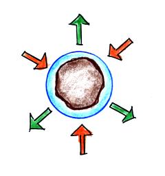
easier for water vapor
to condense onto small particles
called condensation nuclei
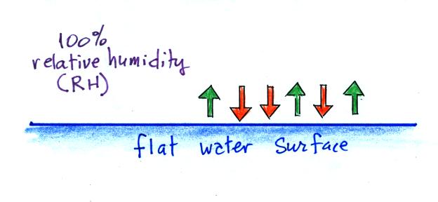
it is much harder for water vapor
to just condense and form
small droplets of pure water
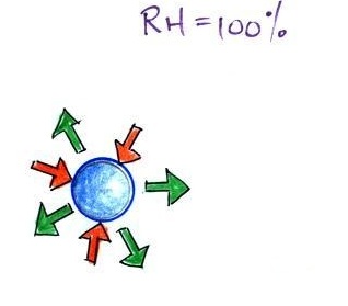


We didn't go into all of the details that follow.
When the air is saturated with water vapor (the relative humidity is 100%) the rates of evaporation and condensation above a flat surface of water will be equal.


There's no real reason for picking three arrows each of evaporation and condensation, the important point is that they are equal when the RH is 100%.

It's hard for water vapor to condense and form a small droplet of water because small droplets evaporate at a very high rate.  This is known as the curvature effect and is illustrated below.


The surface of the smallest droplet above at left has the most curvature and the highest rate of evaporation (6 arrows).  If a small droplet like this were to form, it wouldn't stay around very long.  With it's high rate of evaporation it would quickly evaporate away and disappear. 

The middle droplet is larger and would stick around a little longer because it does not evaporate as quickly.  But it too would eventually disappear.

The drop on the right is large enough that curvature no longer has an effect.  This drop has an evaporation rate (3 arrows) that is the same as would be found over a flat surface of water.  A droplet like this could survive, but the question is how could it get this big without going through the smaller sizes with their high rates of evaporation.  
A droplet must somehow reach a critical size before it will be in equilibrium with its surroundings.

Particles in the air, cloud condensation nuclei (CCN), make it much easier for cloud droplets to form.  The figure below explains why.


By condensing onto a particle, the water droplet starts out large enough and with an evaporation rate low enough that it is in equilibrium with the moist surroundings (equal rates of condensation and evaporation). 

There are always lots of CCN (cloud condensation nuclei in the air) so this isn't an impediment to cloud formation.  The following information is from p. 91 in the ClassNotes.  I did show the following figure in class.


Note that condensation onto certain kinds of condensation nuclei and growth of cloud droplets can begin even when the relative humidity is below 100%.   These are called hygroscopic nuclei.  Salt is an example; small particles of salt mostly come from evaporating drops of ocean water.

Here are some more of the details that we didn't cover in class.  To understand how this can occur we first need to learn about the solute effect


solution droplet
pure water droplet

Water vapor condensing onto the particle in the left figure dissolves the particle.  The resulting solution evaporates at a lower rate (2 arrows of evaporation).  A droplet of pure water of about the same size would evaporate at a higher rate (4 arrows in the figure at right).  Note the rates of condensation are equal in both figures above.  This is determined by the amount of moisture in the air surrounding each droplet.  We assume the same moist (the RH is 100%) air surrounds both droplets and the rates of condensation are equal. 

The next figure compares solution droplets that form when the RH is 100% (left figure) and when the RH is less than 100%.


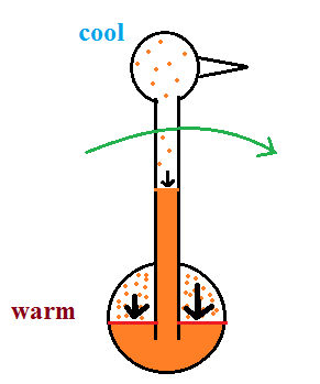
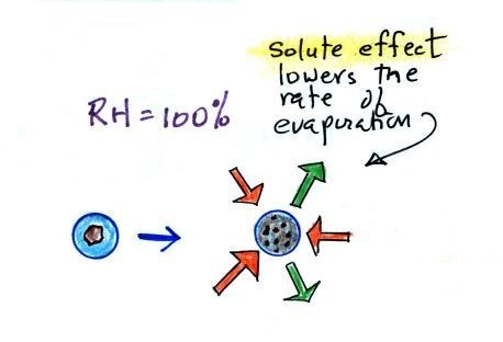
the droplet is able to grow
the droplet is in equilibrium with its surroundings
even when the RH is less than 100%
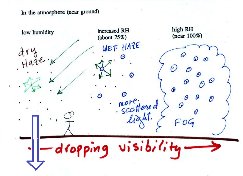
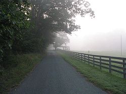

The solution droplet will grow in the RH=100% environment at left.  You can tell the RH is less than 100% in the figure at right because there are now only 2 arrows of evaporation.  But because the solution droplet only has 2 arrows of evaporation it can form and be in equilibrium in this environment.

Don't worry too much about all the details.  The key point is that particles help clouds to form.


The following figure is at the bottom of p. 91 in the ClassNotes and illustrates how cloud condensation nuclei and increasing relative humidity can affect the appearance of the sky and the visibility.

The air in the left most figure is relatively dry.  Even though the condensation nuclei particles are too small to be seen with the human eye you can tell they are there because they scatter sunlight.  When you look at the sky you see the deep blue color caused by scattering of sunlight by air molecules mixed together with some white sunlight scattered by the condensation nuclei.  This changes the color of the sky from a deep blue to a bluish white color.  The more particles there are the whiter the sky becomes.  This is called "dry haze."  Visibility under these conditions might be anywhere from a few miles up to a few tens of miles.


(source of the image above)

A photograph of fairly severe air pollution in Paris that illustrates an extreme case of dry haze (this is more common and more severe in China).   In Paris cars with even numbered license plates weren't allowed into the city on certain days of the week, odd numbers were banned on other days.  Public transportation was free for a short time to try to reduce automobile use.


The middle picture below shows what happens when you drive from the dry southwestern part of the US into the humid southeastern US or the Gulf Coast.  One of the first things you would notice is the hazier appearance of the air and a decrease in visibility.  It isn't that there are more particles.  The relative humidity is higher, water vapor begins to condense onto some of the condensation nuclei particles (the hygroscopic nuclei) in the air and forms small water droplets.  The water droplets scatter more sunlight than just small particles alone.  The increase in the amount of scattered light is what gives the air its hazier appearance. This is called "wet haze."  Visibility now might now only be a few miles.


Thin fog (perhaps even wet haze)
with pretty good visibility

(source of the image)

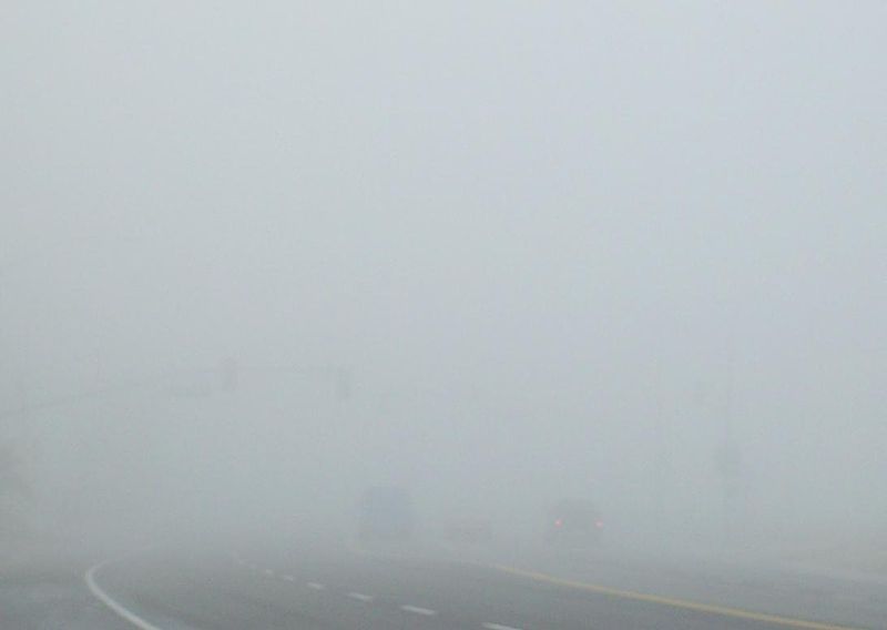
Thick fog
(visibility was less than 500 feet)

(source of the image)


Finally when the relative humidity increases to 100% fog forms and water vapor condenses onto all the condensation nuclei.  Fog can cause a severe drop in the visibility.  The thickest fog forms in dirty air that contains lots of condensation nuclei.  That is part of the reason the Great London Smog of 1952 was so impressive.  Visibility was at times just a few feet!

Making a cloud in a bottle
Cooling air & increasing relative humidity, condensation nuclei, and scattering of light
are all involved in this demonstration.


We used a strong, thick-walled, 4 liter vacuum flask (designed to not implode when all of the air is pumped out of them, they really aren't designed to be pressurized).  There was a little water in the bottom of the flask to moisten the air in the flask.  Next we pressurized the air in the flask with a bicycle pump.  At some point the pressure blows the cork out of the top of the flask.  The air in the flask expands outward and cools.  This sudden cooling increases the relative humidity of the moist air in the flask to more than 100% momentarily and water vapor condenses onto cloud condensation nuclei in the air. 

I like it best when a faint, hard to see, cloud becomes visible.  That's because there is something we can add to the demonstration that will make the cloud much "thicker" and easier to see.


The demonstration was repeated an additional time with one small change.  A burning match was dropped into the bottle.  The smoke from the matches added lots of very small particles, condensation nuclei, to the air in the flask (you could see the swirls of smoke, the small particles scattered light).  The same amount of water vapor was available for cloud formation but the cloud that formed this time was quite a bit "thicker" and much easier to see.  To be honest the burning match probably also added a little water vapor (water vapor together with carbon dioxide is one of the by products of combustion).

I have found a couple of online versions of the demonstration.  The first is performed by Bill Nye "The Science Guy" and is pretty similar to the one done in class.  The second differs only in the way that is used to caused the sudden expansion and cooling of the air (I didn't care much for the music (probably your opinion of the music I play before class) and would recommend turning down the sound while watching the video).

Clouds and climate change
This effect has some implications for climate change.


A cloud that forms in dirty air is composed of a large number of small droplets (right figure above).  This cloud is more reflective than a cloud that forms in clean air, that is composed of a smaller number of larger droplets (left figure).  

Combustion of fossil fuels adds carbon dioxide to the atmosphere.  There is concern that increasing carbon dioxide concentrations (and other greenhouse gases) will enhance the greenhouse effect and cause global warming.  Combustion also adds condensation nuclei to the atmosphere (just like the burning match added smoke to the air in the flask).  More condensation nuclei might make it easier for clouds to form, might make the clouds more reflective, and might cause cooling.  There is still quite a bit of uncertainty about how clouds might change and how this might affect climate.  Remember that clouds are good absorbers of IR radiation and also emit IR radiation.

Clouds are one of the best ways of cleaning the atmosphere.  This is something we mentioned earlier in the semester and you're now in a position to understand it better.


A cloud is composed of small water droplets (diameters of 10 or 20 micrometers) that form on particles ( diameters of perhaps 0.1 or 0.2 micrometers). The droplets "clump" together to form a raindrop (diameters of 1000 or 2000 micrometers which is 1 or 2 millimeters), and the raindrop carries the particles to the ground.  A typical raindrop can contain 1 million cloud droplets so a single raindrop can remove a lot of particles from the air.  You may have noticed how clear the air seems the day after a rainstorm; distant mountains are crystal clear and the sky has a deep blue color.  Gaseous pollutants can dissolve in the water droplets and be carried to the ground by rainfall also.  We'll be looking at the formation of precipitation in more detail later this week.


Finally before we leave the topic of condensation nuclei, here's Mother Nature's version of the cloud in a bottle demonstration.


A brush fire in this picture is heating up air and causing it to rise.  Combustion also adds some moisture and lots of smoke particles to the air.  You can see that initially the rising air doesn't form a cloud (the RH is still less than 100%).  A little higher and once the rising air has cooled enough (to the dew point) a cloud does form.  And notice the cloud's appearance - puffy and not a layer cloud.  Cumulo or cumulus is the word used to describe a cloud with this appearance.  These kinds of fire caused clouds are called pyrocumulus clouds.  The example above is from a Wikipedia article about these kinds of clouds.  The fire in this case was the "Station Fire" burning near Los Angeles in August 2009.  We sometimes see clouds like this in the summer when lightning starts a fire burning in one of the nearby forests.  The pyrocumulus cloud caused by the fire is sometimes the only cloud in the sky.


Identifying and naming clouds - 10  main cloud types
We spent the remainder of the class learning to identify and name clouds. 


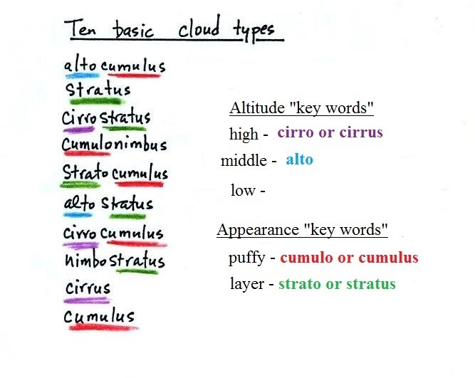
I'm hoping you'll try to learn these 10 cloud names.  There is a smart and a not-so-smart way of learning these names.  The not-so-smart way is to just memorize them.  Because they all sound alike you will inevitably get them mixed up.  In addition to learning the names, I'm hoping you'll be able to sketch each of the clouds and describe them in words.  That gets to be a lot of material to try to just memorize.

A better way is to recognize that all the cloud names are made up of key words. 

Clouds are classified using just two criteria: altitude and appearance. 

There are 2 key words that tell you something about the cloud's altitude and 2 more for cloud appearance (there's a 5th key word for clouds that are producing precipitation wasn't).  My recommendation is to learn the key words and what they mean.
  Then you can usually construct a cloud name by taking key words from both the altitude and appearance groups and combining them.  


Cloud Altitude


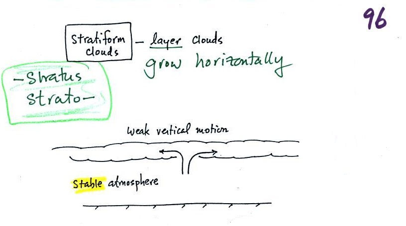
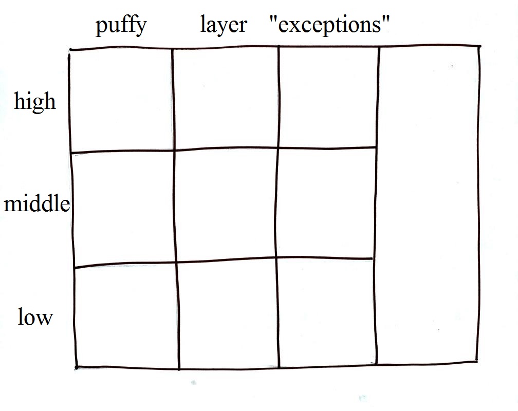
Clouds are grouped into one of three altitude categories: high, middle level, and low. 
It is very hard to just look up in the sky and determine a cloud's altitude.  You will need to look for other clues to distinguish between high and middle altitude clouds.  We'll learn about some of the clues when we look at cloud pictures today and more so on Thursday.

Cirrus or cirro identifies a high altitude cloud.  There are three types of clouds found in the high altitude category..

Alto in a cloud name means the cloud is found at middle altitude.  The arrow connecting altostratus and nimbostratus indicates that they are basically the same kind of cloud.  When an altostratus cloud begins to produce rain or snow its name is changed to nimbostratus.  A nimbostratus cloud may become somewhat thicker and lower than an altostratus cloud.  Sometimes it might sneak into the low altitude category.

There is no key word for low altitude clouds.  Low altitude clouds have bases that form 2 km or less above the ground.  The summit of
Mt. Lemmon in the Santa Catalina mountains north of Tucson is about 2 km above the valley floor.  Low altitude clouds will have bases that form at or below the summit of Mt. Lemmon.

Examples of puffy patchy (cumuliform) clouds found at different altitudes


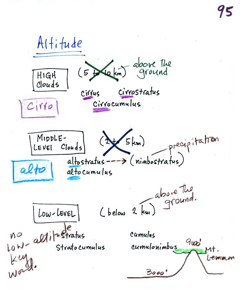
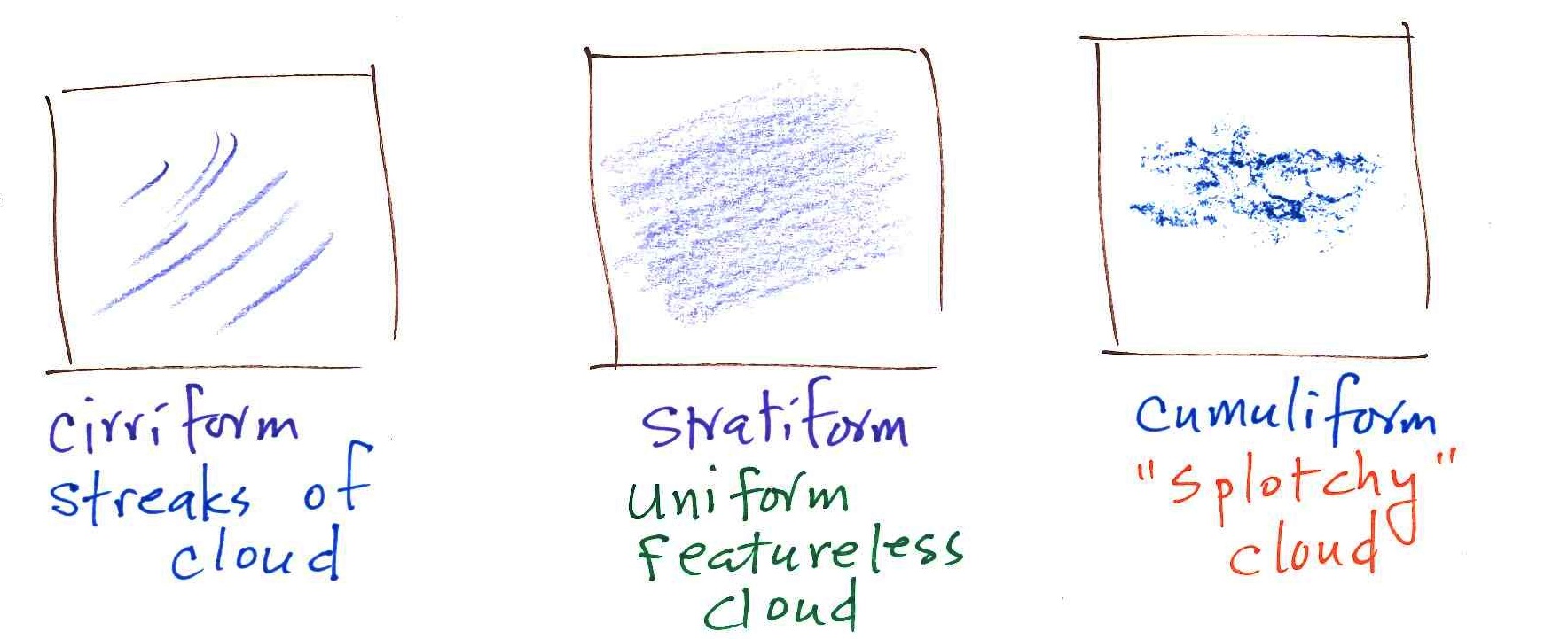
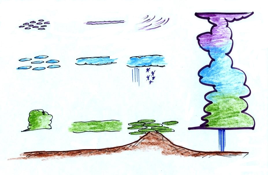
high altitude cloud
the patches of cloud are small because they are far away
This is
a cirrocumulus cloud, cirro means high altitude, cumulus means "patchy".

The air is cold at high altitude and doesn't contain much water vapor.  High altitude clouds are thin, there's not much raw material available to make the cloud.
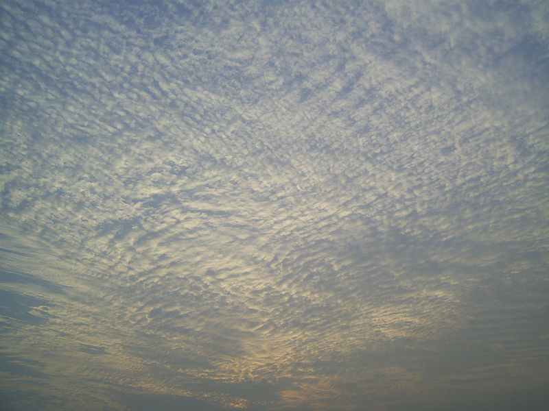
middle altitude cloud
the patches of cloud are bigger because they closer to the ground.

This is an altocumulus cloud.

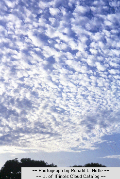
low altitude cloud
cumulus clouds
(there is no key word for low altitude)


Cloud Appearance


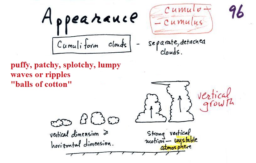
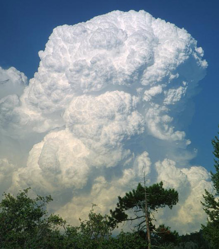
Cumulus clouds are often described as resembling a head of cauliflower.  Clouds can have a patchy of puffy (or lumpy, wavy, splotchy or ripply) appearance.  These are cumuliform clouds and will have cumulo or cumulus in their name.  These clouds are as tall or taller than they are across, in an unstable atmosphere cumuliform clouds will grow vertically and turn into thunderstorms.  Strong thunderstorms can produce dangerous weather.

Here are some examples of the different textures or features that characterize cumuliform clouds:


Cumuliform cloud
source

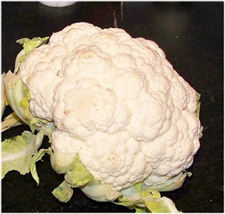
Head of cauliflower

source
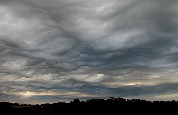
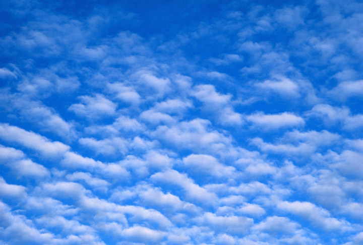

lumpy cloud
source

patchy appearing cloud
source


ripples or waves
note the size, this is probably a middle or low level cloud
source

This is probably a middle or high level cloud because the ripples are smaller (higher and further away)
source


Stratiform clouds grow horizontally and form layers.  They form when the atmosphere is stable. 


You'll find strato or stratus in the cloud name. Stratiform - as in rock strata, or stratosphere.


rock strata at the Grand Canyon
source


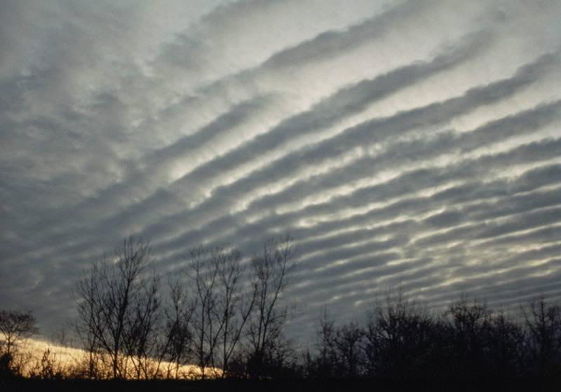
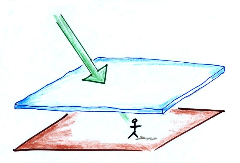
A side view of a layer cloud.   How much sunlight is able to shine through the cloud depends on how thick the cloud is (and a clue about the cloud's altitude).  A person on the ground may or may not cast a shadow.

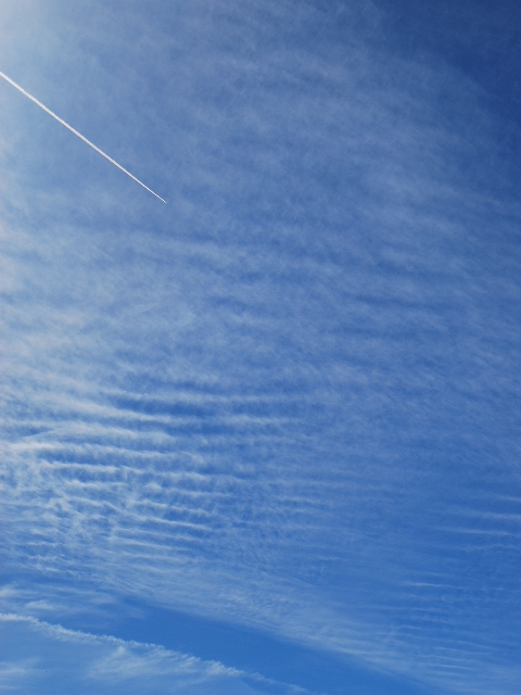
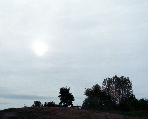
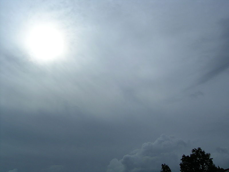
A view from the ground looking up at the sun through a middle level layer cloud.  The sun is visible but blurred.  (source)


Cloud appearance comparison
You'll become more familiar with different types of cloud appearances by looking at clouds and cloud photographs.

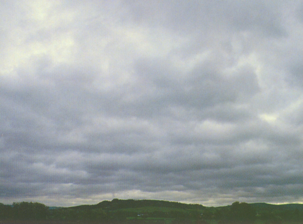
featureless Stratiform cloud
(layer cloud)

an altostratus cloud
an in between case,
a "lumpy layer cloud"

this is named stratocumulus

patchy, puffy Cumuliform cloud
cumulus clouds


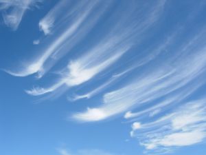
cirriform is sometimes used
as an appearance key word

source of this image
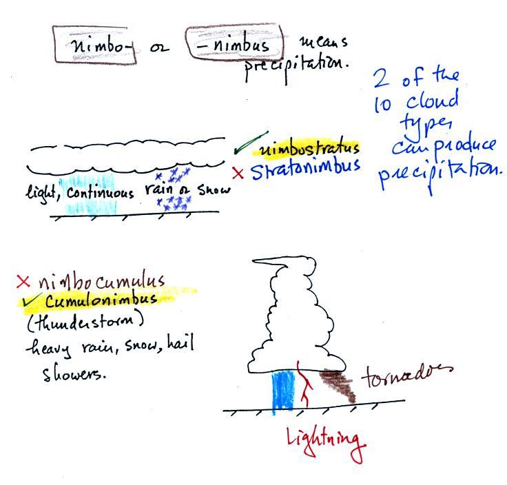
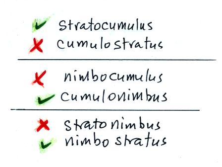
Note the stratocumulus cloud name is formed by combining the two key words for appearance which is a little unusual.

Trying to draw the different clouds will help you to visualize the differences in appearance.


To draw the cirriform cloud you could use the sharp end of a pencil.  Using the side of a pencil as you would if you were shading in or coloring in a picture was used in the center picture.  To make the right picture I put a bunch of ink on the side of a sponge and pressed it against the paper.

There's a 5th key word that I have been neglecting to mention.


Nimbo or nimbus, means precipitation (it is also the name of a local brewing company).  Only two of the 10 cloud types are able to produce (significant amounts of) precipitation.  It's not as easy as you might think to make precipitation.  We'll start to look at precipitation producing processes in the next class.

Nimbostratus clouds tend to produce fairly light precipitation over a large area.  Cumulonimbus clouds produce heavy showers over localized areas.  Thunderstorm clouds can also produce hail, lightning, and tornadoes.  Hail would never fall from a Ns cloud. 

While you are still learning the cloud names you might put the correct key words together in the wrong order (stratonimbus instead of nimbostratus, for example).  You won't be penalized for those kinds of errors in this class because you are putting together the right two key words.


No penalty for putting the key words in the wrong order


We've covered a fair amount of information and we're going to be looking at a lot of cloud pictures on Thursday.  You'll need to organize this material is a clear compact way.  Here's something that may help.


Take out a blank sheet of paper and draw a chart like shown above at left.  There are 10 boxes, one for each of the cloud types.  The three altitude categories run along the vertical side of the chart and the two appearance categories run along the top (note the exceptions column).  This will force you to remember the key words.  Then you should be able to put a name in each box, sketch each of the clouds (as done above at right), and a short written description of each cloud. 

A final note, something not mentioned in class today, the colors used on the clouds at right.  Green is indicating clouds that are warm (above freezing) and made up of only water droplets.  Purple or violet indicates very cold high altitude clouds composed of only ice crystals.  The middle level clouds shaded blue are colder than freezing and contain both unfrozen water droplets and ice crystals.  That's a little surprising but turns out to be a very important part of precipitation producing (and lightning producing) clouds.