Tuesday Oct. 25, 2011
click here to
download today's notes in a more printer friendly format.
Only a single short music selection before class today. You
heard "Big Noise from Winnetka" performed by New Orleans' Own Dukes of
Dixieland (this
version on YouTube is a little longer than the one played in
class). I heard the song at the Pilobolus
dance performance at Centennial Hall Sunday night.
The
Experiment #2 reports have been graded and were returned in
class today. You now have two weeks to revise your report if you
want to (it's not required). Revised reports are due on or before
Tuesday Nov. 7. Please return
your original report with your revised report.
Grade summaries were also distributed in class today. You'll
find more information at the end of today's notes.
The Controls of Temperature and Humidity Optional Assignments were
collected today.
And something like an optional assignment was handed out in
class. It is just some (reasonably tough) questions about some of
the humidity concepts we have been covering. You'll find the
answers to the questions at the end of today's notes. But try the
questions yourself before looking at the answers. If you can
answer all the questions on this handout you have a pretty solid and
complete understanding of this topic. You can download a copy of
the handout here.
Here are a couple sketches of the day
Evaporative
cooling will make you feel cold if
you get
out of a swimming pool on a warm dry day.
You won't
feel as cold if the air is humid and the relative humidity is high (the
water on your body still evaporates but some of the moisture in the air
condenses and tries to warm you up).
Sling
psychrometers
make use of this difference in cooling to
measure relative humidity and
dew point.

Going back to something we covered
earlier
in the semester. At left in the figure above a
40 F
day with 30 MPH winds will feel colder (because of
increased transport of energy away from your body by convection) than a
40 F
day
with no wind. The wind chill
temperature tells you how much colder it will feel ( a thermometer
would measure the same temperature on both the calm and the windy
day). If your
body isn't able to keep up with the heat loss, you can get hypothermia and
die.
Now something similar but new.
Your body tries to stay cool by perspiring. You
would feel
hot on
a dry 105 F day. You'll feel even hotter on a 105 F day with high
humidity; the net evaporation won't be as high. The heat index
measures how much hotter you'd feel. The
combination of heat and high humidity is a serious, potentially deadly,
weather hazard
because it can cause heatstroke
(hyperthermia).
When the
relative humidity in air above the ground (and away from objects on the
ground) reaches 100%, water vapor will condense onto small particles
called condensation nuclei. It would be much harder for the water
vapor to just condense and form small droplets of pure water (you can
learn why that is so by reading the
top
of
p.
92 in the
photocopied class notes). There are always lots of CCN (cloud
condensation nuclei in the air) so this isn't an impediment to cloud
formation.
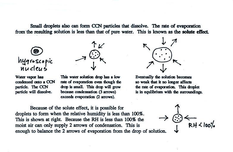
Water vapor will condense onto
certain kinds of condensation
nuclei
even when the relative humidity is below 100% (again you will find some
explanation of this on the bottom of p. 92).
These
are
called
hygroscopic
nuclei. Salt is an example; small particles of salt
mostly come from evaporating drops of ocean water.
A short homemade video (my first actually) that showed how water
vapor would,
over time,
preferentially
condense onto small grains of salt rather than small spheres of
glass. The
figure
below
wasn't
shown
in
class.
The start of the video at left
showed the small grains
of
salt were
placed on a platform in a petri dish
containing water. Some small spheres of glass were placed in the
same
dish. After about 1 hour small drops of water had formed around
each
of the grains of salt but not the glass grains (shown above at
right).
In
humid parts of the US, water will condense onto the grains of
salt
in a salt shaker causing them to stick together. You'll often see
grains of rice
mixed with the salt. They might absorb moisture or may just keep
the salt from "clumping" together. In any event the rice allows
the salt to flow
freely out of the shaker when needed.
The
following figure is at the bottom of p. 91 in the ClassNotes.
This figure shows
how
cloud
condensation nuclei and increasing relative humidity can affect the
appearance of the sky and the visibility.
The air in the left most figure is relatively dry. Even
though
the condensation nuclei particles are too small to be seen with the
human eye you can tell they are there because they scatter
sunlight. When you look at the sky you see the deep blue color
caused by scattering of sunlight by air molecules mixed together with
some white
sunlight scattered by the condensation nuclei. This changes
the color of the sky from a deep blue to a bluish white
color. The more particles there are the whiter the sky
becomes. This is called "dry haze." Visibility under these
conditions might be a few tens of miles.
The middle picture shows what happens when you drive from the dry
southwestern part of the US into the humid
southeastern US or the Gulf Coast. One of the first things you
would notice is the
hazier
appearance of the air and a decrease in visibility. Because the
relative humidity is high,
water vapor begins to condense onto some of the condensation nuclei
particles (the hygroscopic nuclei) in the air and forms small water
droplets. The water droplets scatter more sunlight than just
small particles alone. The increase in the amount of scattered
light is what gives the air its hazier appearance. This is called "wet
haze." Visibility now might now be 10 miles perhaps a little less.
Finally when the relative humidity increases to 100% fog
forms.
Fog can cause a severe drop in the visibility. The thickest fog
forms in dirty air that contains lots of condensation nuclei.
That is part of the reason the Great London Smog of 1952 was so
impressive. Visibility was at times just a few feet! We
could see this effect in the cloud-in-a-bottle demonstration that is
described below.
Cooling air, changing relative humidity, condensation
nuclei, and scattering of
light are all involved in this demonstration.
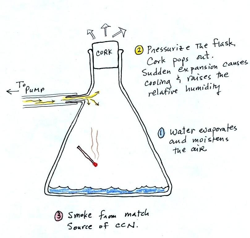
We used a strong, thick-walled, 4 liter flask (vaccum flasks
like this are designed to not implode when all of the air is pumped out
of them, they aren't designed to not explode when pressurized).
There
was a little
water in the bottom of the flask to moisten the air in the flask.
Next we pressurized the air in the flask with a bicycle pump. At
some point the
pressure blows the cork out of the top of the flask.
The air in
the flask expands outward. The expansion causes the air to cool
and the sudden cooling
increases the
relative humidity of the moist air in the flask to 100% ( probably more
than 100% momentarily ) and water vapor condenses onto cloud
condensation nuclei in
the air. A very faint cloud became visible at this point.
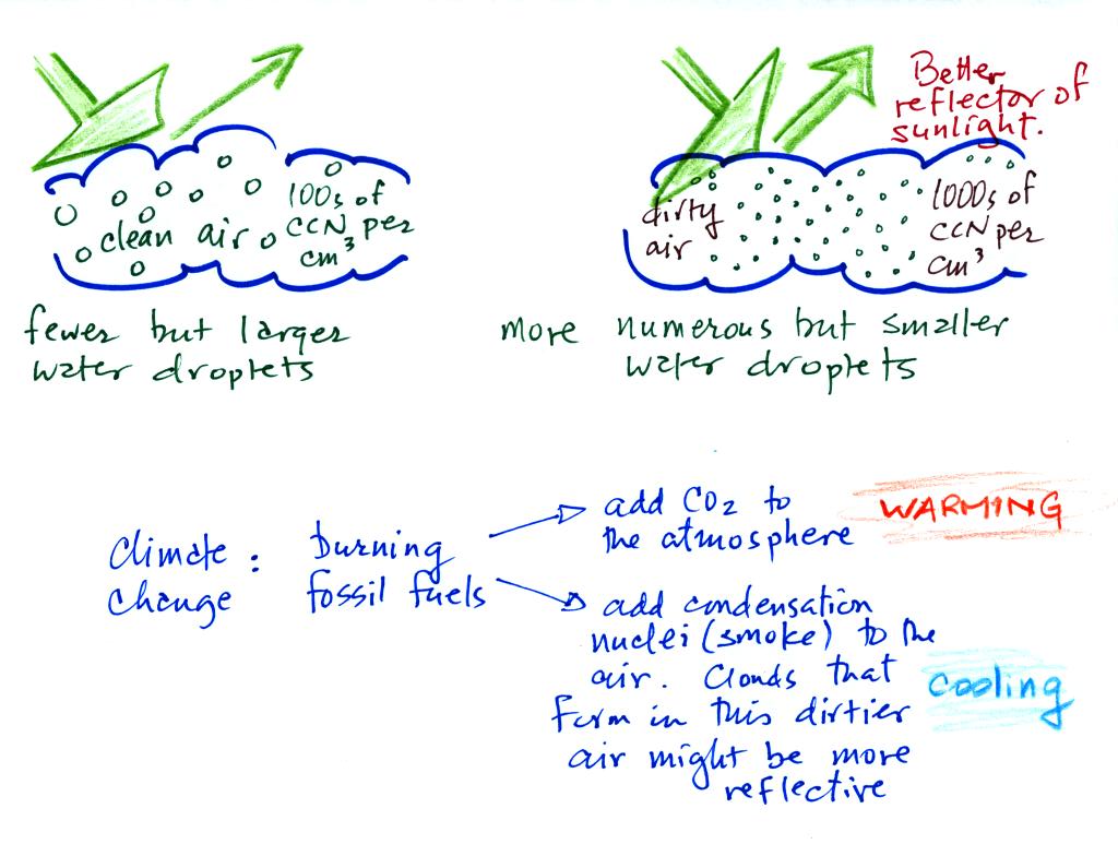
This effect has some implications for climate change.
A cloud that forms in dirty air is composed of a large
number of small droplets (right figure above). This cloud is more
reflective
than a cloud that forms in clean air, that is composed of a smaller
number of larger
droplets (left figure).
Combustion of fossil fuels adds carbon dioxide to the atmosphere.
There is concern that increasing carbon dioxide concentrations (and
other greenhouse gases) will
enhance the greenhouse effect and cause global warming.
Combustion also adds condensation nuclei to the atmosphere (just like
the burning match added smoke to the air in the flask). More
condensation nuclei might make it easier for clouds to form, might make
the clouds more reflective, and might cause cooling. There is
still quite a bit of uncertainty about how clouds might change and how
this
might affect climate. Remember that clouds are good absorbers of
IR radiation and also emit IR radiation.
Clouds are
one of
the best ways of cleaning the atmosphere

A cloud is composed of small water droplets (diameters of 10 or 20
micrometers) that form on particles ( diameters of perhaps 0.1 or 0.2
micrometers). The droplets "clump"
together to form a
raindrop (diameters of 1000 or 2000 micrometers which is 1 or 2
millimeters), and the raindrop carries the particles to the
ground.
A typical raindrop can contain 1 million cloud droplets so a single
raindrop
can remove a lot of particles from the air. You may have noticed
how clear the air seems the day after a rainstorm; distant mountains
are crystal clear and the sky has a deep blue color. Gaseous
pollutants can dissolve in the water droplets and be carried to
the ground by rainfall also. We'll be looking at the formation of
precipitation late next week.
We spent the remainder of the period learning
how to identify
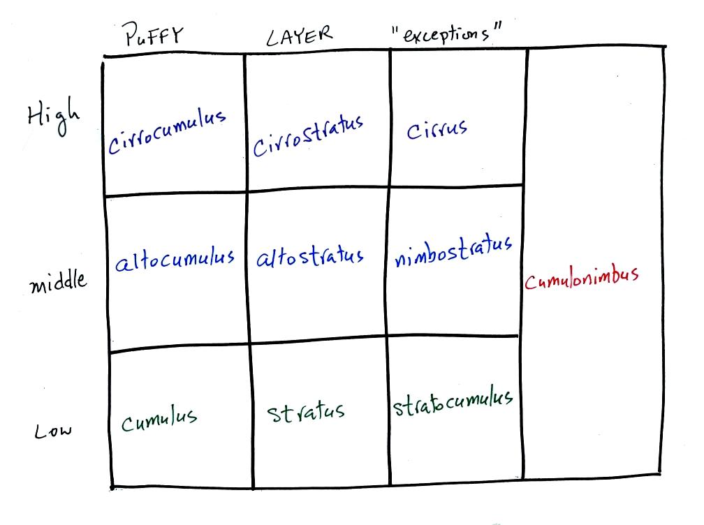
and name clouds. The ten main cloud types are listed below
(you'll find this list on p.
95 in
the photocopied class notes).
I'm hoping you'll try to learn these 10 cloud
names. There is a smart and a not-so-smart way of
doing that. The not-so-smart way is to just memorize them.
Because they all sound alike you
will inevitably get them mixed up. A better way is to recognize
that all
the cloud names are made up of key words. The 5 key words tell
you something about the cloud's altitude and appearance.
Drawing a chart like this on a blank
sheet of
paper is a good way to
review
cloud identification and classification.
There are 10 boxes in this chart, one
for each of the 10 main cloud types. Eventually, you should be
able to
put a cloud name, a sketch, and a short written description in each
square.
Clouds are classified
according to the altitude at which they form and
the
appearance of the cloud. There are two key words for altitude and
two key
words for appearance.
Clouds are grouped into one of three altitude
categories: high, middle
level,
and low. It is
very hard to just look up in the sky and determine a cloud's
altitude. You will need to look for other clues to distinquish
between high and middle altitude clouds. We'll learn about some
of the
clues when we look at cloud pictures later in the class.
Cirrus or cirro
identifies a high altitude
cloud. There are three types of clouds found in the high altitude
category..
Alto in a cloud name means the cloud is found at middle altitude.
The
arrow connecting altostratus and nimbostratus indicates that they are
basically the same kind of cloud. When an altostratus cloud
begins to produce rain or snow
its
name is changed to nimbostratus. A nimbostratus cloud is also
often somewhat
thicker and lower than an altostratus cloud. Sometimes it might
sneak into the low altitude category.
There is no key word for low altitude clouds. Low altitude clouds
have
bases that form 2 km or less above the ground. The summit of Mt. Lemmon in the Santa Catalina mountains
north of Tucson is about 2 km above the valley floor. Low altitude clouds will have bases that form at or
below the
summit of Mt. Lemmon.
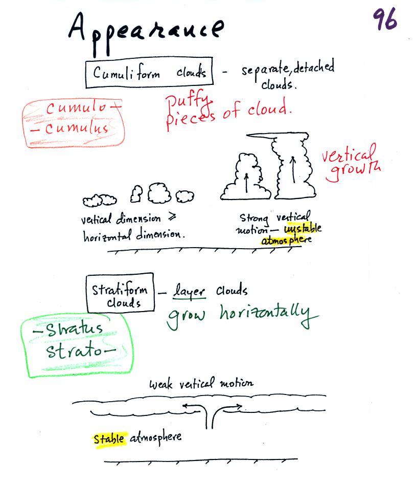
Clouds can have a patchy of puffy (or lumpy,
wavy, or ripply) appearance.
These
are cumuliform clouds and will have cumulo
or cumulus
in their name. In an unstable atmosphere cumuliform clouds will
grow vertically.
Strong thunderstorms can produce dangerous severe weather.
Stratiform clouds grow horizontally and
form
layers. They form when the atmosphere is stable.

The last key word, nimbo
or nimbus, means
precipitation (it is also the name of a local brewing company). Only
two of the 10 cloud types are able to produce
(significant
amounts of) precipitation. It's not as easy as you might think to
make precipitation. We'll start to look at precipitation
producing processes in class on Wednesday.
Nimbostratus clouds tend to produce
fairly light precipitation over a
large
area. Cumulonimbus clouds produce heavy showers over localized
areas. Thunderstorm clouds can also produce hail, lightning, and
tornadoes. Hail would never fall from a
Ns
cloud.
While you are still learning the cloud names you might put the correct
key
words together in the wrong order (stratonimbus
instead of nimbostratus, for example). You won't be penalized for
those kinds of errors
in this
class because you are putting together the right two key words.
Here's
the cloud chart from earlier. We've added the three altitude
categories
along the vertical side of the figure and the two appearance categories
along
the top. By the end of the class we will add a picture to each of
the
boxes.
Next
we started to look at 35 mm slides of most of the 10 cloud
types. This didn't work very well because there's only one
screen in the Gallagher Theater and I wanted to keep the written
descriptions of the cloud types (see pps
97-98 in the ClassNotes) on the screen at the same time as the
photographs. Also I
don't
have
digital copies of my slides and
can't put them online. So I've tried to find some good online
photographs
of all the cloud types we discussed in class. The photographs that
follow weren't shown in class.
high altitude clouds
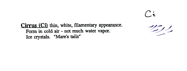
High altitude
clouds
are thin
because the air at high altitudes is very cold and cold air can't
contain much
moisture (the saturation mixing ratio for cold air is very
small). These
clouds are also often blown around by fast high altitude winds.
Filamentary means "stringy" or "streaky". If you
imagine trying to paint a Ci cloud you
would dip a
small pointed brush in white paint brush it quickly and lightly across
a blue
colored canvas. Here are some pretty good photographs of cirrus
clouds (they are all from a Wikipedia article on
Cirrus Clouds)
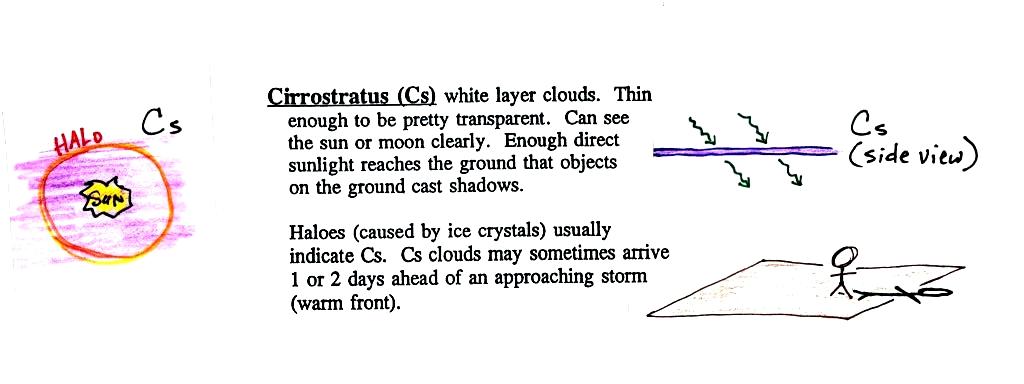
A
cirrostratus cloud is a thin uniform white layer cloud (not purple as
shown in
the figure) covering part or all of the sky. They're so thin you
can
sometimes see blue sky through the cloud layer. Haloes are a
pretty sure
indication that a cirrostratus cloud is overhead. If you were
painting Cs
clouds you could dip a broad brush in watered down white paint and then
paint back and forth across the canvas.
If you spend
enough time outdoors looking up at the sky you will
eventually see all 10 cloud types. Cirrus and cirrostratus clouds
are fairly common. Cirrocumulus
clouds are
a little more unusual. The same is true with animals,
some
are
more
commonly
seen than others.
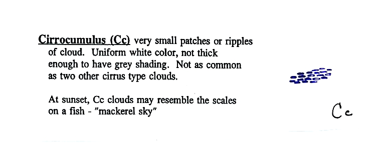
To
paint a Cc cloud you would dip a sponge in white paint and press it
gently
against the canvas. You would leave a patchy, splotchy appearing
cloud
(sometimes you might see small ripples). It is the patchy (or
wavy)
appearance that makes it a cumuliform cloud.
The table below compares cirrostratus (the cloud on the left
without texture) with a good example of a cirrocumulus cloud (the
"splotchy" appearing cloud on the right). Both photographs are
from the Wikipedia article mentioned earlier.
Now a detour to
briefly discuss haloes and sundogs.
Haloes
are
produced when white light
(sunlight or moonlight) enters a 6 sided ice crystal. The light
is refracted (bent). The amount
of
bending depends on the color (wavelength) of the light
(dispersion). The
white light is split into colors just as light passing through a glass
prism. Crystals like this (called columns) tend to be randomly
oriented in the air. That is why a halo forms a complete ring
around
the sun or moon.

This is a flatter crystal and is
called a plate. These crystals
tend to
all be horizontally oriented and produce sundogs which are only a
couple of small sections of a complete halo. A sketch of a
sundog is
shown below.
Sundogs are
pretty
common and are
just patches of light seen to the right and left of the rising or
setting sun.
A very bright halo is shown at upper left with the sun partially
blocked by the roof of a building. Note the sky inside the halo
is darker
than the sky outside the halo. The halo at upper right is more
typical of what you might see in Tucson. Thin cirrus clouds may
appear thicker at sunrise or sunset because the sun is shining through
the cloud at a steeper angle. Very bright sundogs (also known as
parhelia) are shown in the photograph at bottom left. The sun in
the photograph at right is behind the person. You can see both a
halo and a sundog (the the left of the sun) in this photograph. Sources
of
these
photographs:
upper
left, upper
right, bottom row.
This is as far as we got in class (actually a little bit
further). We go over this quickly at the beginning of class on
Thursday and we'll cover the remaining photographs. I'm going to
include them here just so that everything is together in one place.
Now we'll turn our attention to
middle altitude clouds
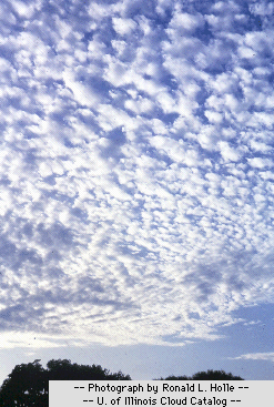
Altocumulus
clouds
are
pretty
common.
Note since it is
hard to
accurately judge altitude, you must rely on cloud element size
(thumbnail size
in the case of Ac) to determine whether a cloud belongs in the high or
middle
altitude category. The cloud elements in Ac clouds appear
larger
than in Cc because the cloud is closer to the ground. A couple of
good photographs are shown below (source: Ron Holle for WW2010 Department of
Atmospheric Sciences, the University of Illinois at Urband-Champaign).
There's a much larger collection in this gallery
of
images. The fact that there are so many examples is an
indication of how common this particular type of cloud is.
It is the patches or ripples of cloud, texture, that makes these
cumuliform clouds.
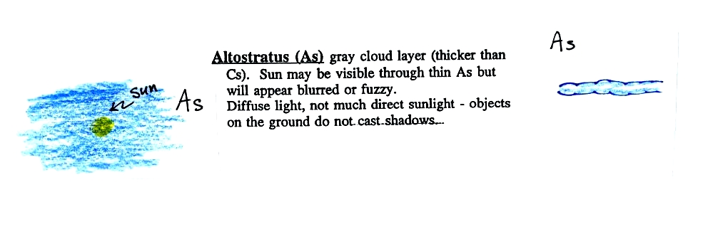
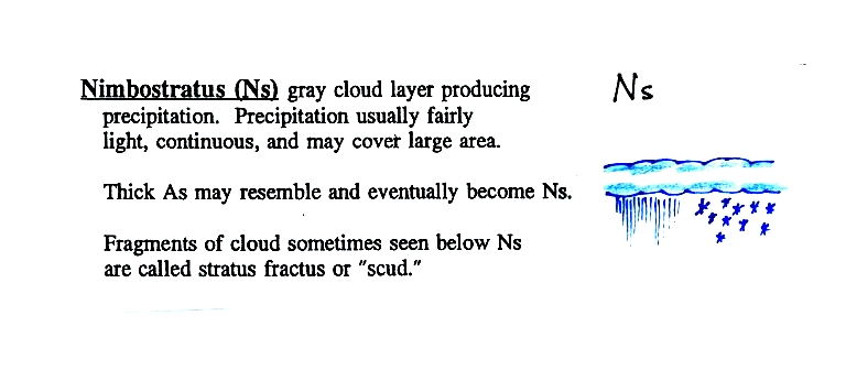
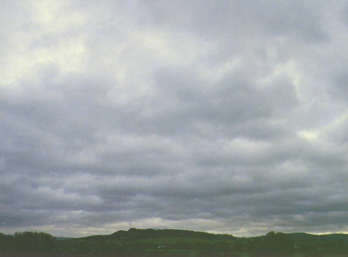
When (if) an
altostratus cloud begins to produce
precipitation, its
name is changed to nimbostratus.
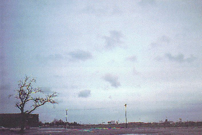
Unless you were there and could check to see if it was raining or
snowing
you might call this an altostratus or even a stratus cloud. The
smaller darker cloud fragments that are below the main layer cloud are
"scud" (stratus fractus) clouds (source
of this image).
low
altitude
clouds
This cloud name
is a
little
unusual because the two key words for cloud appearance have been
combined, but that's a good description of this cloud type - a "lumpy
layer cloud".
Because they are closer to the ground, the
separate
patches of
Sc are about fist size. The patches of Ac, remember, were about
thumb
nail size.(sources of the photographs:
left photo, right
photo ). If the cloud fragments in the photo at right are
clearly separate from each other (and you would need to be underneath
the clouds so that you could look up) these clouds would probably be
"fair weather" cumulus. If the patches of cloud are touching then
stratocumlus would be the correct designation.

I didn't show any photos of stratus
clouds in class. Other than being closer to the ground it really
isn't much different from altostratus or nimbostratus.
A photograph of "fair weather" cumulus
on the left (source)
and
cumulus
congestus
or towering cumulus on the right (source).
Note
how
blue the sky is in the picture at left. The air must be
pretty clean and the visibility is excellent. The sky isn't as
blue and the air appears hazier in the picture at right.
Thunderstorms fit into all three
altitude categories

There are lots of
distinctive
features on cumulonimbus clouds including the flat anvil top and the
lumpy mammatus clouds sometimes found on
the underside of the
anvil.
Cold dense
downdraft winds hit the ground below a
thunderstorm and
spread out horizontally underneath the cloud. The leading edge of
these
winds produces a gust front (dust front might be a little more
descriptive).
Winds at the ground below a thunderstorm can exceed 100 MPH, stronger
than many
tornadoes.
The top of a
thunderstorm (violet in the sketch) is cold enough that it will
be
composed of just ice crystals. The bottom (green) is composed of
water
droplets. In the middle of the cloud (blue) both water droplets
and ice
crystals
exist together at temperatures below freezing (the water droplets have
a hard
time freezing). Water and ice can also be found together in
nimbostratus
clouds. We will see that this mixed phase region of the cloud is
important
for precipitation formation. It is also where the electricity
that
produces lightning is generated.
The top left
photo shows a thunderstorm viewed from space (source: NASA Earth Observatory).
The
flat
anvil
top is the dominant feature. The remaining three
photographs are from the UCAR
Digital
Image
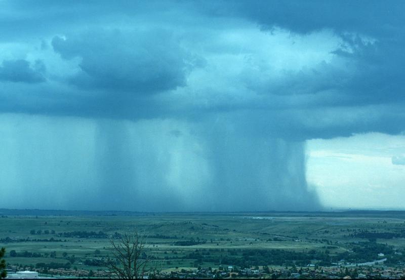
Library. The bottom left photograph shows heavy
by localized rain falling from a thunderstorm. At bottom right is
a photograph of mammatus clouds found on the underside of the flat
anvil cloud.
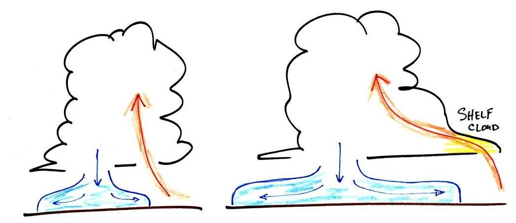
Cold air spilling
out
of the base
of a thunderstorm is just beginning to move outward from the bottom
center of the
storm in the picture at left. In the picture at right the
cold air
has moved further outward and has begun to get in the way of the
updraft.
The updraft is forced to rise earlier and a little ways away from the
center of
the thunderstorm. Note how this rising air has formed an extra
lip of
cloud. This is called a shelf cloud.
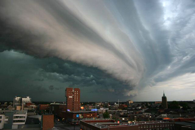
Shelf clouds can sometimes be quite
impressive (the picture above is from a Wikipedia article on
arcus clouds)
Here's the complete hand drawn cloud chart.
And a link to a cloud
chart on a National Weather Service webpage. It has
photographs of all the main cloud types we have discussed.
I've moved the discussion of the grade summaries to the beginning of the Thursday Oct. 27 online notes.
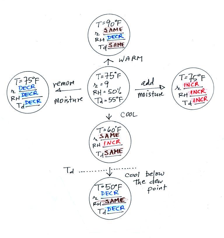
Here are the answers to humidity practice questions that were on a
class
handout. It's not an optional assignment, just some additional
practice with some of the humidity topics we've been covering.
Mixing ratio and dew point temperature have the same job - to tell
you how much moisture is actually in the air. The city with the
highest dew point will also have the highest mixing ratio.
The smaller the difference between the air temperature and the dew
point temperature, the higher the relative humidity.
Warm air has a higher saturation mixing ratio than cooler air.
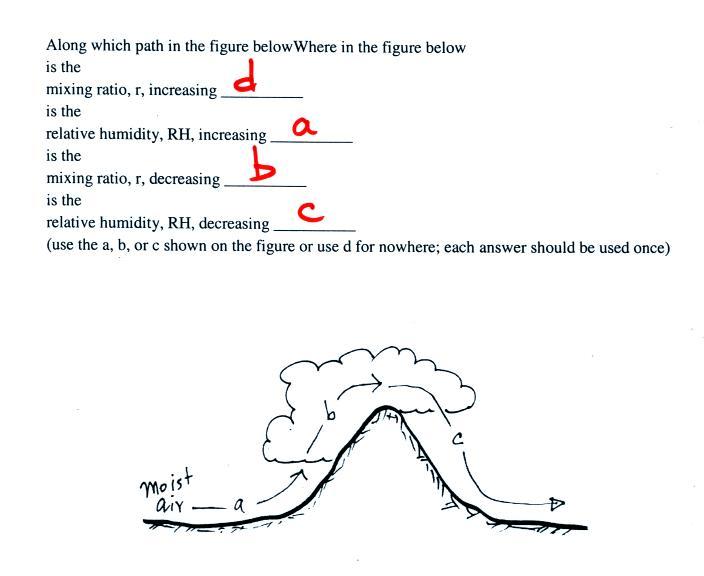
The rising air is cooling and the relative humidity is increasing
along Path A. The RH is 100% along Path B. Because the air
is being cooled below the dew point along Path B, the air is losing
water vapor (it's condensing) and the mixing ratio is decreasing.
The air is sinking and warming along Path C. Warming the air will
cause the relative humidity to decrease. Nowhere in the picture
is water vapor being added to the air (nowhere is the mixing ratio
increasing).