| humidity variable |
mixing ratio |
saturation
mixing ratio |
relative
humidity |
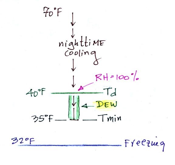
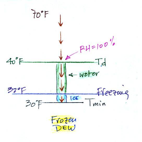
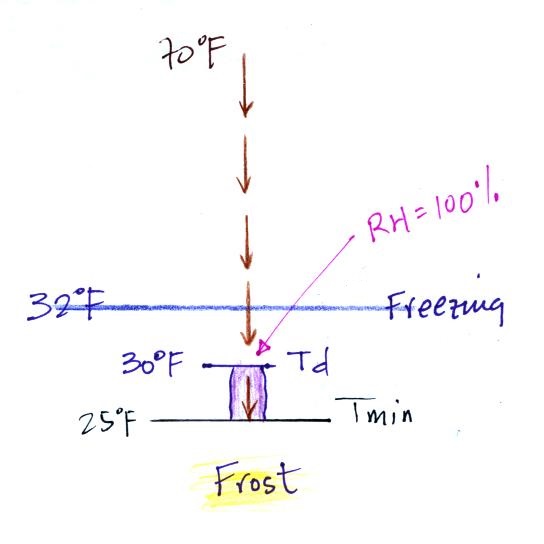
dew point
temperature |
| "job" |
how much water vapor is actually in
the air |
the maximum amount of water vapor
that can be found in air |
how close is the air to being filled to
capacity with water vapor |
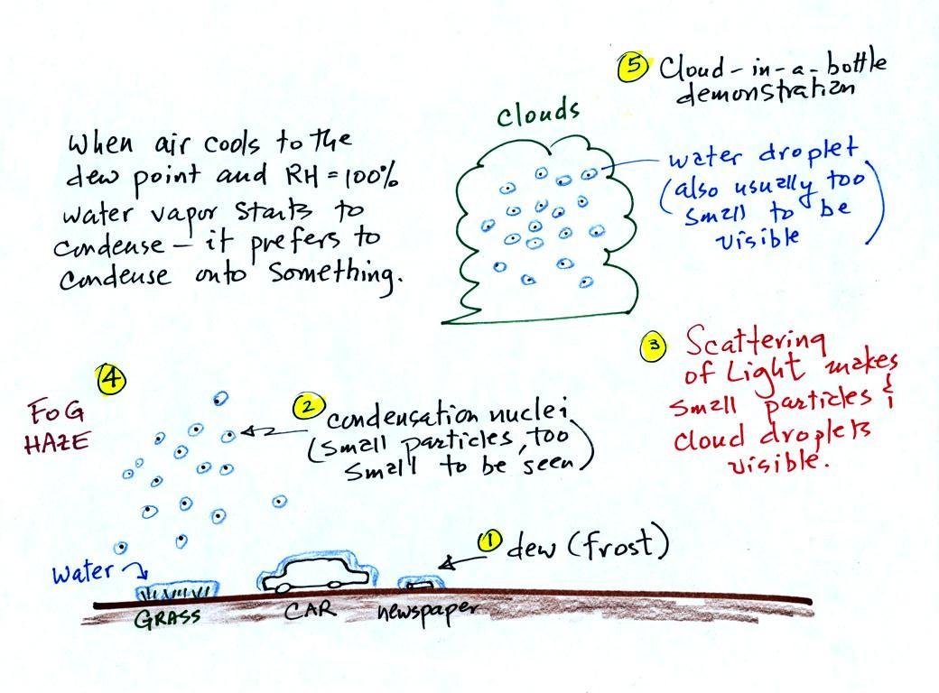
1. like mixing ratio it gives an idea of the
actual amount of water vapor in the air 2. cool the air to its dew point and RH becomes 100% |
| units |
g/kg |
g/kg |
% |
oF |
| to increase value |
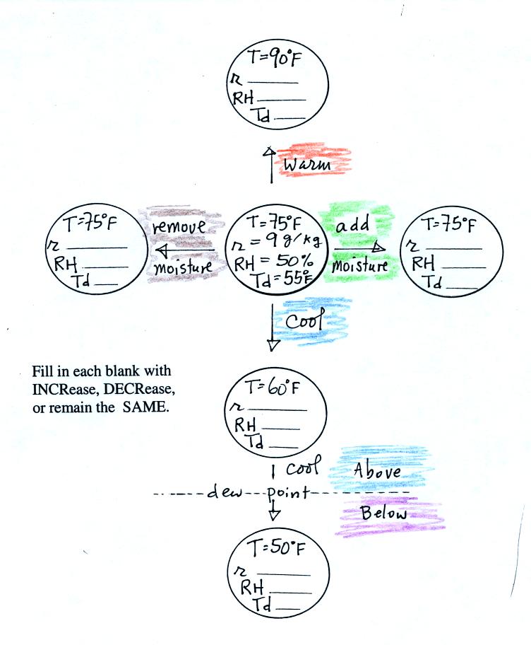
add water vapor
|
warm
the air |
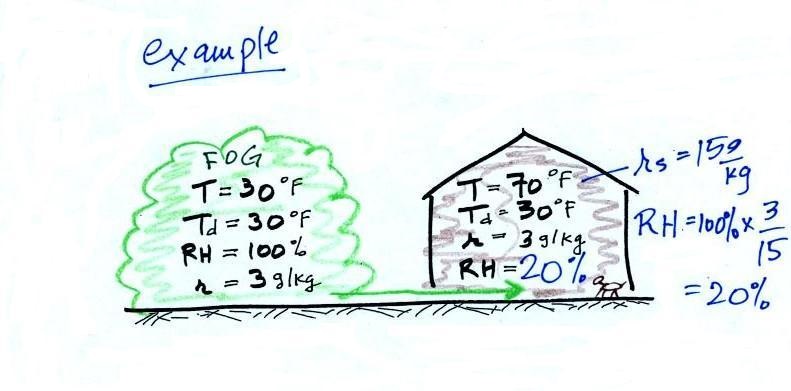
RH = r / rs
incr r or decr
rs
|
same as the mixing ratio |
| to decrease value |
remove
water vapor (or cool the air below the dew point) |
cool
the air |
decr
r or incr rs |

 |
 |
 |
 |
 |
 |