A short video showed how water vapor would, over time, preferentially condense onto small grains of salt rather than small spheres of glass. The figure below wasn't shown in class.
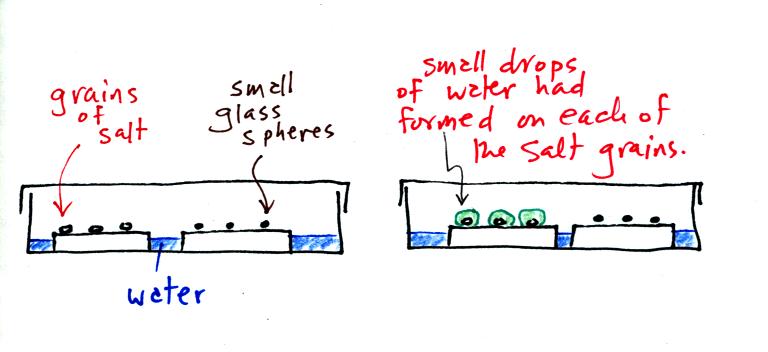
In humid parts of the US, water will condense onto the grains of salt in a salt shaker causing them to stick together. Grains of rice apparently absorb moisture which keeps this from happening and allows the salt to flow freely out of the shaker when needed.
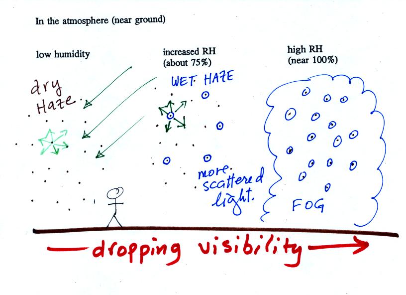
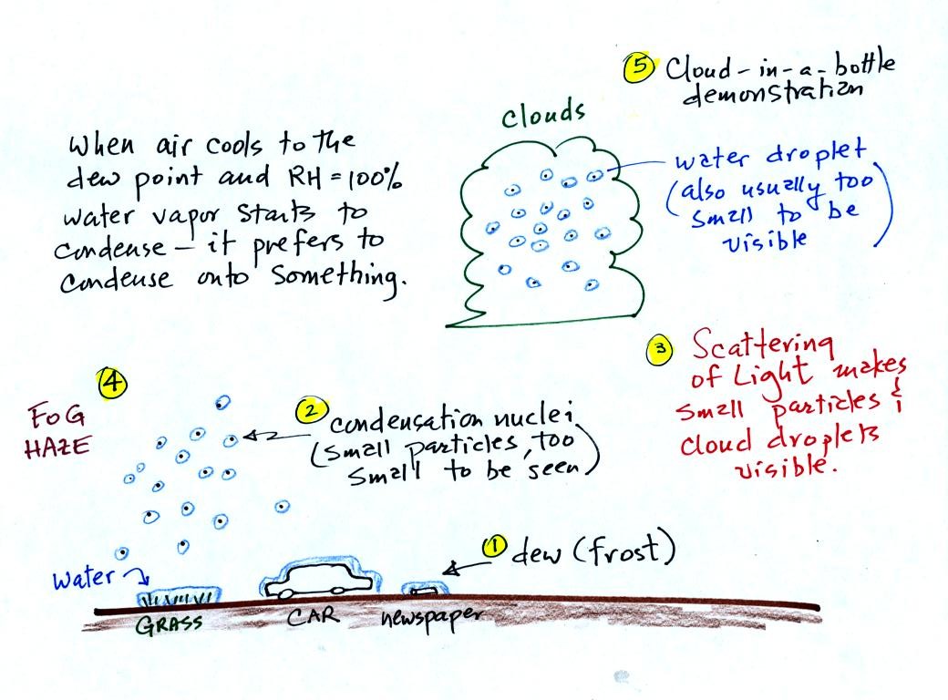
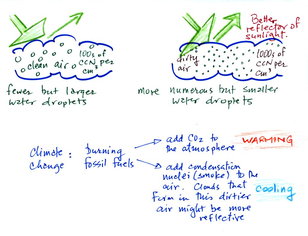
This figure shows how cloud condensation nuclei and increasing relative humidity can affect the appearance of the sky and the visibility.
The air in the left most figure is relatively dry. Even though the condensation nuclei particles are too small to be seen with the human eye you can tell they are there because they scatter sunlight. When you look at the sky you see the deep blue color caused by scattering of sunlight by air molecules mixed together with some white sunlight scattered by the condensation nuclei. This changes the color of the sky from a deep blue to a bluish white color. The more particles there are the whiter the sky becomes. This is called "dry haze."
The middle picture shows what happens when you drive from the dry southwestern part of the US into the humid southeastern US. One of the first things you would notice is the hazier appearance of the air and a decrease in visibility. Because the relative humidity is high, water vapor begins to condense onto some of the condensation nuclei particles (the hygroscopic nuclei) in the air and forms small water droplets. The water droplets scatter more sunlight than just small particles alone. The increase in the amount of scattered light is what gives the air its hazier appearance. This is called "wet haze."
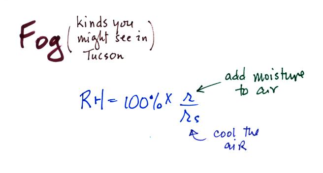
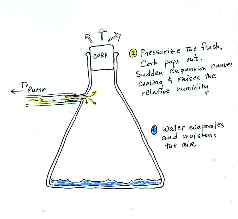
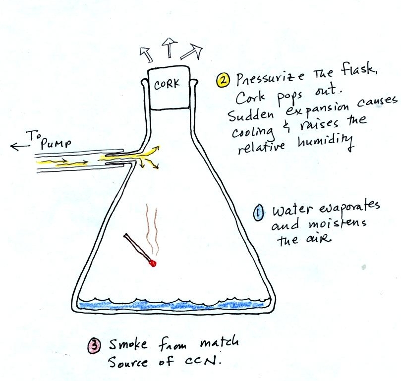
Finally when the relative humidity increases to 100% fog forms. Fog can cause a severe drop in the visibility. The thickest fog forms in dirty air that contains lots of condensation nuclei. We will see this effect in the cloud-in-a-bottle demonstration coming up later in the class.
Probably the most common type of fog in Tucson is radiation fog. The ground cools during the night by emitting IR radiation (left figure below). The ground cools most rapidly and gets coldest when the skies are free of clouds and the air is dry (except for a thin layer next to the ground.
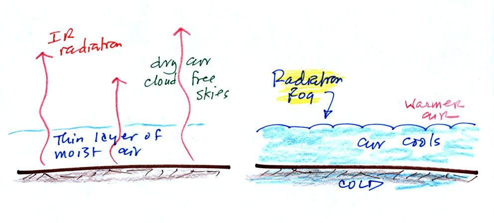
Radiation fog is sometimes called valley fog.
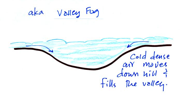
The cold dense foggy air will move downhill and fill low lying areas. Because the fog reflects sunlight, it is often difficult for the sun to warm the air and dissipate thick clouds of valley fog.
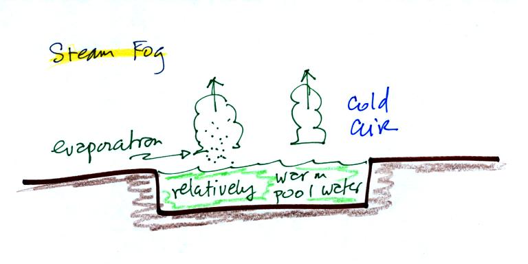
Steam fog or evaporation fog (also sometimes known as mixing fog) is commonly observed on cold mornings over the relatively warm water in a swimming pool.
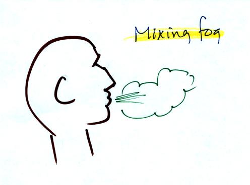
When you "see your breath" on a cold day (the figure below wasn't shown in class)
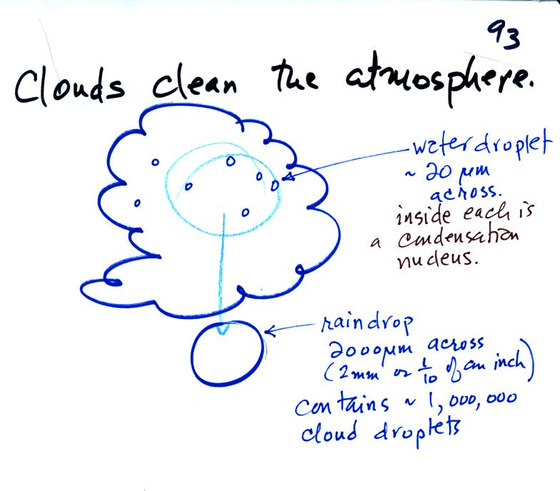
Clouds are one of the best ways of cleaning the atmosphere (cloud droplets form on particles, the droplets "clump" together to form a raindrop, and the raindrop carries the particles to the ground). A raindrop can contain 1 million cloud droplets so a single raindrop can remove a lot of particles from the air. You may have noticed how clear the air seems the day after a rainstorm; distant mountains are crystal clear and the sky has a deep blue color. Gaseous pollutants can dissolve in the water droplets and be carried to the ground by rainfall also.
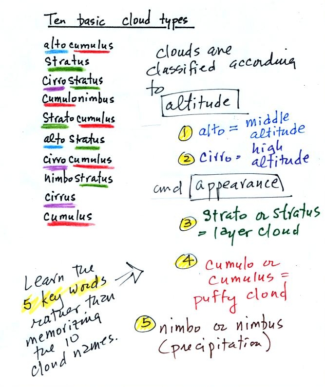
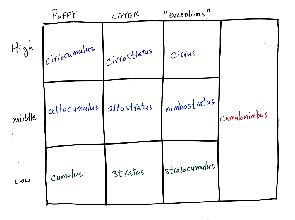
The ten main cloud types are listed below (you'll find this list on p. 95 in the photocopied class notes).
You should try to learn these 10 cloud
names. Not just because
they might
be on a quiz (they will) but because you will be able to impress your
friends
with your knowledge. There is a smart and a not-so-smart way of
learning
these names. The not-so-smart way is to just memorize them.
You
will inevitably get them mixed up. A better way is to recognize
that all
the cloud names are made up of key words. The 5 key words, we
will
find,
mostly tell you something about the cloud altitude and appearance.
Drawing a figure like this on a blank sheet of
paper is a good way to
review
cloud identification and classification.
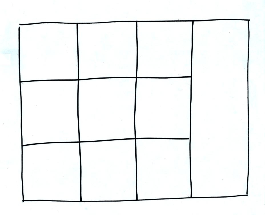
Each of the clouds above has a box reserved for
it in the figure.
Clouds are classified according to the altitude at which they form and
the
appearance of the cloud. There are two key words for altitude and
two key
words for appearance.
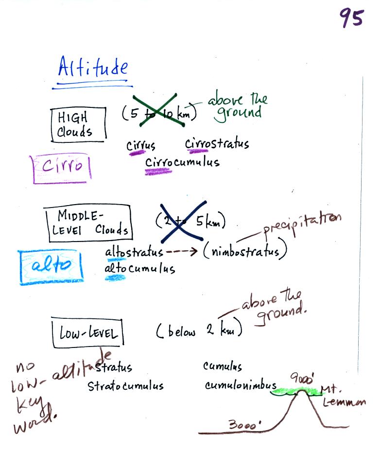
Clouds are grouped into one of three altitude
categories: high, middle
level,
and low.
Cirrus or cirro
identifies a high altitude
cloud. There are three types of clouds found in the high altitude
category..
Alto in a cloud name means the cloud is found at middle altitude.
The
arrow connecting altostratus and nimbostratus indicates that they are
very
similar. When an altostratus cloud begins to produce rain or snow
its
name is changed to nimbostratus. A nimbostratus cloud is also
often somewhat
thicker and lower than an altostratus cloud. Sometimes it might
sneak into the low altitude category.
It is very hard to just look up in the sky and determine a cloud's
altitude. You will need to look for other clues to distinquish
between high and middle altitude clouds. We'll learn about some
of the
clues when we look at cloud pictures later in the class.
There is no key word for low altitude clouds. Low altitude clouds
have
bases that form 2 km or less above the ground. The summit of
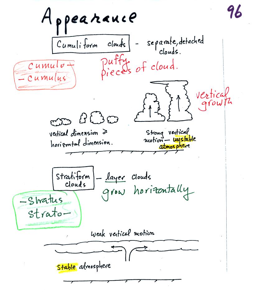
Clouds can have a patchy of puffy (or lumpy,
wavy, or ripply) appearance.
These
are cumuliform clouds and will have cumulo
or cumulus
in their name. In an unstable atmosphere cumuliform clouds will
grow vertically.
Strong thunderstorms can produce dangerous severe weather.
Stratiform clouds grow horizontally and
form
layers. They form when the atmosphere is stable.
Cirrus
clouds
are
sometimes considered to be a third type of cloud appearance.
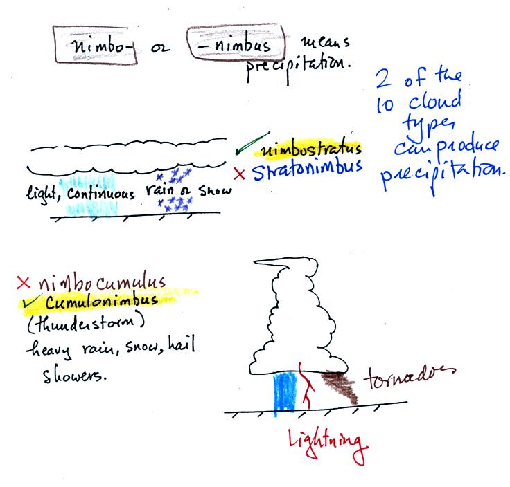
The last key word, nimbo
or nimbus, means
precipitation. Only two of the 10 cloud types are able to produce
(significant
amounts of) precipitation. It's not as easy as you might think to
make precipitation.
Nimbostratus clouds tend to produce fairly light precipitation over a
large
area. Cumulonimbus clouds produce heavy showers over localized
areas. Thunderstorm clouds can also produce hail, lightning, and
tornadoes. Hail would never fall from a
Ns
cloud.
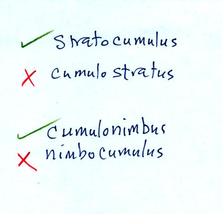
While you are still learning the cloud names you might put the correct
key
words together in the wrong order (stratonimbus
instead of nimbostratus or nimbocumulus
instead of
cumulonimbus). You won't be penalized for those kinds of errors
in this
class because you are putting together the right two key words.
We'll look at slides and learn about some of the key characteristics of each of the 10 cloud types in class on Thursday.