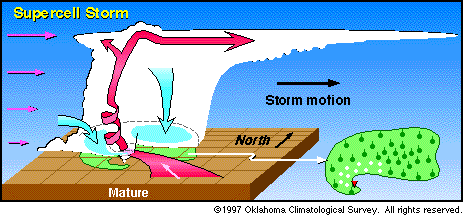
| This diagram shows the structure of a mature "supercell" thunderstorm.
(The vertical scale is exaggerated so that details of the cloud structure can be shown.)
Pink arrows indicate the winds at various heights in the atmosphere.
Red arrows are updrafts; blue arrows are downdrafts.
Note that because wind speeds increase with height, rain falls away from
the updraft, allowing the storm to be maintained for hours.
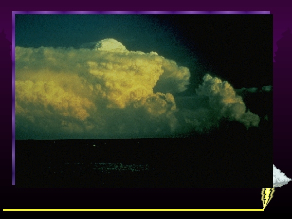
Supercell thunderstorms are significantly more destructive than ordinary thunderstorms.
|