 |
 |
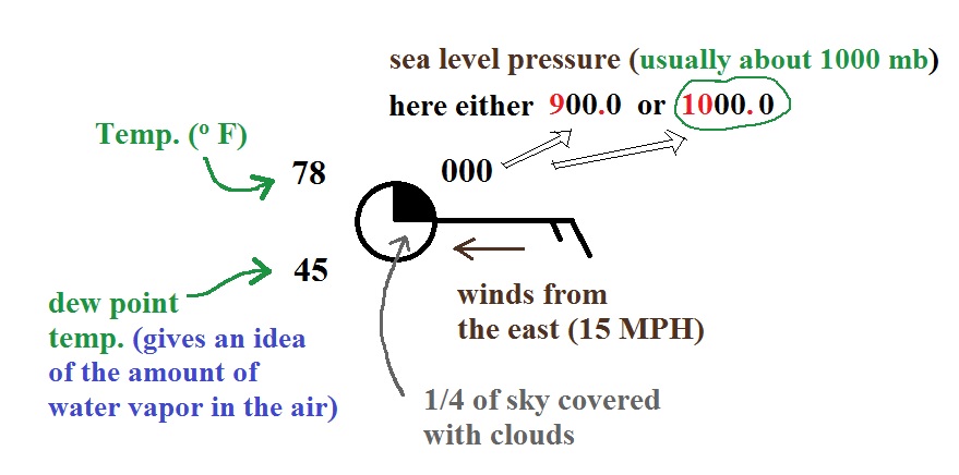
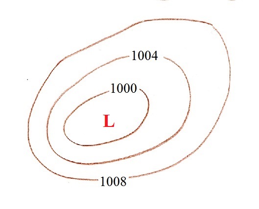
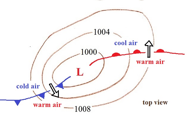
| The labels on the contours are
reasonable sea level pressure values. These are
pressure contours, isobars. The fact that the
values decrease as you move in toward the center means
this is a center of low pressure. |
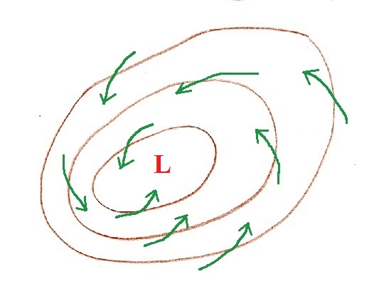
Surface winds blow across the
isobars always toward low pressure. That's
another way of figuring out this is a center of low
pressure. The term cyclone refers to
winds spinning around a center of low pressure. |
 |
 |
 |
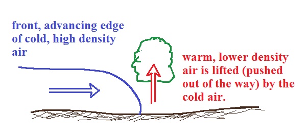
| You should be able to identify cold
fronts (at left above) and warm fronts (right),
determine where the cold and warm air would be found,
and show their direction of motion. |
 |
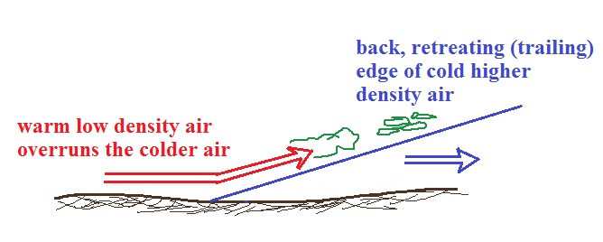 |
| In these
crossectional views of cold and warm fronts you should
be able to determine whether the cold air is advancing
or retreating (bunched up shape vs a ramp like shape).
Which ever air mass is rising is the lower density
warmer air mass. Both warm and cold fronts cause
air to rise. |
|