Monday, Mar. 26, 2018

Playing for Change  "Clandestino" (3:47), "With My Own Two Hands" (4:06), "Satchita" (4:16), "Pluto: King of the Underworld" (3:46)

Identifying and naming clouds - 10  main cloud types

We'll spent the entire class learning to identify and name clouds. 


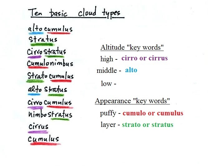
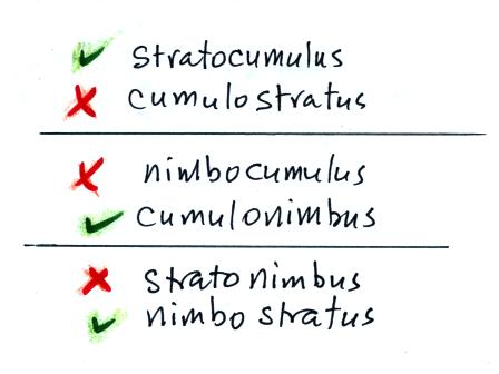
I'm hoping you'll try to learn these 10 cloud names.  There is a smart and a not-so-smart way of learning these names.  The not-so-smart way is to just memorize them.  Because they all sound alike you will inevitably get them mixed up.  In addition to learning the names, I'm hoping you'll be able to sketch each of the clouds and describe them in words.  That gets to be a lot of material to try to just memorize.

A better way is to recognize that all the cloud names are made up of a few key words. 

***    Clouds are classified using just two criteria: altitude and appearance    ***

There are 2 key words that tell you something about the cloud's altitude and 2 more for cloud appearance (there's a 5th key word for clouds that are producing precipitation).  My recommendation is to learn the key words and what they mean.
  Then you can usually construct a cloud name by taking key words from both the altitude and appearance groups and combining them.  

Cloud Altitude


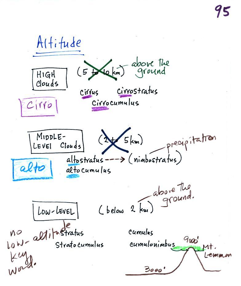
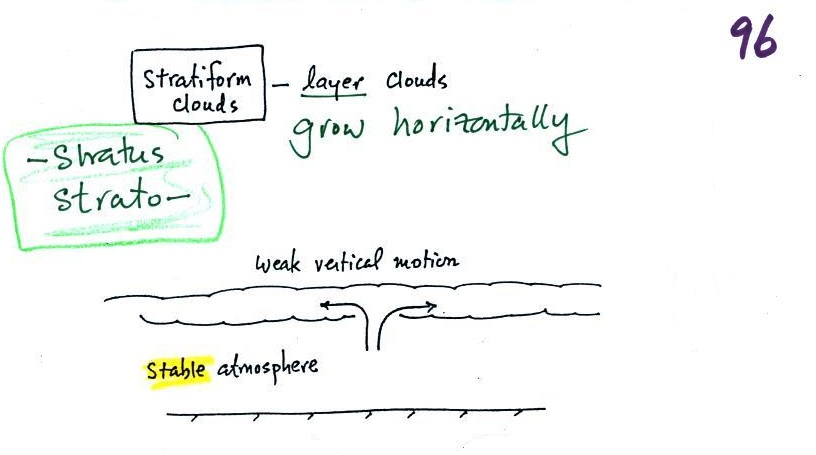
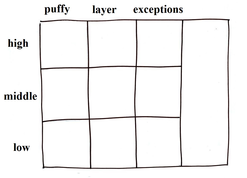
Clouds are grouped into one of three altitude categories: high, middle level, and low. 
It is very hard to just look up in the sky and determine a cloud's altitude.  You will need to look for other clues to distinguish between high and middle altitude clouds.  We'll learn about some of the clues when we look at cloud pictures.

Cirrus or cirro identifies a high altitude cloud.  There are three types of clouds found in the high altitude category..

Alto in a cloud name means the cloud is found at middle altitude.  The arrow connecting altostratus and nimbostratus indicates that they are basically the same kind of cloud.  When an altostratus cloud begins to produce rain or snow its name is changed to nimbostratus.  A nimbostratus cloud may become somewhat thicker and lower than an altostratus cloud.  Sometimes it might sneak into the low altitude category.

There is no key word for low altitude clouds.  Low altitude clouds have bases that form 2 km or less above the ground.  The summit of
Mt. Lemmon in the Santa Catalina mountains north of Tucson is about 2 km above the valley floor.  Low altitude clouds will have bases that form at or below the summit of Mt. Lemmon.

Examples of puffy patchy (cumuliform) clouds found at different altitudes


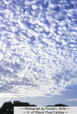
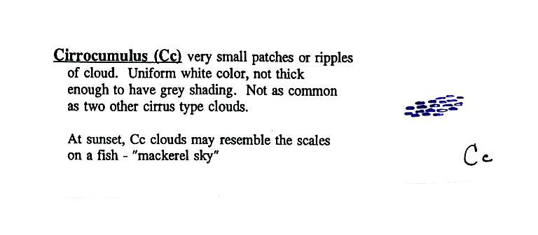
high altitude cloud
the patches of cloud are small because they are far away
This is
a cirrocumulus cloud, cirro means high altitude, cumulus means "patchy".

The air is cold at high altitude and doesn't contain much water vapor.  High altitude clouds are thin, there's not much raw material available to make the cloud.
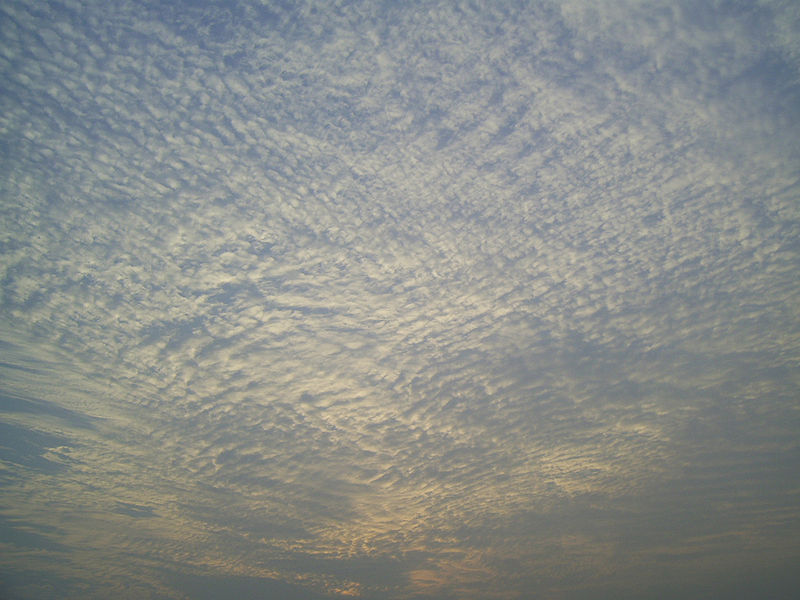
middle altitude cloud
the patches of cloud are bigger because they closer to the ground.

This is an altocumulus cloud.

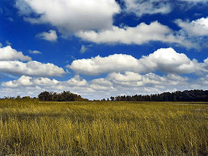
low altitude cloud
cumulus clouds
(there is no key word for low altitude)


Cloud Appearance


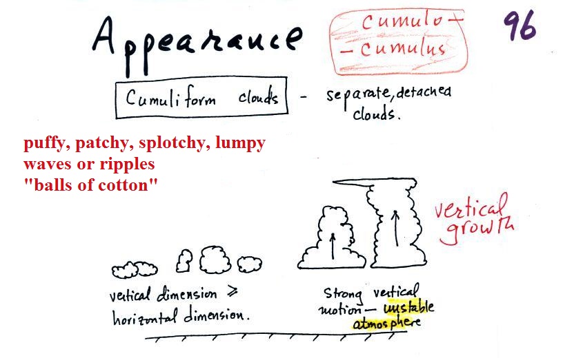
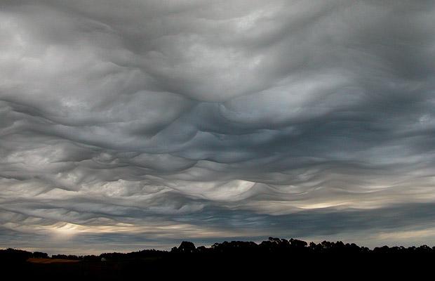
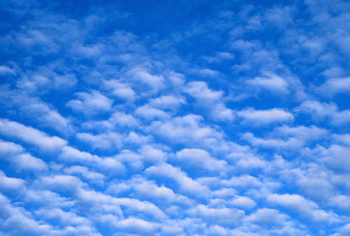
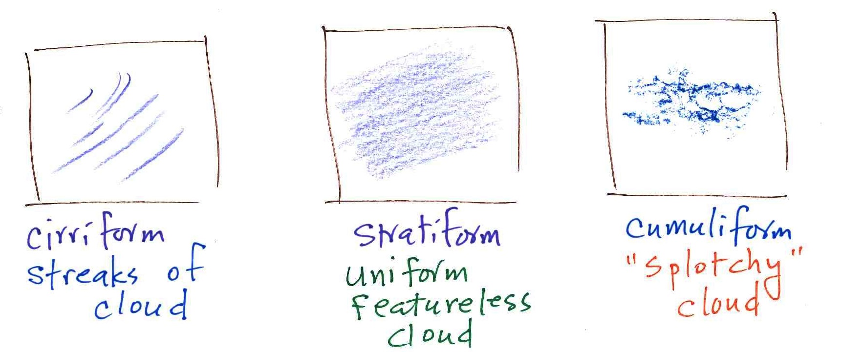
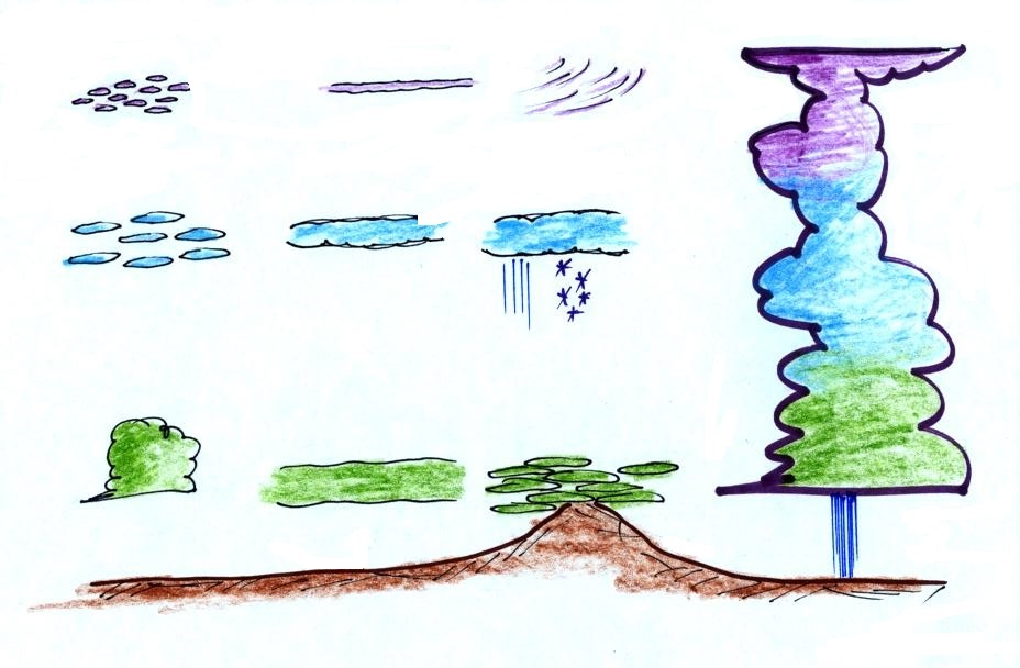
Cumulus clouds are often described as resembling a head of cauliflower.  Clouds can have a patchy of puffy (or lumpy, wavy, splotchy or ripply) appearance.  These are cumuliform clouds and will have cumulo or cumulus in their name.  These clouds are 
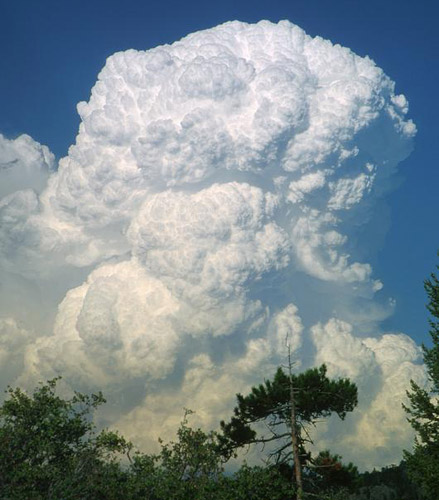
as tall or taller than they are across, in an unstable atmosphere cumuliform clouds will grow vertically and turn into thunderstorms.  Strong thunderstorms can produce dangerous weather.

Here are some examples of the different textures or features that characterize cumuliform clouds:


Cumuliform cloud
source

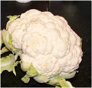
Head of cauliflower

source
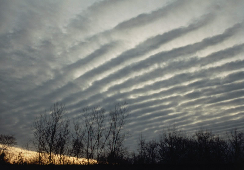
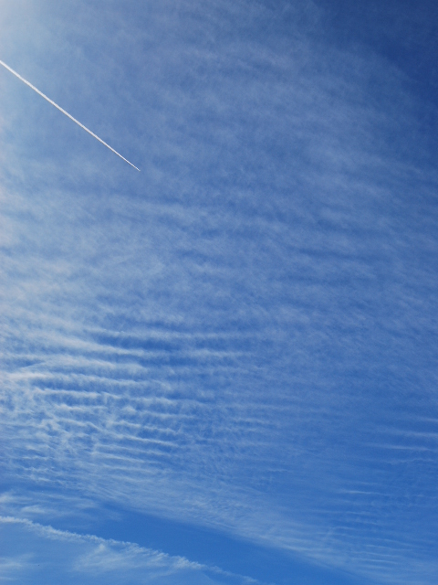

lumpy cloud
source

patchy appearing cloud
source


ripples or waves
note the size, this is probably a middle or low level cloud
source

This is probably a middle or high level cloud because the ripples are smaller (higher and further away)
source


Stratiform clouds grow horizontally and form layers.  They form when the atmosphere is stable. 


You'll find strato or stratus in the cloud name. Stratiform - as in rock strata, or stratosphere.


rock strata at the Grand Canyon
source


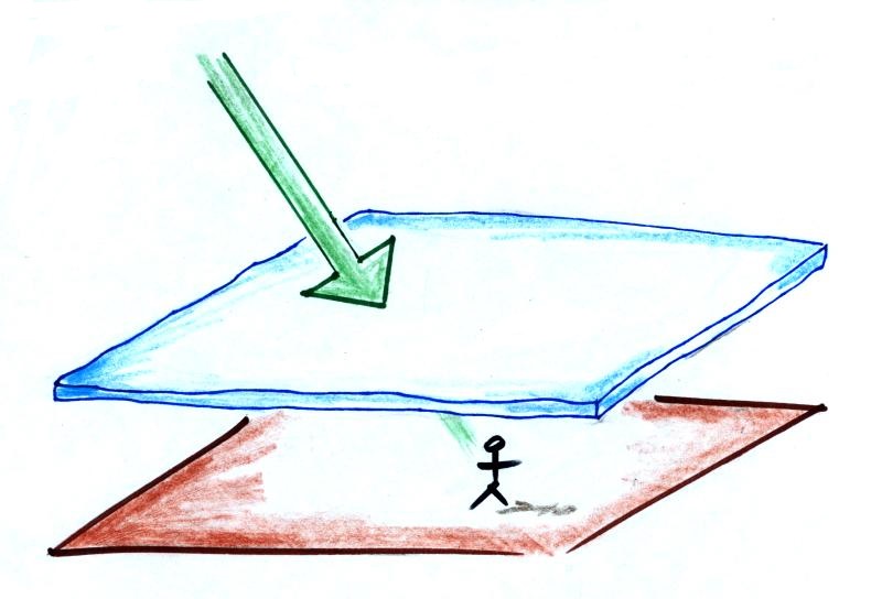
A side view of a layer cloud.   How much sunlight is able to shine through the cloud depends on how thick the cloud is (and is a clue about the cloud's altitude).  A person on the ground may or may not cast a shadow.

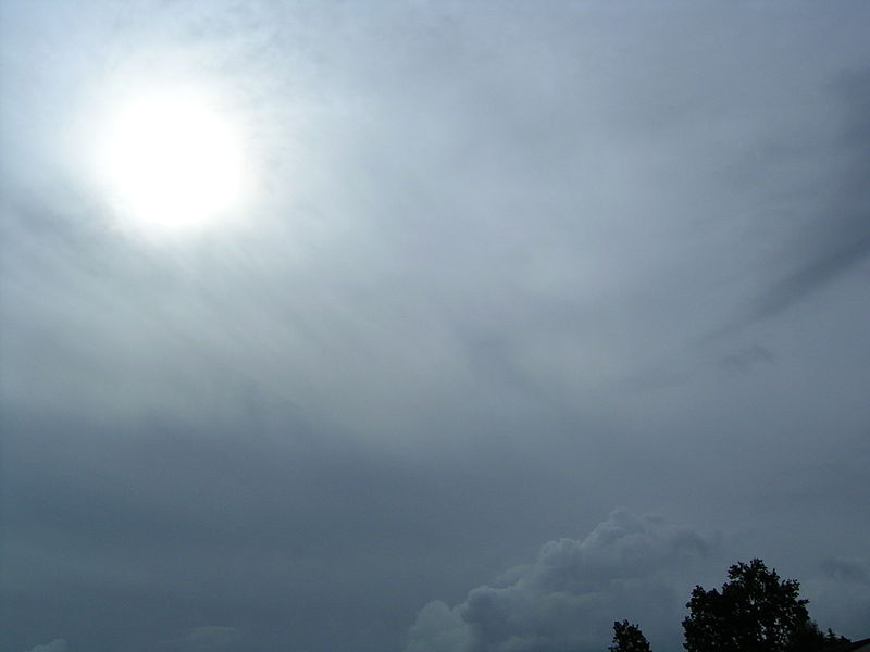
A view from the ground looking up at the sun through a middle level layer cloud.  The sun is visible but blurred.  (source)


Cloud appearance comparison
You'll become more familiar with different types of cloud appearances by looking at clouds and cloud photographs.

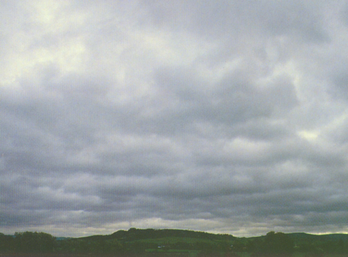
featureless Stratiform cloud
(layer cloud)

an altostratus cloud
an in between case,
a "lumpy layer cloud"

this is named stratocumulus

patchy, puffy Cumuliform cloud
cumulus clouds


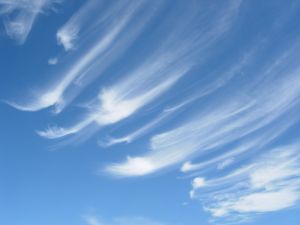
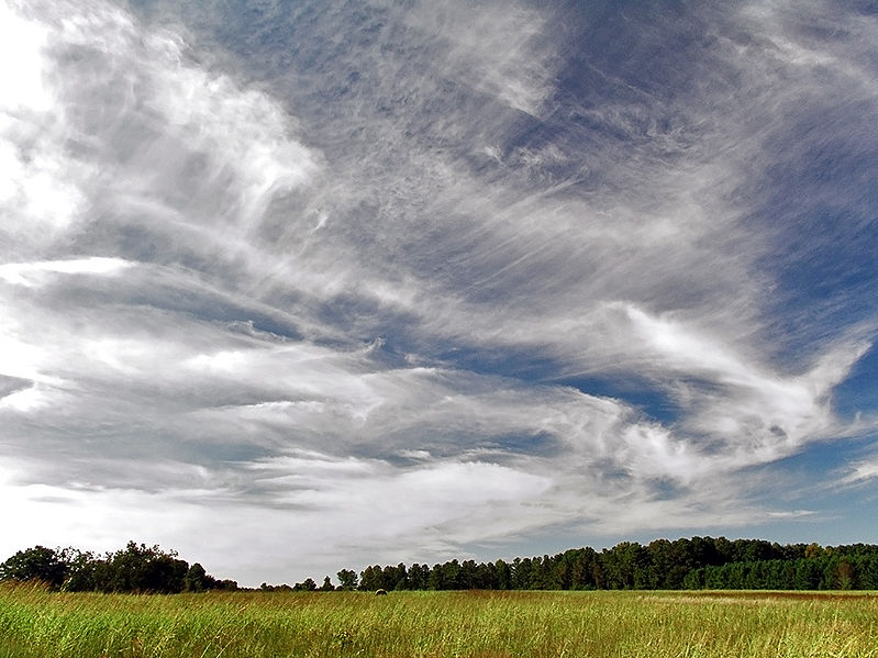
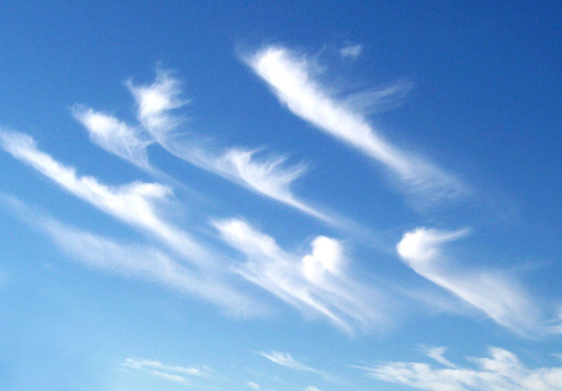
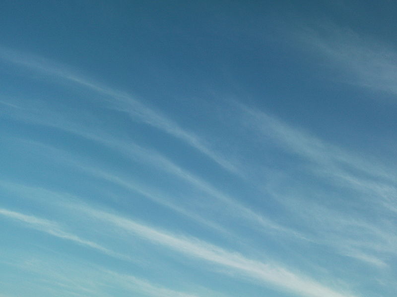
cirriform is sometimes used
as an appearance key word

this is a cirrus cloud
source of this image
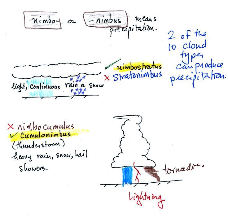
Note the stratocumulus cloud name is formed by combining the two key words for appearance which is a little unusual.

Trying to draw the different clouds will help you to visualize the differences in appearance.


To draw the cirriform cloud you could use the sharp end of a pencil.  Using the side of a pencil as you would if you were shading in or coloring in a picture was used in the center picture.  To make the right picture I put a bunch of ink on the side of a sponge and pressed it against the paper.

There's a 5th key word that I have been neglecting to mention.


Nimbo or nimbus, means precipitation (it is also the name of a local brewing company).  Only two of the 10 cloud types are able to produce (significant amounts of) precipitation.  It's not as easy as you might think to make precipitation.  We'll start to look at precipitation producing processes in the next class.
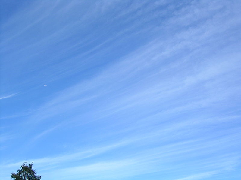
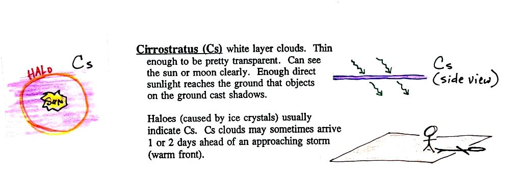
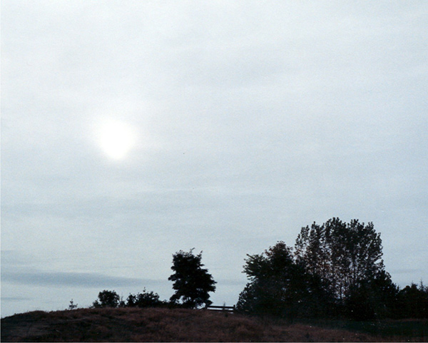
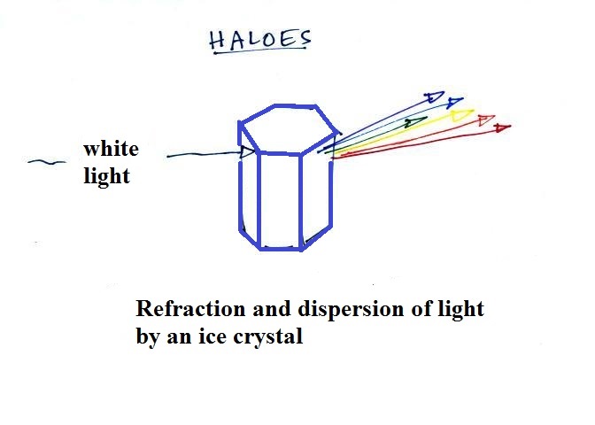
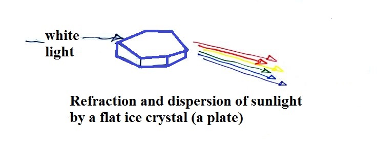
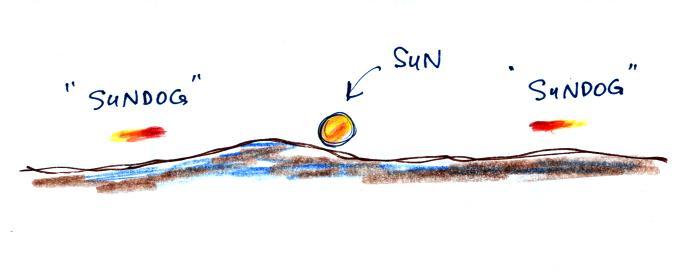
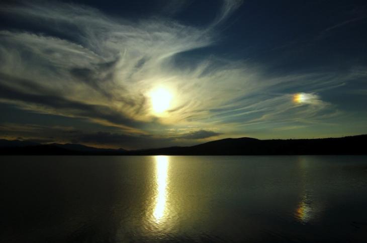
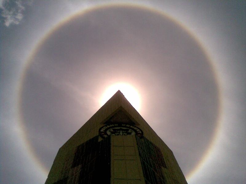
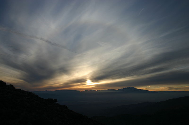
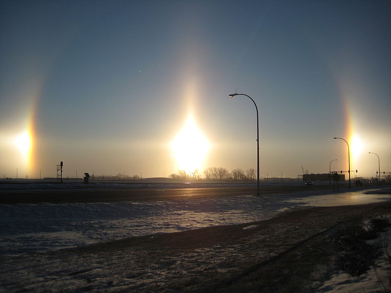
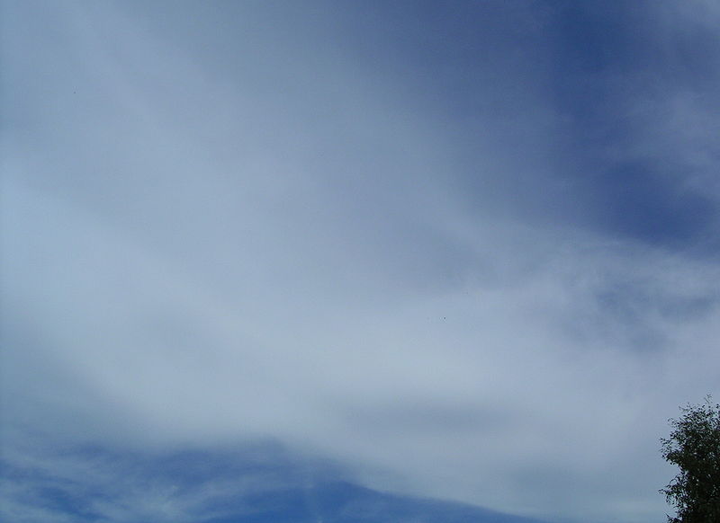
Nimbostratus clouds tend to produce fairly light precipitation over a large area.  Cumulonimbus clouds produce heavy showers over more localized areas.  Thunderstorm clouds can also produce hail, lightning, and tornadoes.  Hail would never fall from a Ns cloud. 

While you are still learning the cloud names you might put the correct key words together in the wrong order (stratonimbus instead of nimbostratus, for example).  You won't be penalized for those kinds of errors in this class because you are putting together the right two key words.


No penalty for putting the key words together in the wrong order


We've covered a fair amount of information and we're going to be looking at a lot of cloud pictures.  You'll need to organize this material is a clear compact way.  Here's something that may help.


Take out a blank sheet of paper and draw a chart like shown above at left.  There are 10 boxes, one for each of the cloud types.  The three altitude categories run along the vertical side of the chart and the two appearance categories run along the top (note the exceptions column).  This will force you to remember the key words.  Then you should be able to put a name in each box, sketch each of the clouds (as done above at right), and a short written description of each cloud. 

Something that I often forget to mention in class - the colors used on the clouds at right.  Green is indicating clouds that are warmer than freezing and made up of only water droplets.  Purple or violet indicates very cold high altitude clouds composed of only ice crystals.  The middle level clouds shaded blue are colder than freezing and contain both unfrozen water droplets and ice crystals.  That's a little surprising but turns out to be a very important part of precipitation-producing (and lightning-producing) clouds.

We'll be looking at pictures of most of the 10 main cloud types today.  I'm hoping you'll go outside and have a look at clouds when and if they're in the sky.  But also a warning, real world examples are often much complex than what we'll be looking at here.  You'll often find many different cloud type mixed together.  One day in ATMO 170 is not going to make you cloud identification experts.

Try to organize this class notes material as you read through it.  For each of the cloud types sketch the cloud, write down its name and add a word or two of description on a small index card size piece of paper.  Put that piece of paper in its proper position on a larger cloud chart.  I.e. does that cloud belong at high, middle or low altitude.

Names, pictures and short descriptions of most of the 10 main cloud types
(many of the descriptions below are found on pps 97 & 98 in the ClassNotes)

Something I usually don't mention in class.  If you get a particularly good photograph of a cloud or if you are an artist (as I know some of you must be) and are able to draw some really nice cloud pictures, I'd like to see them (and include them in the class notes).  So send them in.
 
High altitude clouds


High altitude clouds are thin because the air at high altitudes is very cold and cold air can't contain much moisture, the raw material needed to make clouds  (the saturation mixing ratio for cold air is very small).  These clouds are also often blown around by fast high altitude winds.  Filamentary means "stringy" or "streaky".  If you imagine trying to paint a Ci cloud you might dip a small pointed brush in white paint brush it quickly and lightly across a blue colored canvas.  Here are some pretty good photographs of cirrus clouds (they are all from a Wikipedia article on Cirrus Clouds)


A cirrostratus cloud is a thin uniform white layer cloud (not purple as shown in the figure) covering part or all of the sky.  They're so thin you can sometimes see blue sky through the cloud layer.  Haloes are a pretty sure indication that a cirrostratus cloud is overhead.  If you were painting Cs clouds you could dip a broad brush in watered down white paint and then paint back and forth across the canvas.  Look down at your feet and see if your body is casting a shadow.

Haloes and sundogs


Haloes are produced when white light (sunlight or moonlight) enters a 6 sided ice crystal.  The light is bent (refraction).  The amount of bending depends on the color (wavelength) of the light (dispersion).  The white light is split into colors just as when light passes through a glass prism Crystals like this (called columns) tend to be randomly oriented in the air.  That is why a halo forms a complete ring around the sun or moon.  You don't usually see all the colors, usually just a hint of red or orange on the inner edge of the halo.


This is a flatter crystal and is called a plate.  These crystals tend to all be horizontally oriented and produce sundogs which are only a couple of small sections of a complete halo.  A sketch of a sundog is shown below.


Sundogs are pretty common
.  Keep an eye out for them whenever you see high thin clouds in the sky at sunrise or sunset.   The photograph above (source) is like you might see in Tucson (except perhaps for the lake in the foreground).  The sun is in the center of the photograph and the sundog is send at right.  The photograph also illustrates how thin cirriform clouds will often appear thicker at sunrise or sunset because the rays of sunlight shine through them at an angle.


A very bright halo is shown at upper left with the sun partially blocked by a building (the cloud is very thin and most of the sunlight is able to shine straight through).  A halo like this would draw a crowd.  Note the sky inside the halo is darker than the sky outside the halo.  The halo at upper right is more typical of what you might see in Tucson.  Thin cirrus clouds may appear thicker at sunrise or sunset because the sun is shining through the cloud at a steeper angle.  Very bright sundogs (also known as parhelia) are shown in the photograph at bottom left.  The sun in the photograph at right is behind the person.  You can see both a halo and a sundog (the the left of the sun) in this photograph.  Sources of these photographs: upper left, upper right, bottom row.

If you spend enough time outdoors looking up at the sky you will eventually see all 10 cloud types.

Cirrus and cirrostratus clouds are fairly common.  Cirrocumulus clouds are a little more unusual. 

The same is true with
animals, some are more commonly seen in the desert around Tucson (and even in town) than others.
  If you click on the link you'll see pictures of some of the wild animals that live in and around Tucson.  With the exception of a skunk I've seen all of them in my neighborhood in central Tucson (often in my backyard).


To paint a Cc cloud you could dip a sponge in white paint and press it gently against the canvas (as I tried to do earlier).  You would leave a patchy, splotchy appearing cloud (sometimes you might see small ripples).  It is the patchy (or wavy) appearance that makes it a cumuliform cloud.

The table below compares cirrostratus (the cloud on the left without texture) with a good example of a cirrocumulus cloud (the "splotchy" appearing cloud on the right).  Both photographs are from the Wikipedia article mentioned earlier.

Cirrostratus - Cirrocumulus comparison


These are just the high clouds, we've still got the middle and low level clouds.  We have a long way yet to go.