The purpose of this short optional reading
section is to explain how temperature differences (such as you
might find between a coast and the ocean or between a city and the
surrounding country side) can cause the wind to start to
blow. This kind of situation is known as a thermal
circulation.
Thermal circulations are usually a small scale phenomenon.
The pressure gradient created by differences in
temperature ends up being much stronger than the Coriolis force
and the Coriolis force can be ignored.
By applying some of
the concepts we learned earlier in the semester we can
understand pretty well how thermal circulations develop.
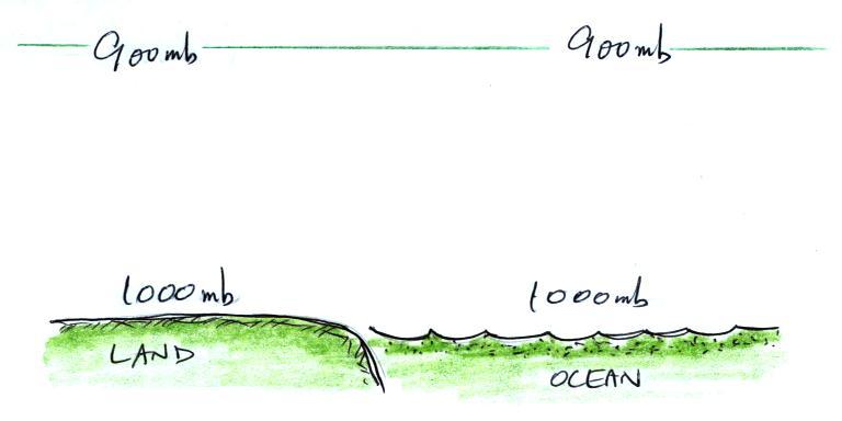
We'll start with this picture of conditions along a sea
coast. At this point the air temperatures and pressures
on both sides of the picture are the same.
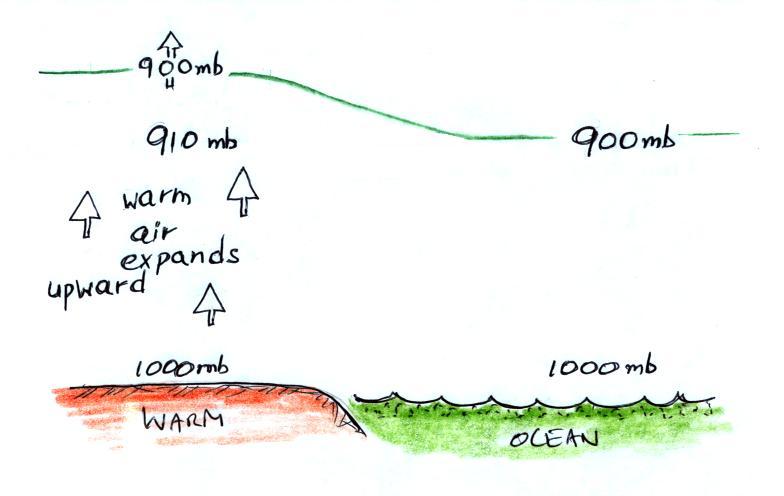
A beach will often become much warmer than the nearby ocean
during the day (the sand gets hot enough that it is painful to
walk across in bare feet). The warm air over the land will
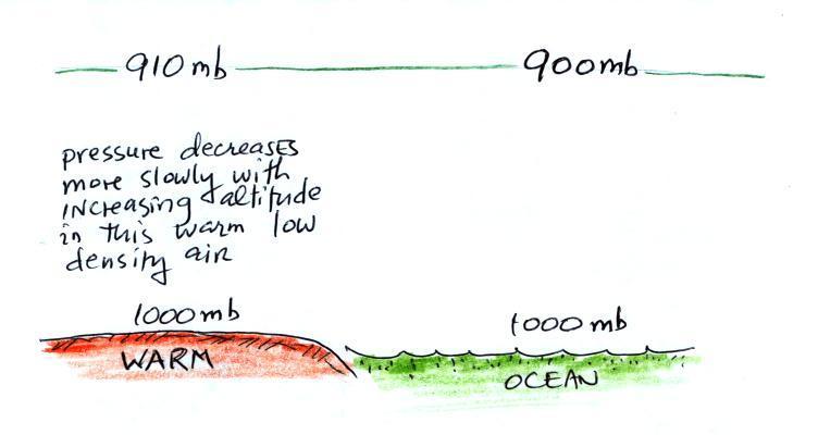
expand upward. Note how the 900 mb level has moved upward
in the picture. We've left the temperature of the water
the same as it was in the earlier picture and the 900 mb level
above the ocean hasn't changed either. So on
the left side of the figure at the level where we find 910 mb we
find 900 mb on right (see the top of the picture below).
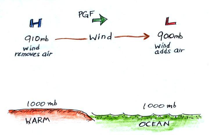
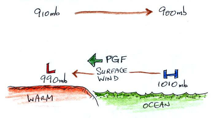
These upper level pressure differences cause air above the
ground to start to blow from left to right.
Once the air aloft begins to move it will change the surface
pressure pattern. The air leaving the top left side of the
picture will lower the surface pressure (from 1000 mb to 990
mb). Adding air at upper right side of the picture will
increase the surface pressure (from 1000 mb to 1010 mb).
Now we have a pressure difference at the surface and the surface
winds will begin to blow from right to left.
Sea breezes
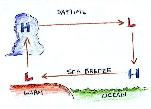
You can complete the circulation loop by adding rising air
above the surface low pressure at left and sinking air above the
surface high at right. The surface winds which blow from
the ocean onto land are called a sea breeze (meteorologists
specify where the wind is coming from). Since this air is
likely to be moist, cloud formation is likely when the air rises
over the warm ground. Rising air expands and cools.
If you cool moist air to its dew point, clouds form.
shortcut
It is pretty easy to figure the directions of the winds in a
thermal circulation without going through a long-winded
development like this. Just remember that
warm air
rises
Draw in a rising air arrow above the warm part of the picture,
then complete the loop.
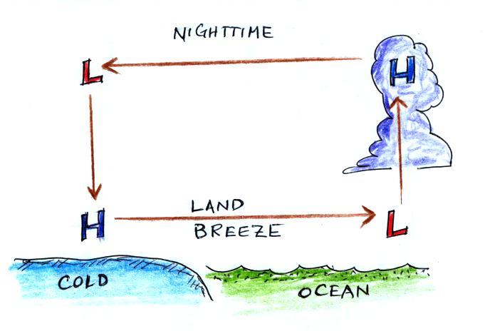
At night the ground cools more quickly than the ocean and
becomes colder than the water. Rising air is found over
the warmer ocean water (sea below). The thermal
circulation pattern reverses direction. Surface winds blow
from the land out over the ocean. This is referred to as a
land breeze.
Land breezes
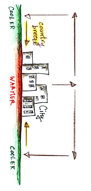
Country
breeze
Here is an additional situation where a thermal circulation
could develop.
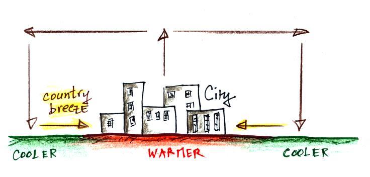
Cities are often warmer than the surrounding countryside,
especially at night. This is referred to as the urban
heat island effect. This difference in temperature
can create a "country breeze." This will
sometimes carry pollutants from a factory outside the city back
into the city or odors from a sewer treatment plant outside of
town back into town.
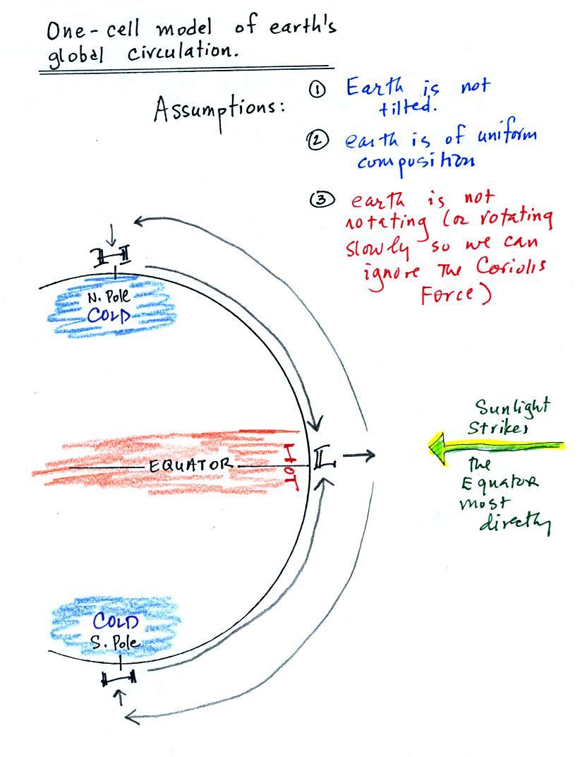
Global scale thermal circulation
We made use of this idea of a thermal circulation in class on
Thursday when discussing the 1-cell model of the earth's global
scale circulation. Ordinarily you couldn't
apply a small scale phenomena like a thermal circulation to the
much larger global scale. However because we assumed that
the earth doesn't rotate or only rotates slowly, we could ignore
the Coriolis force, and a thermal circulation could become
established.
The temperature differences that would exist between the
equator and the poles is shown above at left. At right
we've taken the country breeze figure and rotated it 90
degrees. The two temperature patterns and the thermal
circulations that would develop are similar.