Thursday Apr. 2, 2015
Just in time for Easter, some gospel music from The Blind Boys
of Alabama "Soldier",
"Amazing
Grace", "Nobody's
Fault But Mine", "Run
On", "Down
By the Riverside", "Way Down in
the Hole"
Quiz #3 is one week from today and the complete Quiz #3 Study Guide is now available
online.
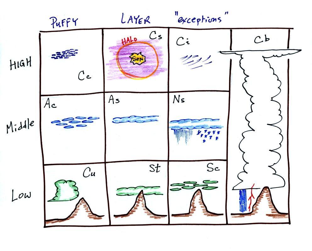
The goal today is to
spend the first part of the period looking at examples of
the 10 main clouds. Most of the written descriptions below
come from pps 97 & 98 in the ClassNotes.
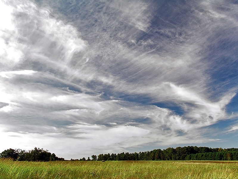
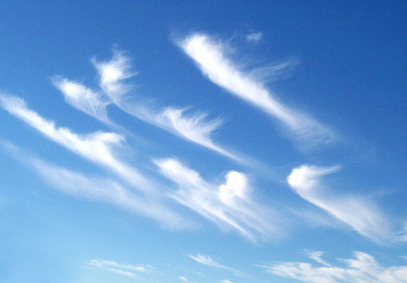
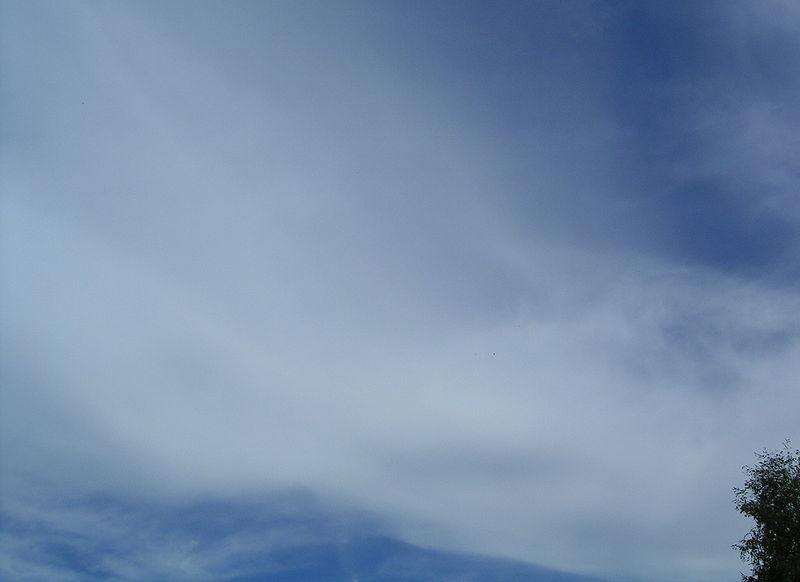
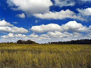
High altitude clouds
High altitude clouds are thin because the air at high
altitudes is very cold and cold air can't contain much
moisture, the raw material needed to make
clouds (the saturation mixing ratio for cold air is
very small). These clouds are also often blown
around by fast high altitude winds.
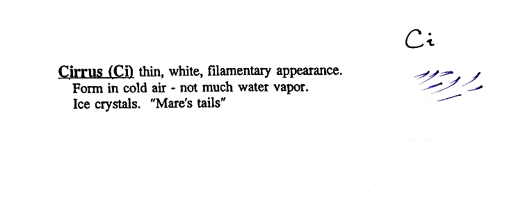
Filamentary means "stringy" or "streaky". If you
imagine trying to paint a Ci
cloud you might dip a small pointed brush in white paint
brush it quickly and lightly across a blue colored
canvas. Here are some pretty good photographs of
cirrus clouds (they are all from a Wikipedia
article on Cirrus Clouds)
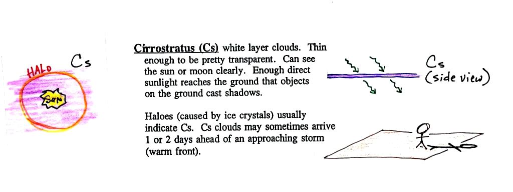
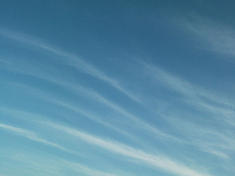
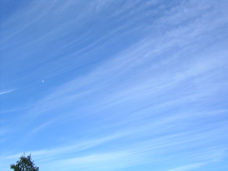
A
cirrostratus cloud is a thin uniform white layer cloud (not
purple as shown in the figure) covering part or all of the
sky. They're so thin you can sometimes see blue sky
through the cloud layer. Haloes are a pretty
sure indication that a cirrostratus cloud is overhead.
If you were painting Cs clouds you could dip a broad brush
in watered down white paint and then paint back and forth
across the canvas. Look down at your feet and
see if you cast a shadow.
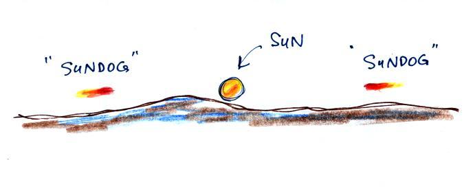
Haloes and sundogs
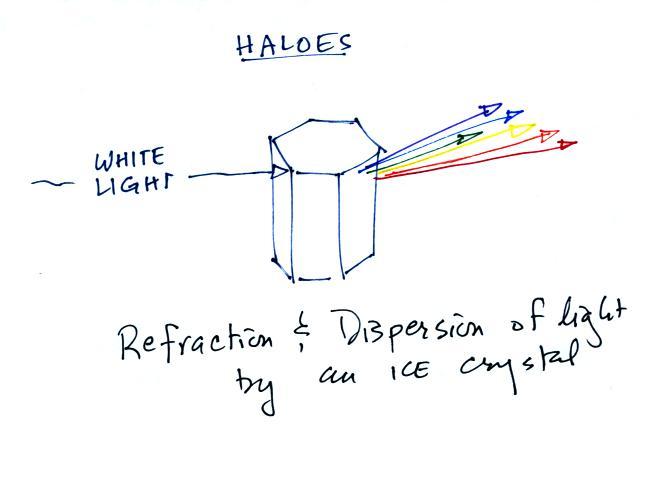
Haloes are produced when white light
(sunlight or moonlight) enters a 6 sided ice crystal.
The light is bent (refraction). The amount of bending
depends on the color (wavelength) of the light
(dispersion). The white light is split into
colors just as when light passes through a glass prism.
Crystals like this (called columns) tend to be randomly
oriented in the air. That is why a halo forms a
complete ring around the sun or moon. You don't
usually see all the colors, usually just a hint of red or
orange on the inner edge of the halo.
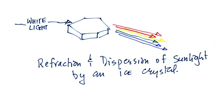
This is a
flatter crystal and is called a plate. These crystals
tend to all be horizontally oriented and produce sundogs
which are only a couple of small sections of a complete
halo. A sketch of a sundog is shown below.
Sundogs are pretty common.
Keep an eye out for them whenever you see high thin clouds in
the sky at sunrise or sunset.
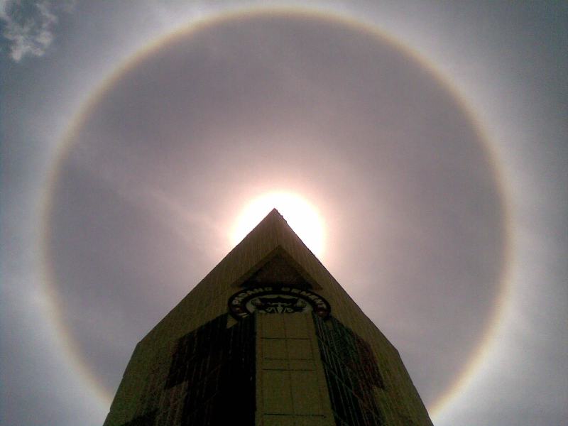
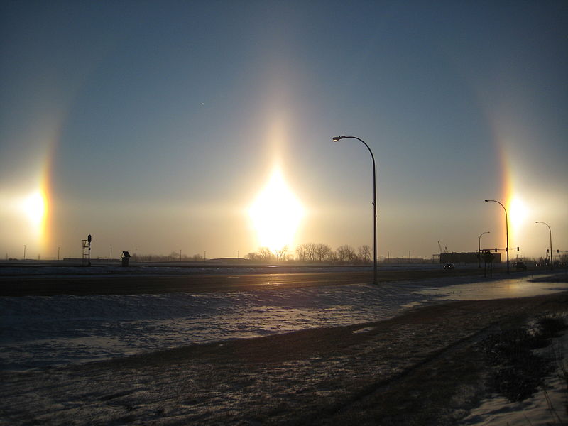
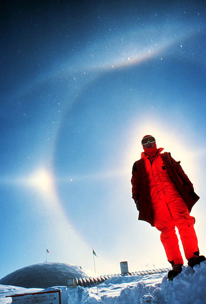
A very bright halo is shown at upper
left with the sun partially blocked by a building
(the cloud is very thin and most of the sunlight is
able to shine straight through). A halo like
this would draw a crowd. Note the sky inside
the halo is darker than the sky outside the
halo. The halo at upper right is more typical
of what you might see in Tucson. Thin cirrus
clouds may appear thicker at sunrise or sunset
because the sun is shining through the cloud at a
steeper angle. Very bright sundogs (also known
as parhelia) are shown in the photograph at bottom
left. The sun in the photograph at right is
behind the person. You can see both a halo and
a sundog (the the left of the sun) in this
photograph. Sources of these
photographs: upper
left, upper
right, bottom
row.
If you spend enough time outdoors looking
up at the sky you will eventually see all 10 cloud types.
Cirrus and cirrostratus clouds are fairly common.
Cirrocumulus clouds are a little more unusual.
The same is true with animals,
some are more commonly seen in the desert around Tucson (and
even in town) than others.
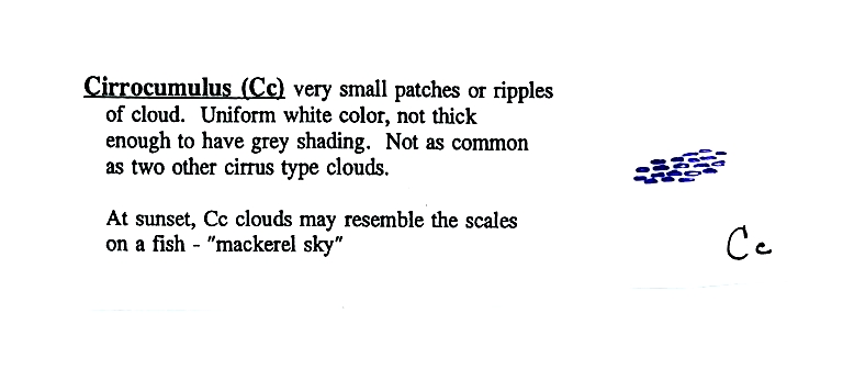
To
paint a Cc cloud you could dip a sponge in white paint
and press it gently against the canvas (as I tried to do
earlier). You would leave a patchy, splotchy
appearing cloud (sometimes you might see small
ripples). It is the patchy (or wavy) appearance
that makes it a cumuliform cloud.
The table below compares
cirrostratus (the cloud on the left without texture)
with a good example of a cirrocumulus cloud (the
"splotchy" appearing cloud on the right). Both
photographs are from the Wikipedia article mentioned
earlier.
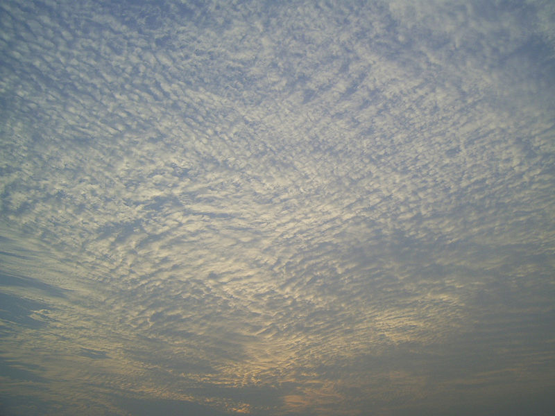
Middle altitude clouds
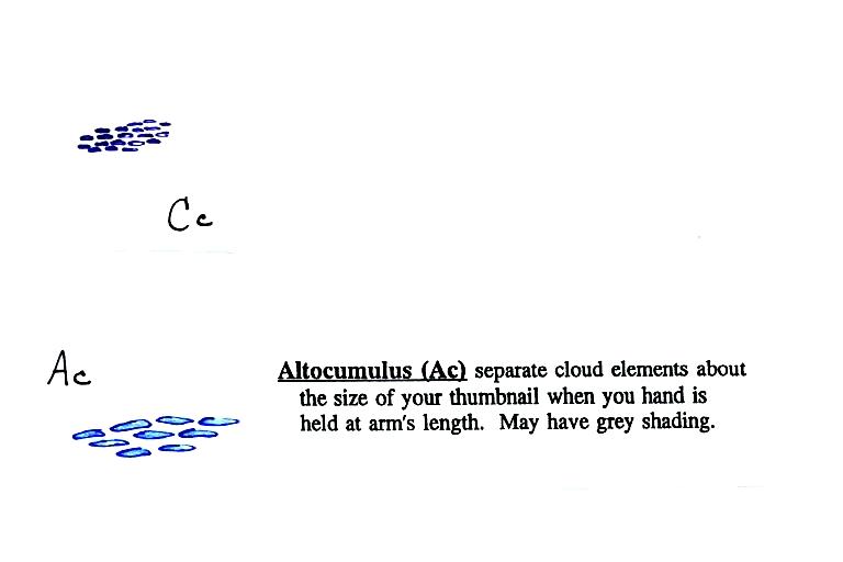
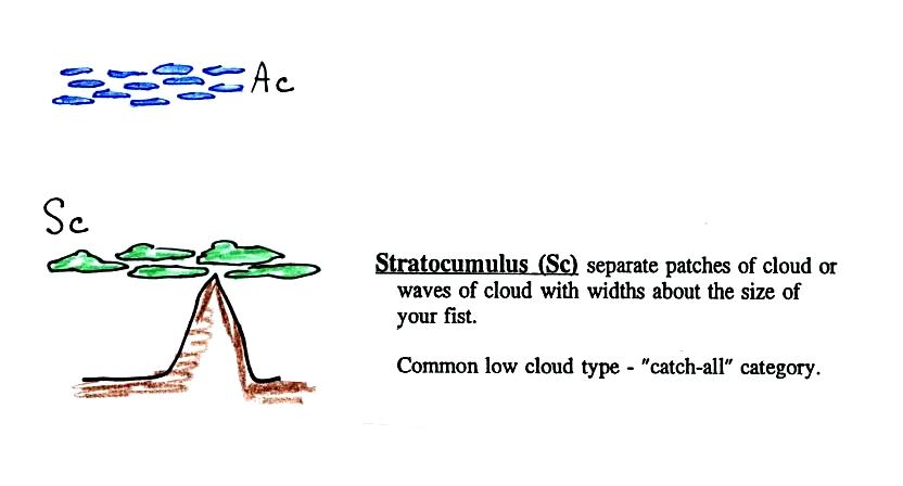
Altocumulus
clouds are pretty common. Note
since it is hard to accurately judge altitude, you must rely
on cloud element size (thumbnail size in the case
of Ac) to determine whether a cloud belongs in the high or
middle altitude category. The cloud elements in
Ac clouds appear larger than in Cc because the cloud is closer
to the ground. A couple of photographs are shown below
(source: Ron Holle for WW2010 Department of
Atmospheric Sciences, the University of Illinois at
Urbana-Champaign)
There's a much larger collection in this gallery
of images. The fact that there are so many examples
is an indication of how common this particular type of cloud is.
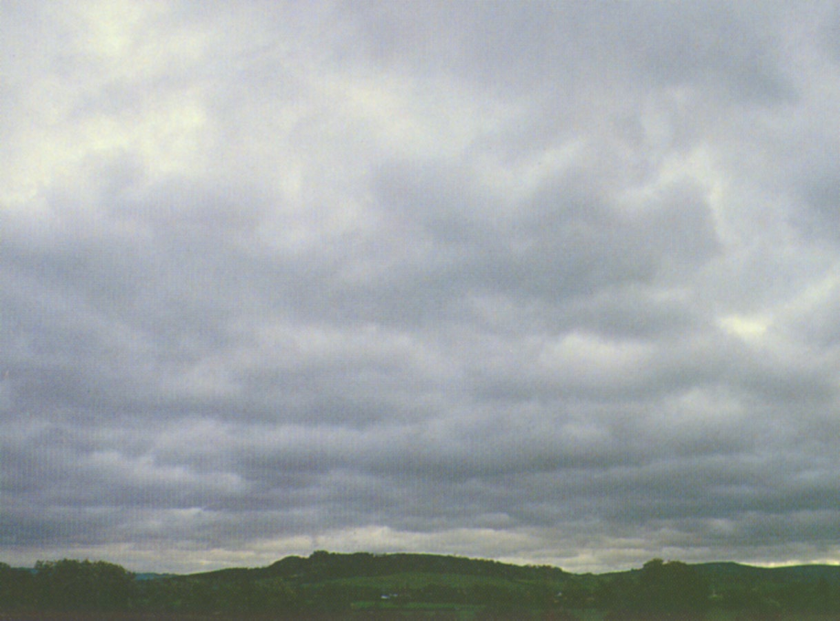
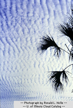
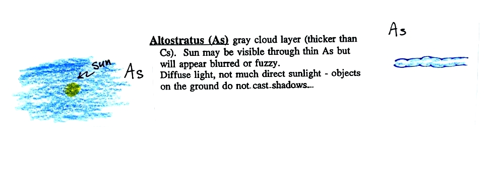
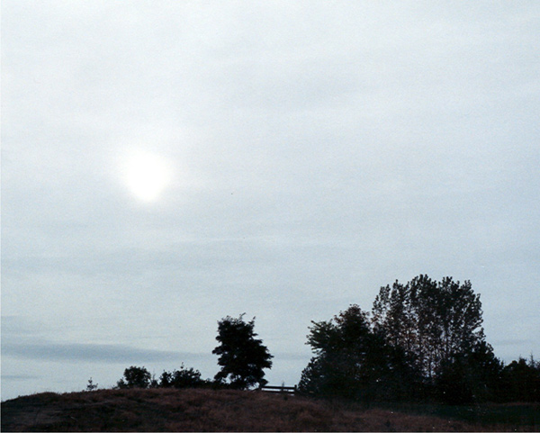
Altostratus
clouds are thick enough that you probably won't
see a shadow if you look down at your feet.
The sun may or may not be visible through the
cloud. Three examples are shown below
(the first is from a
Wikipedia article, the
middle and right photograph are from an Environment
Canada web page)
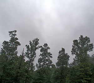
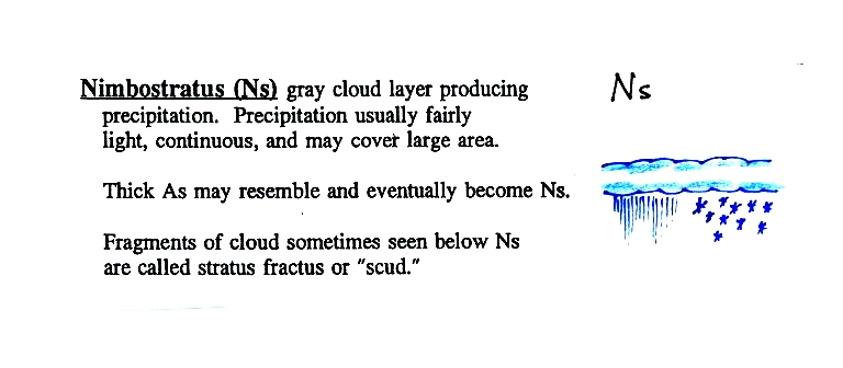
When (if) an altostratus cloud begins
to produce precipitation, its name is changed to
nimbostratus.
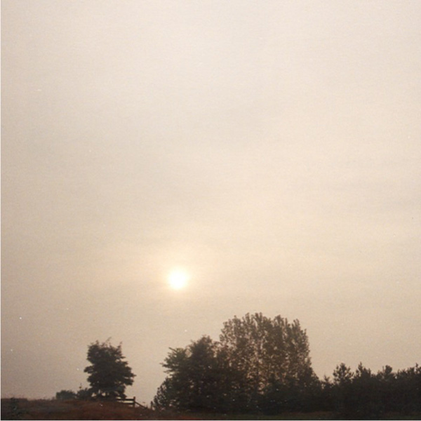
Unless you were there
and could see if it was raining or snowing you might
call this an altostratus or even a stratus
cloud. The smaller darker cloud fragments that
are below the main layer cloud are "scud" (stratus
fractus) clouds (source
of this image).
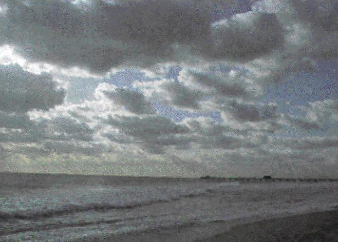
Low
altitude clouds
Pretty common.
This cloud name is a little unusual because the two key
words for cloud appearance have been combined, but
that's a good description of this cloud type - a "lumpy layer
cloud". Remember there isn't a key word for low altitude
clouds.
|
|
Because they are closer to
the ground, the separate patches of Sc are
bigger, about fist size (sources of these
images:left
photo, right
photo ).
The patches of Ac, remember, were about thumb
nail size.. If the cloud fragments in the
photo at right are clearly separate from each
other (and you would need to be underneath the
clouds so that you could look to make this
determination) these clouds would probably be
"fair weather" cumulus. If the patches of
cloud are touching each other (clearly the case
in the left photo) then stratocumulus would be
the correct designation.
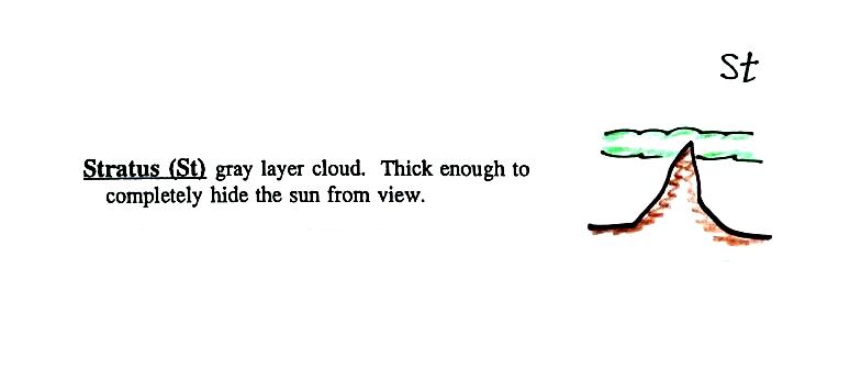
No photographs of stratus clouds, sorry. Other than being closer to
the ground they really aren't much different from
altostratus or nimbostratus.
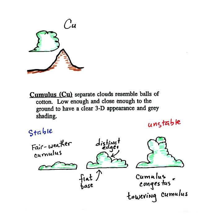
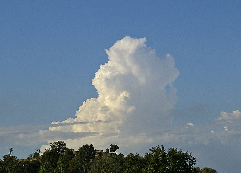
Cumulus
clouds come with different degrees of vertical
development. The fair weather cumulus clouds don't grow
much vertically at all. A cumulus congestus
cloud is an intermediate stage between fair weather cumulus
and a thunderstorm.
Photographs
of "fair weather" cumulus on the left (source)
and cumulus congestus or towering cumulus on the right
(source)
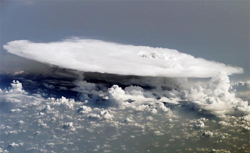
Thunderstorms
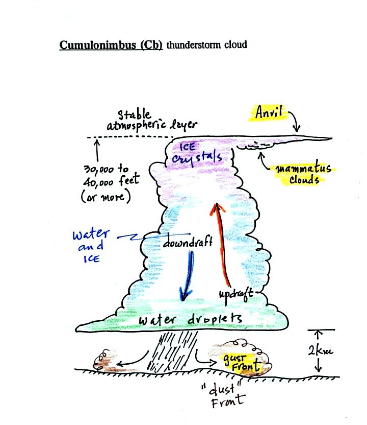
There
are lots of distinctive features on cumulonimbus clouds
including the flat anvil top and the lumpy
mammatus clouds
sometimes found on the underside of the anvil.
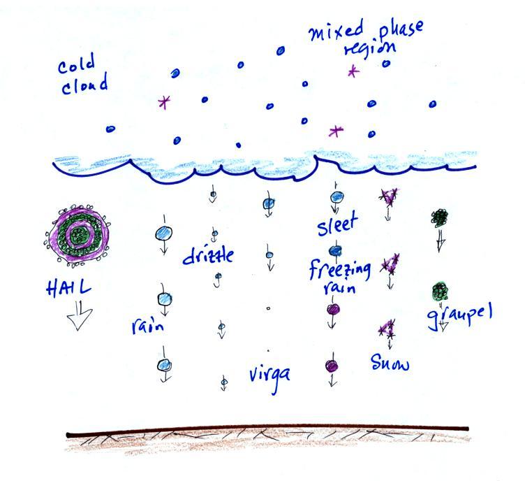
Cold
dense downdraft winds hit the ground below a
thunderstorm and spread out horizontally underneath the
cloud. The leading edge of these winds produces a
gust front (in Arizona dust front might be a
little more descriptive). Winds at the ground
below a thunderstorm can exceed 100 MPH, stronger than
many tornadoes.
The top of a thunderstorm
(violet in the sketch) is cold enough that it will be
composed of just ice crystals. The bottom (green) is
composed of water droplets. In the middle of the
cloud (blue) both water droplets and ice crystals exist
together at temperatures below freezing (the water
droplets have a hard time freezing). Water and ice
can also be found together in nimbostratus clouds.
We will see that this mixed phase region of the cloud is
important for precipitation formation. It is also
where the electricity that produces lightning is
generated.
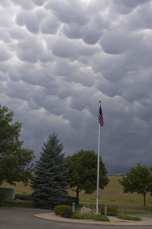
The top left
photo shows a thunderstorm viewed from space (source: NASA Earth
Observatory). The flat anvil top is the dominant
feature. The remaining three photographs are from the UCAR Digital Image
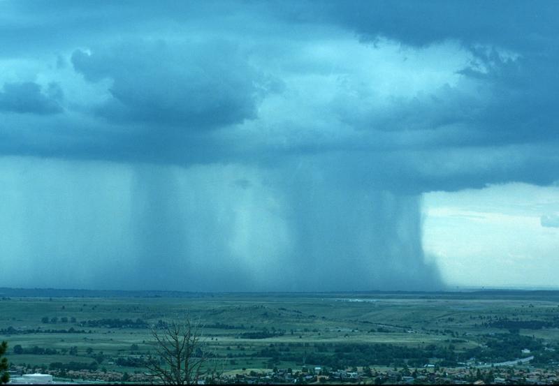
Library. The bottom left photograph shows heavy by
localized rain falling from a thunderstorm. At bottom
right is a photograph of mammatus clouds found on the
underside of the flat anvil cloud.
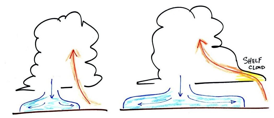
Cold air
spilling out of the base of a thunderstorm is just beginning
to move outward from the bottom center of
the storm in the picture at
left. In the picture at right the cold air has moved
further outward and has begun to get in the way of the
updraft. The updraft is forced to rise earlier and a
little ways away from the center of the thunderstorm.
Note how this rising air has formed an extra lip of
cloud. This is called a shelf cloud.
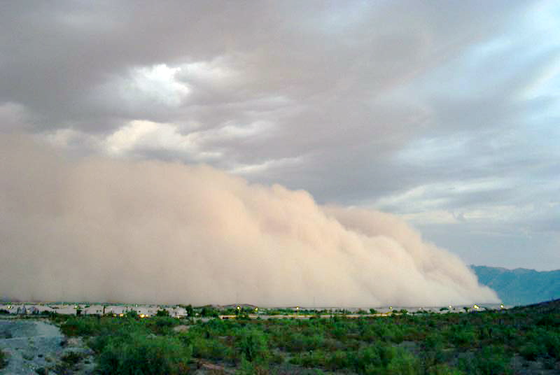
Here's a photograph of the dust stirred
up by the thunderstorm downdraft winds (blowing into
Ahwatukee, Pheonix on Aug. 22, 2003). The thunderstorm
would be off the left somewhere and the dust front would be
moving toward the right. Dust storms like this
are often called "haboobs" (source of
this image).
We'll learn more about the
hazards associated with strong downdraft winds later in the
semester when we cover thunderstorms.
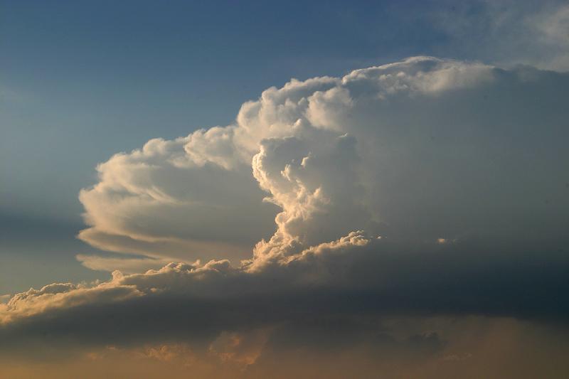
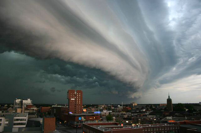
Shelf clouds can sometimes be
quite impressive (the picture above is from a Wikipedia
article on arcus clouds).
The main part
of the thunderstorm would be to the left. Cold air is
moving from left to right in this picture. The shelf cloud
forms along the advancing edge of the gust front.
Here's the completed cloud chart and here's a link to a cloud
chart on a National Weather Service webpage with
actual photographs. See
if you can fill in the cloud names using just the abbreviations
and pictures of the clouds as clues.
Precipitation producing processes
The last topic we will cover
before next week's quiz is precipitation formation and types of
precipitation. Only two of the 10 main cloud types
(nimbostratus and cumulonimbus) are able to produce significant
amounts of precipitation and produce precipitation that can
survive the fall from cloud to ground without evaporating.
Why is that? Why is it so hard for clouds to make
precipitation?
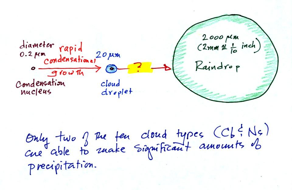
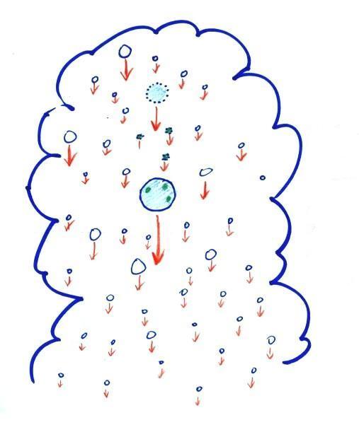
This figure shows typical sizes of cloud condensation nuclei
(CCN), cloud droplets, and raindrops (a human hair is about 50 μm
thick for comparison). As we saw in the cloud in a bottle
demonstration it is relatively easy to make cloud
droplets. You cool moist air to the dew point and raise
the RH to 100%. Water vapor condenses pretty much
instantaneously onto a cloud condensation nucleus to form a
cloud droplet. It would take much longer (a day or more)
for condensation to turn a cloud droplet into a raindrop.
You must know from personal experience that once a cloud forms
you don't have to wait that long for precipitation to begin to
fall.
Part of the problem is that it takes quite a few 20 μm
diameter cloud droplets to make one 2000 μm
diameter raindrop. A raindrop is about 100 times bigger
across than a cloud droplet. How many droplets are needed to
make a raindrop? Before answering that question we will look
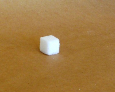
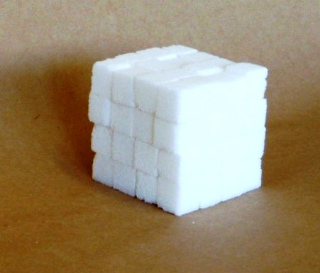
at a cube (rather than a sphere).
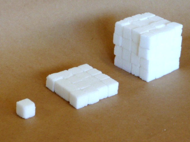
How many sugar cubes
would you need to make a box that is 4 sugar cubes on a
side?
It would take 16 sugar cubes to
make each layer and there are 4 layers. So you'd
need 64 sugar cubes. Volume is length x width x
height.
The raindrop is 100 times wider, 100 times bigger
from front to back, and 100 times taller than the cloud
droplet. The raindrop has a volume that is 100 x 100 x
100 = 1,000,000 (one million) times larger than the volume
of the cloud droplets. It takes about
a million cloud droplets to make one average size raindrop.
Fortunately
there
are
two
processes
capable
of
quickly
turning
small
cloud
droplets
into
much
larger
precipitation particles in a cloud.
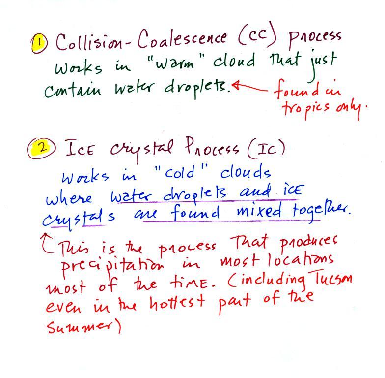
The collision coalescence process works in clouds that are
composed of water droplets only. Clouds like this are only
found in the tropics. We'll see that this is a pretty easy
process to understand.
This process will only produce rain, drizzle, and something
called virga (rain that evaporates before reaching the
ground). Because the clouds are warm and warm air can
potentially contain more water vapor than cooler air, the
collision-coalescence process can produce very large amounts of
rain.
The ice crystal process produces precipitation everywhere
else. This is the process that makes rain in Tucson, even on
the hottest day in the summer (summer thunderstorm clouds are tall
and reach into cold parts of the atmosphere, well below
freezing). Hail and graupel often fall from these storms;
proof that the precipitation started out as an ice
particle). Thunderstorms also produce lightning and later in
the semester we will find that ice is needed to make the
electrical charge that leads to lightning.
There is one part of this process that is a little harder to
understand, but look at the variety of different kinds
of precipitation particles (rain, snow, hail, sleet, graupel, etc)
that can result.
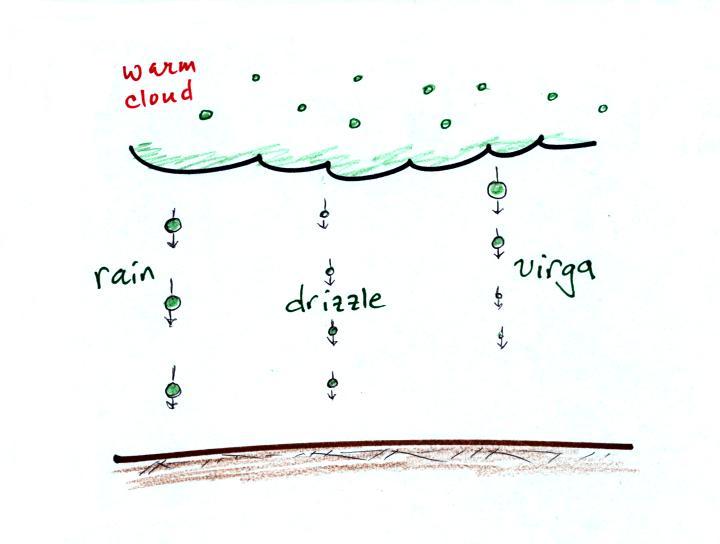
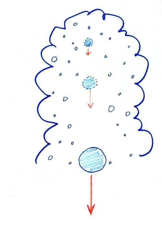
Here's how the collision coalescence process works. The
picture below shows what you might see if you looked
inside a warm cloud with just water droplets:
The collision coalescence
process works in a cloud filled with cloud droplets of
different sizes, that's critical. The larger
droplets fall faster than the small droplets. A
larger-than-average cloud droplet will overtake and collide with
smaller slower moving ones.
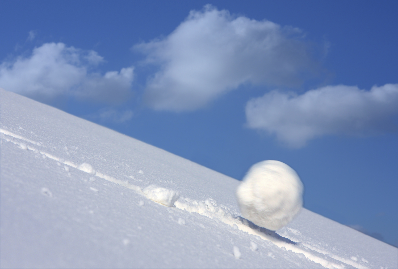
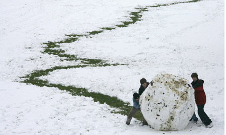
This is an accelerating growth
process. The falling droplet gets wider, falls faster, and
sweeps out an increasingly larger volume inside the cloud.
The bigger the droplet gets the faster it starts to grow (think
of a growing ball of snow as it rolls down a snow-covered hill
and picks up snow, grows, and starts to roll faster and
faster; or think of an avalanche
that gets bigger and moves faster as it travels downslope)
A larger than average cloud droplet can very quickly grow
to raindrop size.
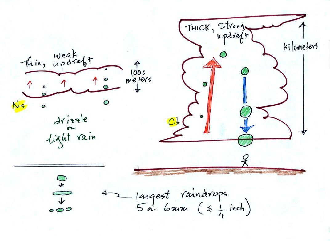
The figure shows the two precipitation producing clouds:
nimbostratus (Ns) and cumulonimbus (Cb). Ns
clouds are thinner and have weaker updrafts than Cb clouds.
The largest raindrops fall from Cb clouds because the droplets
spend more time in the cloud growing. In a Cb cloud raindrops can
grow while being carried upward by the updraft and also when
falling in the downdraft.
Raindrops grow up to about 1/4 inch in diameter. When
drops get larger than that, wind resistance flattens out the drop
as it falls toward the ground. The drop begins to "flop" or
"wobble" around and breaks apart into several smaller
droplets. Solid precipitation particles such as hail can get
much larger (an inch or two or three in diameter).
And actually my sketch at lower left above isn't quite accurate
as this video of the breakup of a
5 mm diameter drop of water shows.