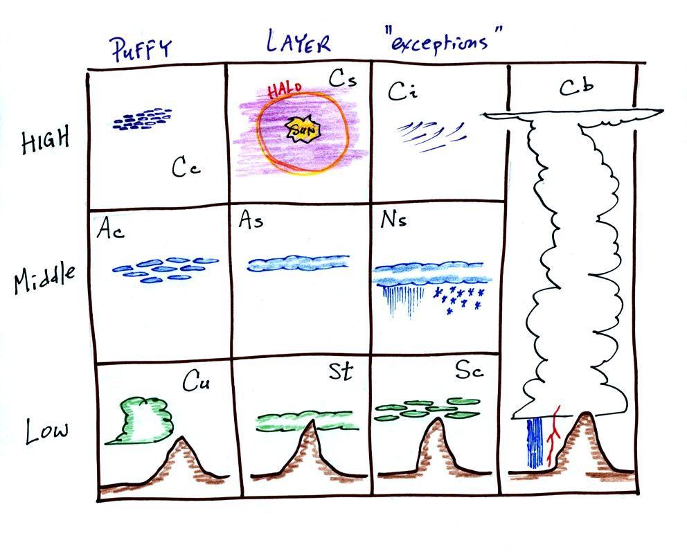
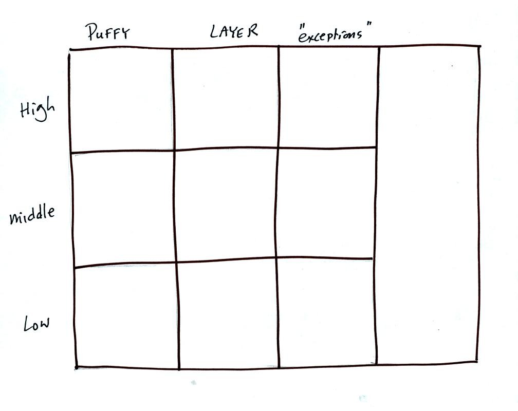
Drawing a chart like this on a blank sheet of paper is a good way to review cloud identification and classification. There are 10 boxes in this chart, one for each of the 10 main cloud types. Eventually, you should be able to put a cloud name, a sketch, and a short written description in each square.
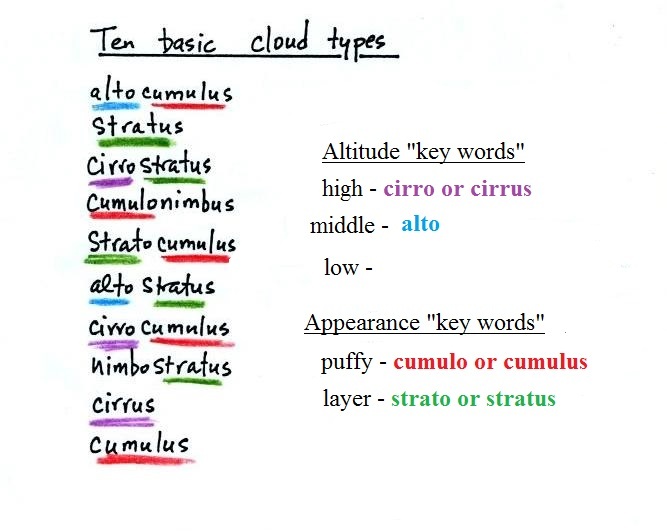
Clouds are classified according to the altitude at which they form and the appearance of the cloud. We'll discuss altitude again briefly.
Cloud Altitude
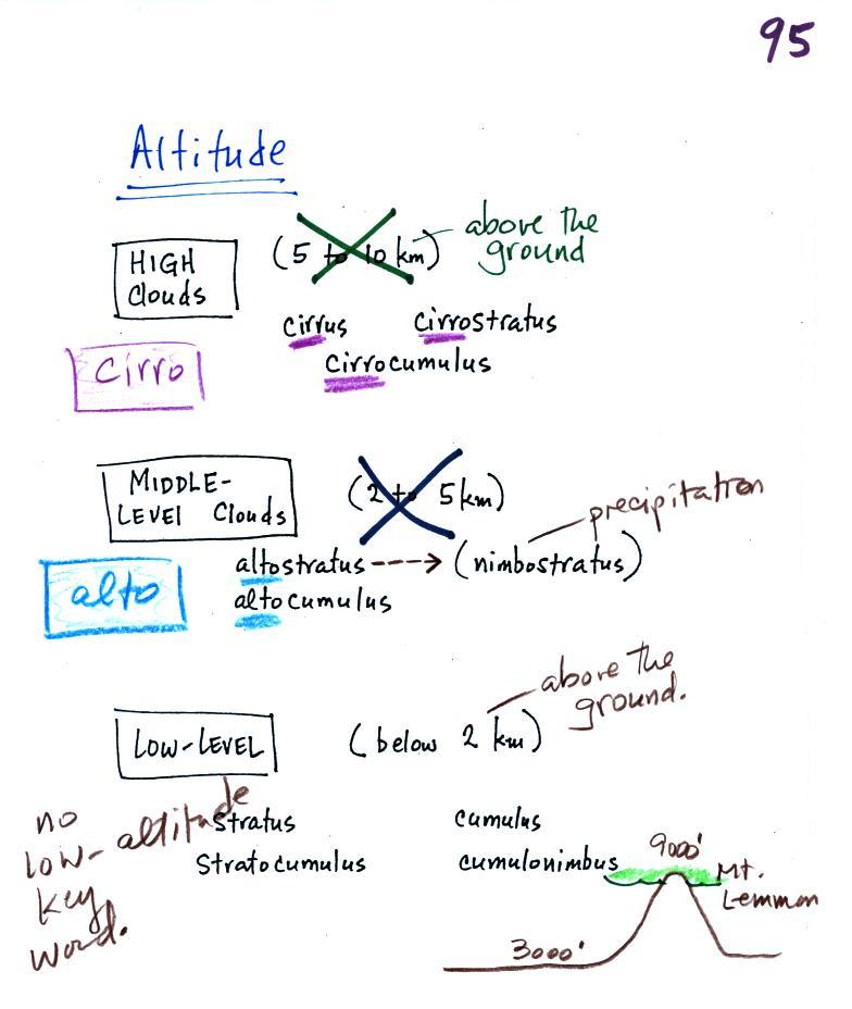
Clouds are grouped into one of three altitude categories: high, middle level, and low. It is very hard to just look up in the sky and determine a cloud's altitude. You will need to look for other clues to distinguish between high and middle altitude clouds. We'll learn about some of the clues when we look at cloud pictures later in the class.
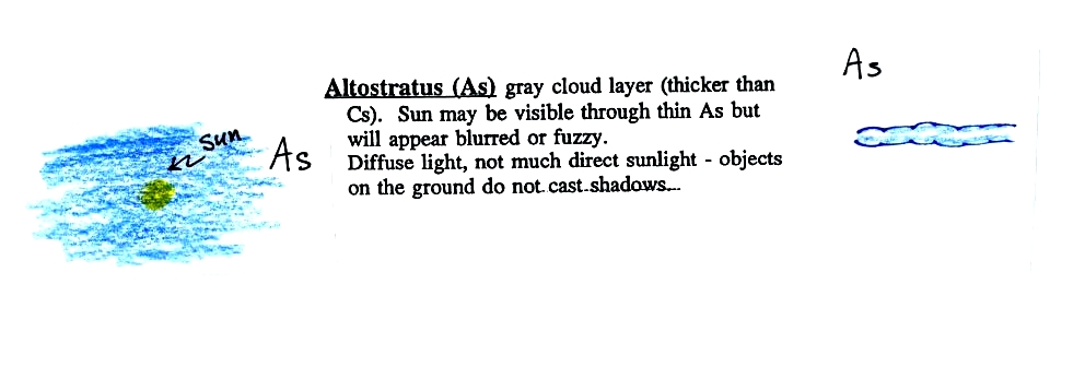
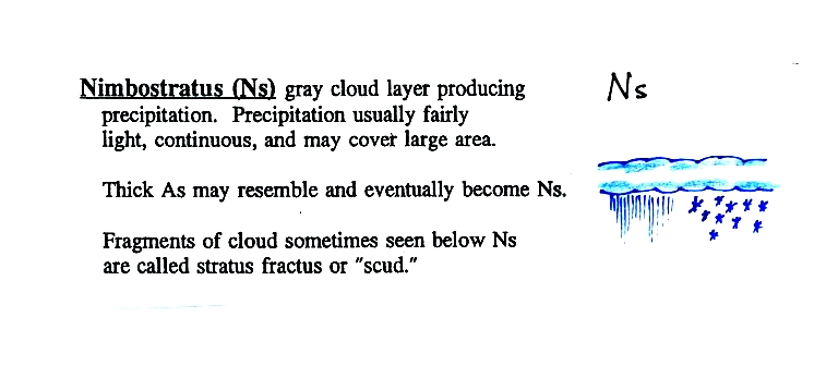
Cirrus or cirro identifies a high altitude cloud. There are three types of clouds found in the high altitude category..Alto in a cloud name means the cloud is found at middle altitude. The arrow connecting altostratus and nimbostratus indicates that they are basically the same kind of cloud. When an altostratus cloud begins to produce rain or snow its name is changed to nimbostratus. A nimbostratus cloud may become somewhat thicker and lower than an altostratus cloud. Sometimes it might sneak into the low altitude category.
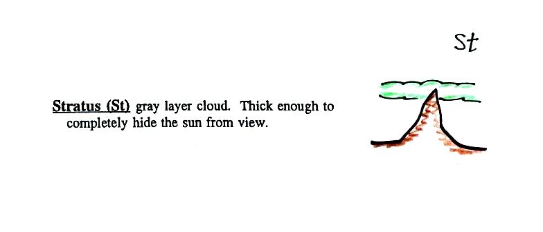
There is no key word for low altitude clouds. Low altitude clouds have bases that form 2 km or less above the ground. The summit of
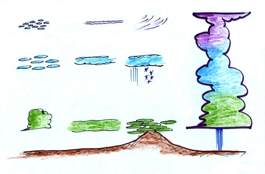
High clouds are found up near the top of the troposphere. Moving from left to right across the top of the picture are cirrocumulus, cirrostratus, and cirrus. It's cold up at high altitude and violet in this picture means the cloud is composed entirely of ice crystals.
Green at the bottom of the figure indicates clouds that form in warmer air and are composed of just water droplets, As you move left to right at the bottom of the picture are cumulus, stratus, and stratocumulus. Note how the base of these low clouds is at or below the summit of the mountain in the sketch.
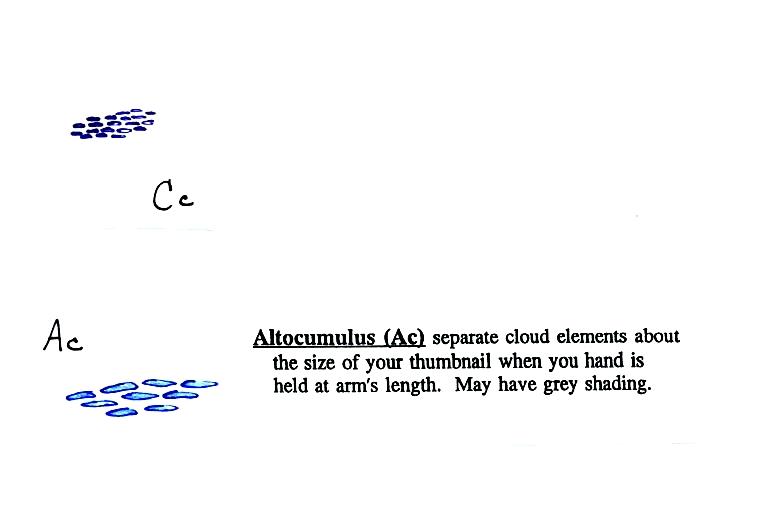
Blue, at middle levels indicates a mixture of ice crystals and supercooled water droplets (water that has cooled to below freezing but hasn't frozen). The figure shows altocumulus, altostratus, and nimbostratus producing rain and snow.
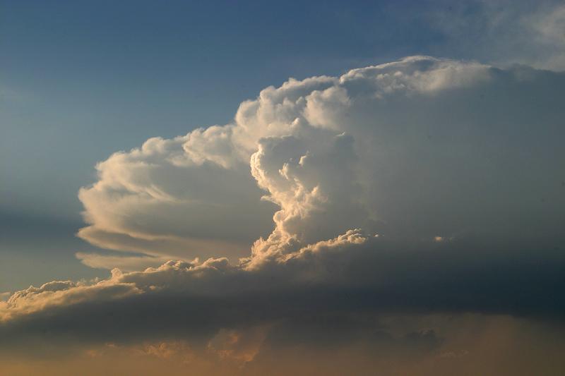
The tall cloud at right is a thunderstorm, also named cumulonimbus. The cloud starts in the low altitude category and grows all the way up to the top of the troposphere, the top of the high altitude category.
A key word for cloud appearance is the second part of most cloud names.
Cloud Appearance
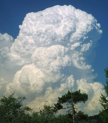
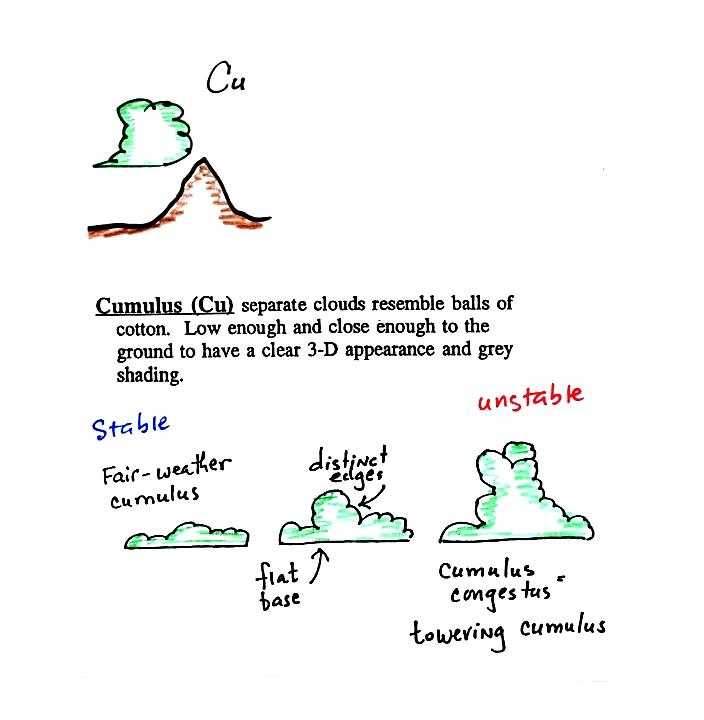
We'll start with cumuliform. In some ways cumulus clouds resemble a head of cauliflower. C for cumuliform and C for cauliflower. Cumulus clouds might also have a lumpy, patchy or puffy appearance and might form in waves or ripples. You'll find cumulo or cumulus in a cloud that has texture like this
 |
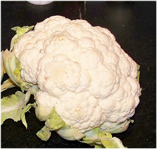 Head of cauliflower source |
 |
 |
 |
 |
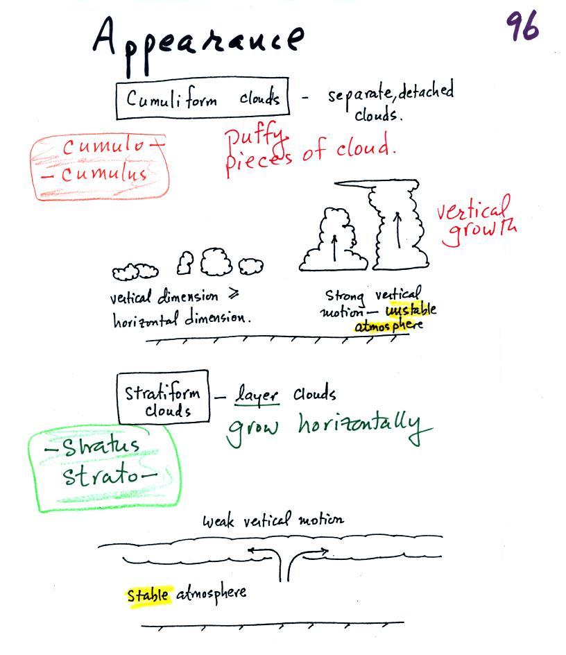
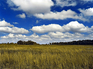
Clouds can have a patchy of
puffy (or lumpy, wavy, splotchy or ripply)
appearance. These are cumuliform clouds and
will have cumulo or cumulus
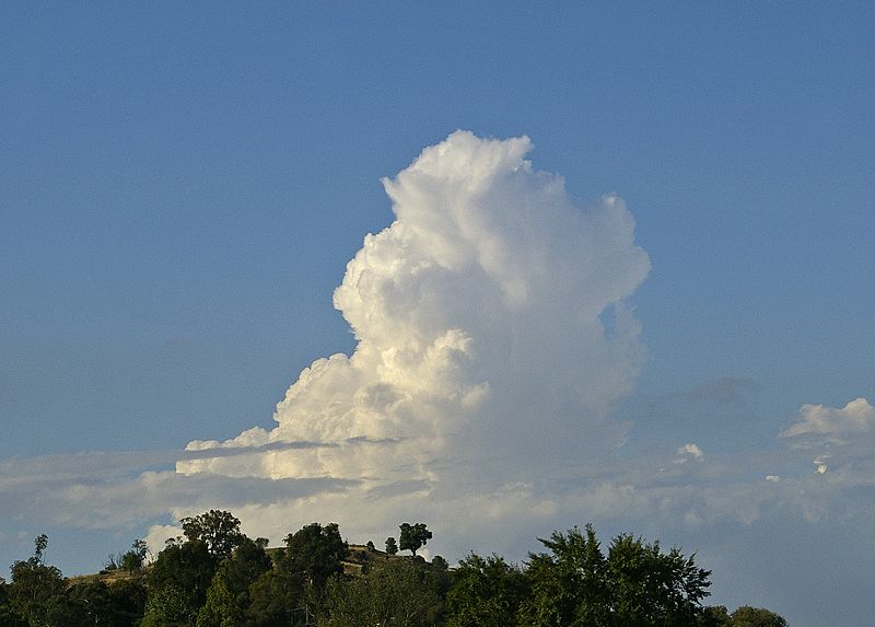
in their name. In an unstable atmosphere
cumuliform clouds will grow vertically.
Strong thunderstorms can produce dangerous severe
weather.
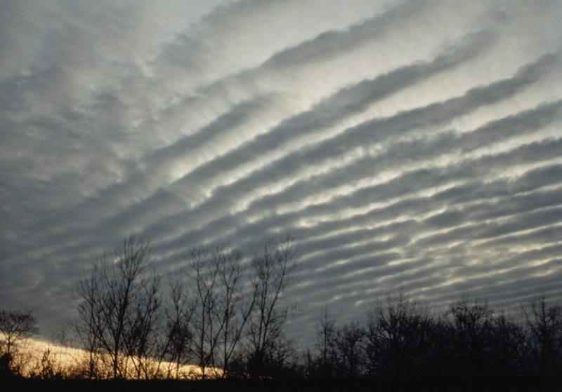
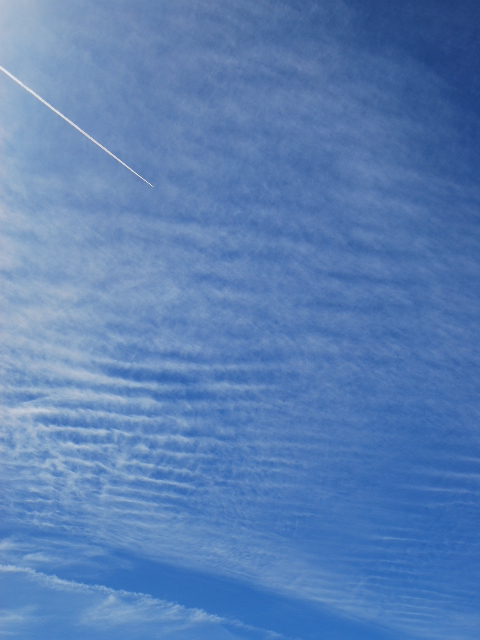
Stratiform clouds grow
horizontally and form layers. They form when
the atmosphere is stable. You'll find strato or stratus
in the cloud name.
 |
|
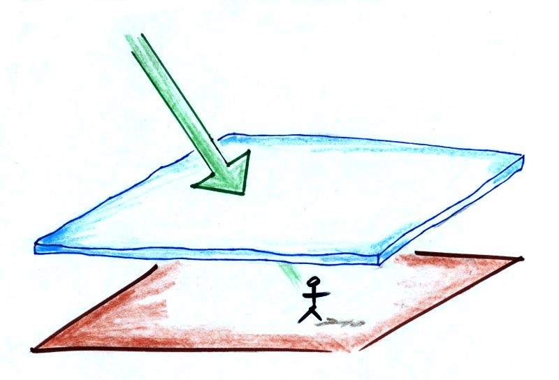 A side view of a layer cloud. How much sunlight is able to shine through the cloud depends on how thick the cloud is. A person on the ground may or may not cast a shadow. |
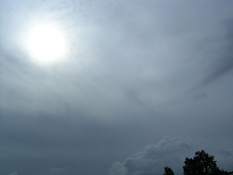 A view from the ground
look up at the sun through a middle level
layer cloud. The sun is visible but
blurred. (source)
|
There's a 5th key word that I have been forgetting to mention.
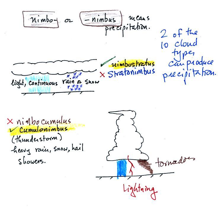
Nimbo
or nimbus, means precipitation (it is also the
name of a local
brewing company). Only two of the 10
cloud types are able to produce (significant
amounts of) precipitation. It's not as easy
as you might think to make precipitation.
We'll start to look at precipitation producing
processes in the next class.
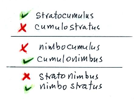
While you are still learning the cloud names you might put the correct key words together in the wrong order (stratonimbus instead of nimbostratus, for example). You won't be penalized for those kinds of errors in this class because you are putting together the right two key words.
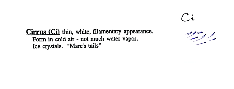
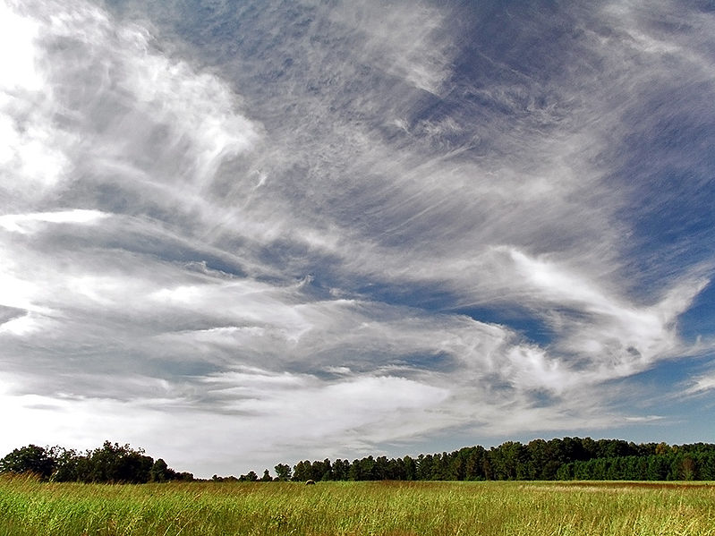
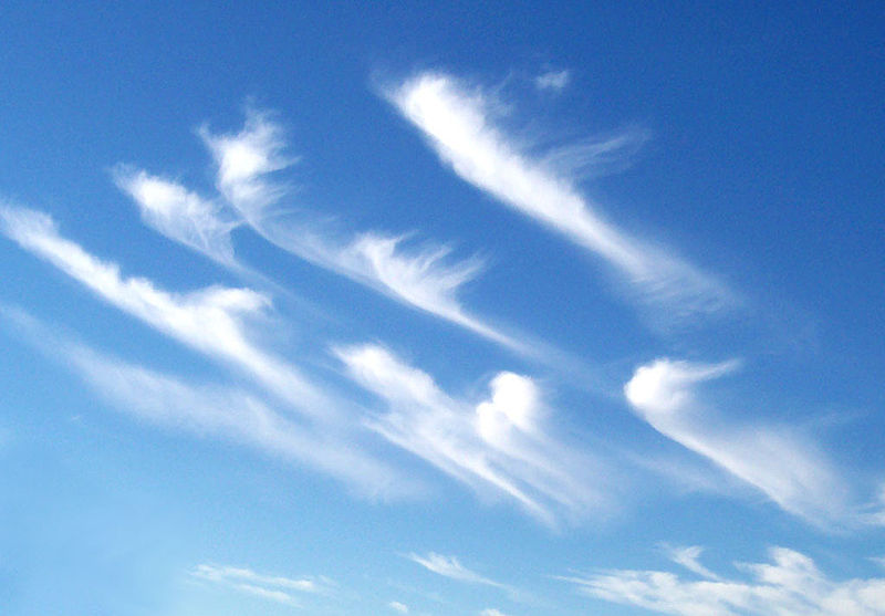
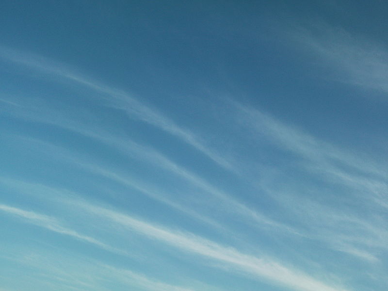
High altitude clouds are thin because the air at high altitudes is very cold and cold air can't contain much moisture, the raw material needed to make clouds (the saturation mixing ratio for cold air is very small). These clouds are also often blown around by fast high altitude winds. Filamentary means "stringy" or "streaky". If you imagine trying to paint a Ci cloud you might dip a small pointed brush in white paint brush it quickly and lightly across a blue colored canvas. Here are some pretty good photographs of cirrus clouds (they are all from a Wikipedia article on Cirrus Clouds)
 |
 |
 |
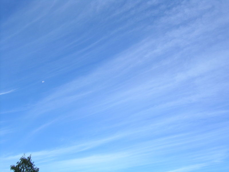 |
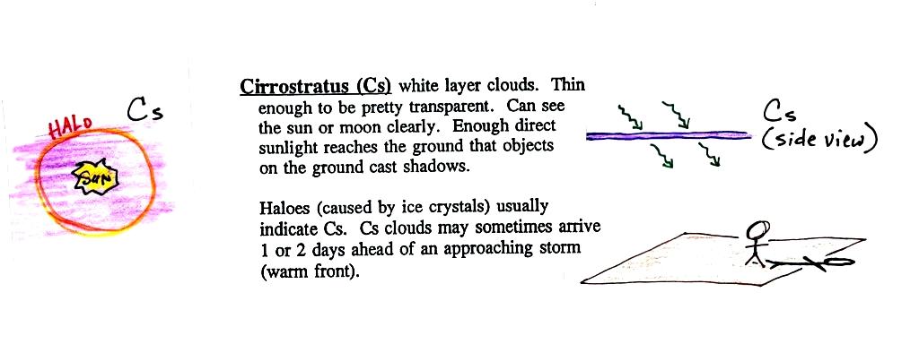
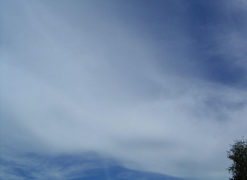
A cirrostratus cloud is a thin uniform white
layer cloud (not purple as shown in the figure)
covering part or all of the sky. They're so
thin you can sometimes see blue sky through the
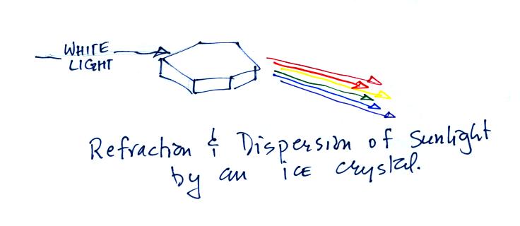
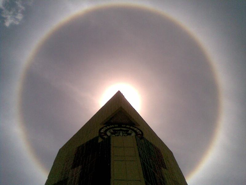
cloud layer. Haloes are a pretty sure
indication that a cirrostratus cloud is
overhead. If you were painting Cs clouds you
could dip a broad brush in watered down white paint
and then paint back and forth across the canvas.
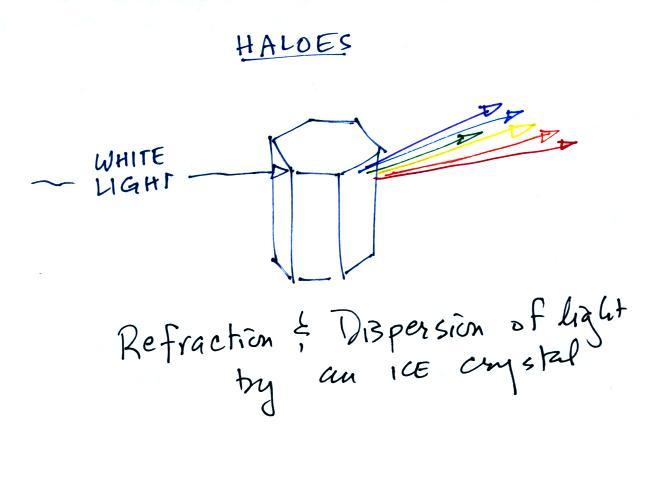
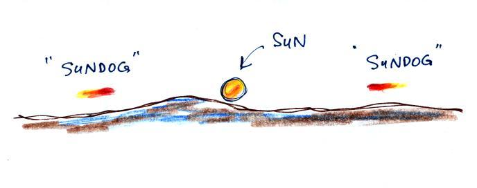
Haloes are produced when white light (sunlight or moonlight) enters a 6 sided ice crystal. The light is refracted (bent). The amount of bending depends on the color (wavelength) of the light (dispersion). The white light is split into colors just as light passing through a glass prism. Crystals like this (called columns) tend to be randomly oriented in the air. That is why a halo forms a complete ring around the sun or moon. You don't usually see all the colors, usually just a hint of red or orange on the inner edge of the halo.
 |
 |
 |
 |
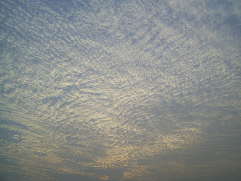
If you spend enough time outdoors looking up at the sky you will eventually see all 10 cloud types. Cirrus and cirrostratus clouds are fairly common. Cirrocumulus clouds are a little more unusual. The same is true with animals, some are more commonly seen in the desert around Tucson (and even in town) than others.
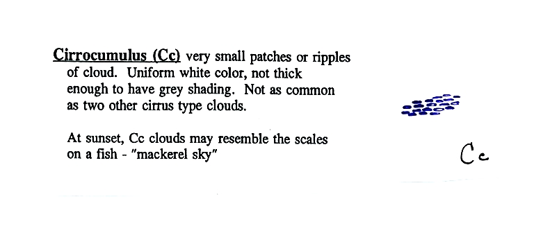
The table below compares cirrostratus (the cloud on the left without texture) with a good example of a cirrocumulus cloud (the "splotchy" appearing cloud on the right). Both photographs are from the Wikipedia article mentioned earlier.
 |
 |
 |
 |
There's a much larger collection in this gallery of images. The fact that there are so many examples is an indication of how common this particular type of cloud is.
 |
 |
 |
 |
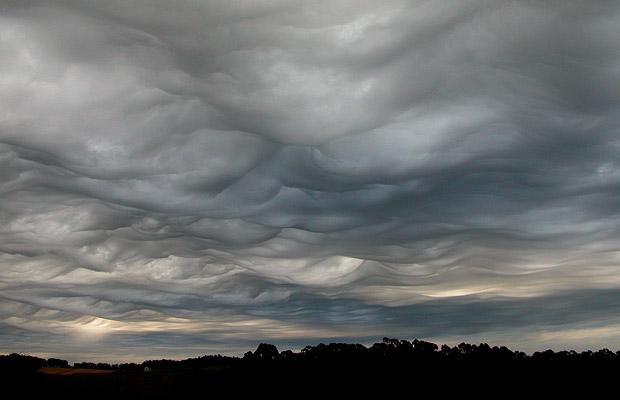
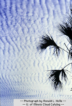
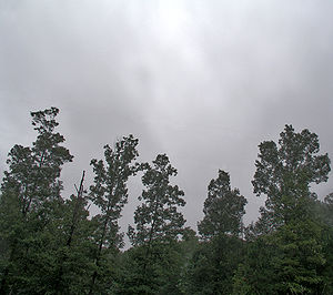
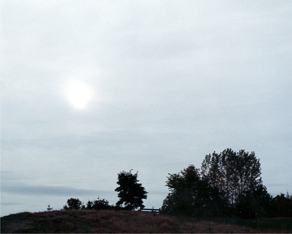
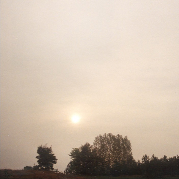
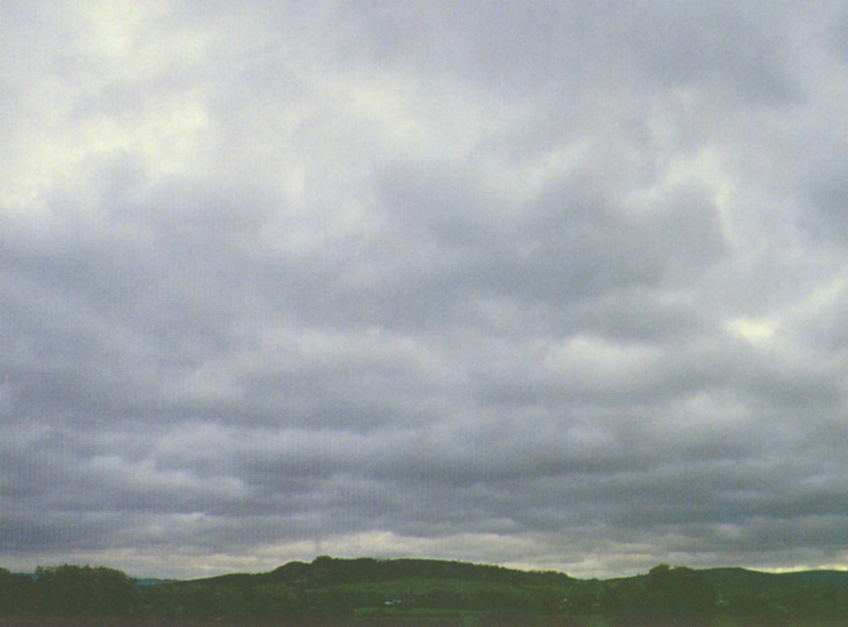
Unless you were there and could see if it was raining or snowing you might call this an altostratus or even a stratus cloud. The smaller darker cloud fragments that are below the main layer cloud are "scud" (stratus fractus) clouds (source of this image).
LOW ALTITUDE CLOUDS
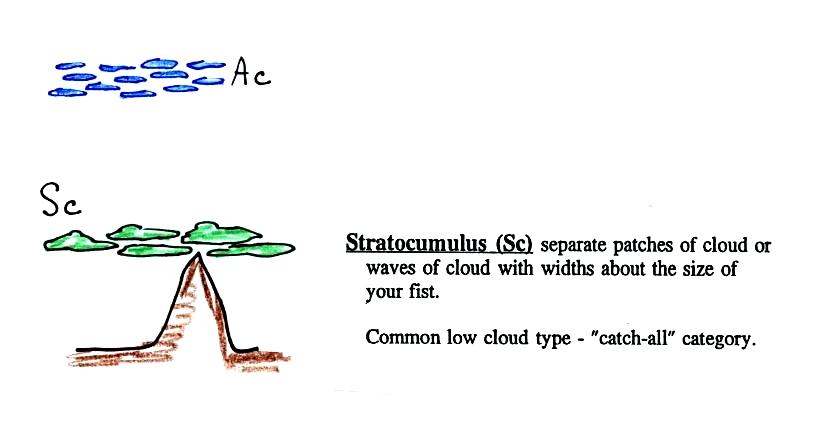
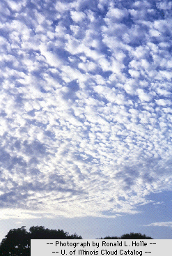
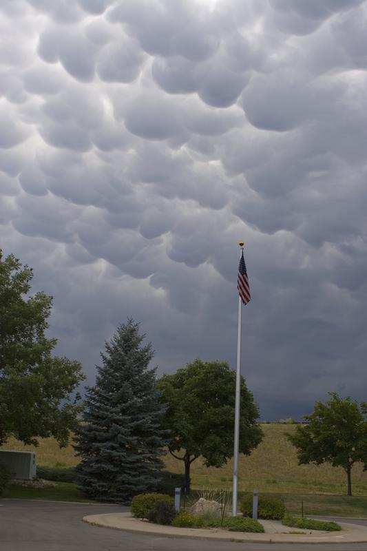
This cloud name is a little unusual because the two key words for cloud appearance have been combined, but that's a good description of this cloud type - a "lumpy layer cloud". Remember there isn't a key word for low altitude clouds.
 |
 |
 |
 |
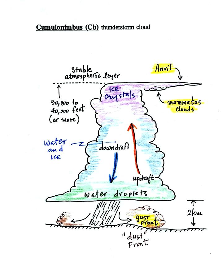
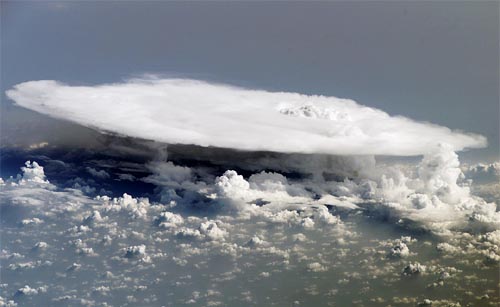
There
are lots of distinctive features on cumulonimbus
clouds including the flat anvil top and the
lumpy mammatus
clouds sometimes found on the underside of the
anvil.
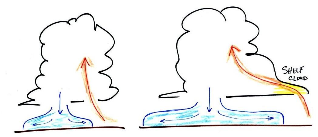
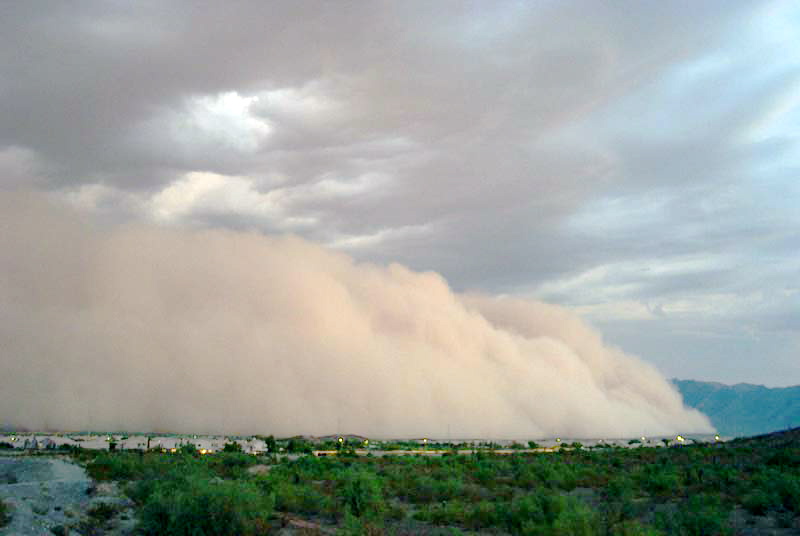
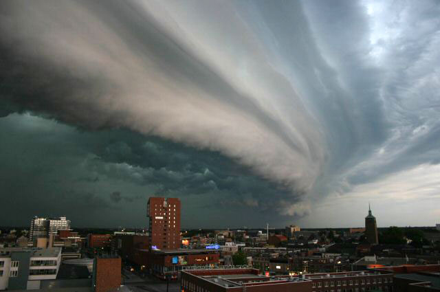
Cold
dense downdraft winds hit the ground below a
thunderstorm and spread out horizontally
underneath the cloud. The leading edge of
these winds produces a gust front (in Arizona
dust front might be a little more
descriptive). Winds at the ground below a
thunderstorm can exceed 100 MPH, stronger than
many tornadoes.
 |
 |
|
 |