Tuesday, Oct. 29, 2019
We'll use page
93 near the start of class today. Page 95, page 96, page 97a, page 97b and page 98a will be needed for
the section on identifying and naming clouds. There's a good
chance that part of that will spill over into the start of
Thursday's class.
Music today will come from the following. The
first two groups are new discoveries from the Spring 2019
semester. I "discovered" the 3rd group (a Russian ska band?)
this summer.
Pokey Lafarge "Actin' a Fool"
(3:21), "Sadie
Green" (3:24), "Something in
the Water" (5:03)
Kitty, Daisy, and Lewis "Going Up the
Country" (3:23), "I'm So Sorry"
(4:45), "Whenever
You See Me" (4:12), "Feeling of
Wonder" (3:20)
Lollypop Lorry "I Won't Let
You Go" (2:15), "Silent River
Runs Deep" (3:01)
Making a cloud in a bottle
Cooling air (caused by sudden expansion) & increasing
relative humidity, condensation nuclei, and scattering of light
are all involved in this demonstration.
We used a
strong, thick-walled, 4 liter vacuum flask (designed
to not implode when all of the air is pumped out of
them, they really aren't designed to be
pressurized). There was a little water in the
bottom of the flask to moisten the air in the
flask. Next we pressurized the air in the
flask with a bicycle pump. At some point the
pressure blows the cork out of the top of the
flask. The air in the flask expands outward
and cools. This sudden cooling increases the
relative humidity of the moist air in the flask to
more than 100% momentarily and water vapor condenses
onto cloud condensation nuclei in the air.
I like it best when a faint, hard to see, cloud
becomes visible. That's because there is
something we can add to the demonstration that will
make the cloud much "thicker" and easier to see.
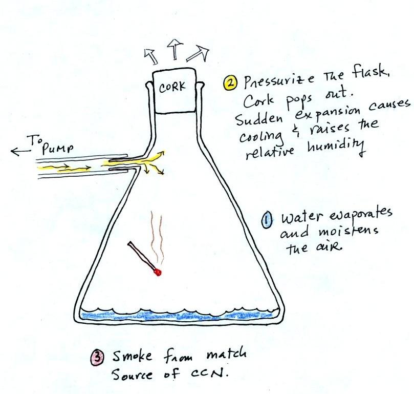
The demonstration was repeated an additional
time with one small change. A burning match was dropped
into the bottle. The smoke from the matches added lots of
very small particles, condensation nuclei, to the air in the
flask (you could see the swirls of smoke, the small particles
scattered light). The same amount of water vapor was
available for cloud formation but the cloud that formed this
time was quite a bit "thicker" and much easier to see. To
be honest the burning match probably also added a little water
vapor (water vapor together with carbon dioxide is one of the by
products of combustion).
I have found a couple of online versions of the
demonstration. The first
is performed by Bill Nye "The Science Guy" and is pretty similar
to the one done in class. The second
differs only in the way that is used to caused the sudden
expansion and cooling of the air (I didn't care much for the
music (probably your opinion of the music I play before class)
and I would recommend turning down the sound while watching the
video).
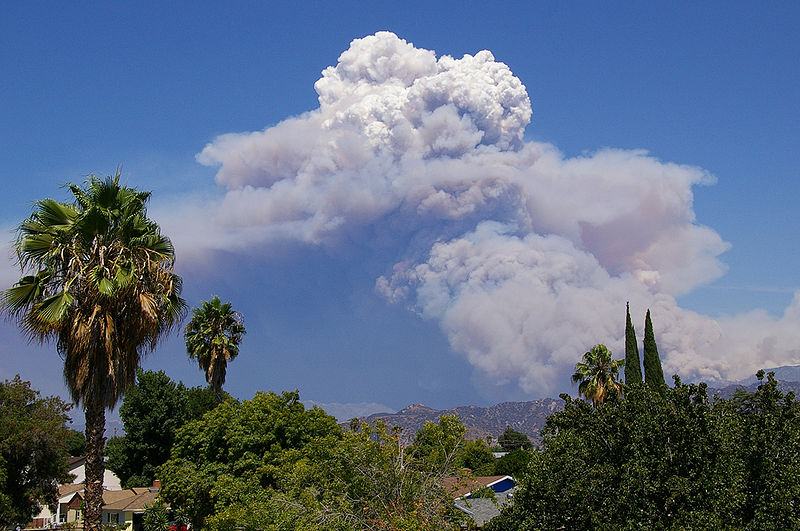
Mother Nature's version of the Cloud in a Bottle
demonstration
A
brush fire in this picture is heating up air and causing
it to rise. Combustion also adds some moisture and
lots of smoke particles to the air. You can see
that initially the rising air doesn't form a cloud (the
RH is still less than 100%). A little higher and
once the rising air has cooled enough (to the dew point)
a cloud does form. And notice the cloud's
appearance - puffy and not a layer cloud. Cumulo
or cumulus is the word used to describe a cloud with
this appearance. These kinds of fire caused clouds
are called pyrocumulus clouds. The example above
is from a
Wikipedia article fire-caused clouds.
The fire in this case was
the "Station Fire" burning near Los Angeles in August
2009. We sometimes see clouds like this in the summer
when lightning starts a fire burning in one of the nearby
forests. The pyrocumulus cloud caused by the fire is
sometimes the only cloud in the sky.
Clouds and climate change
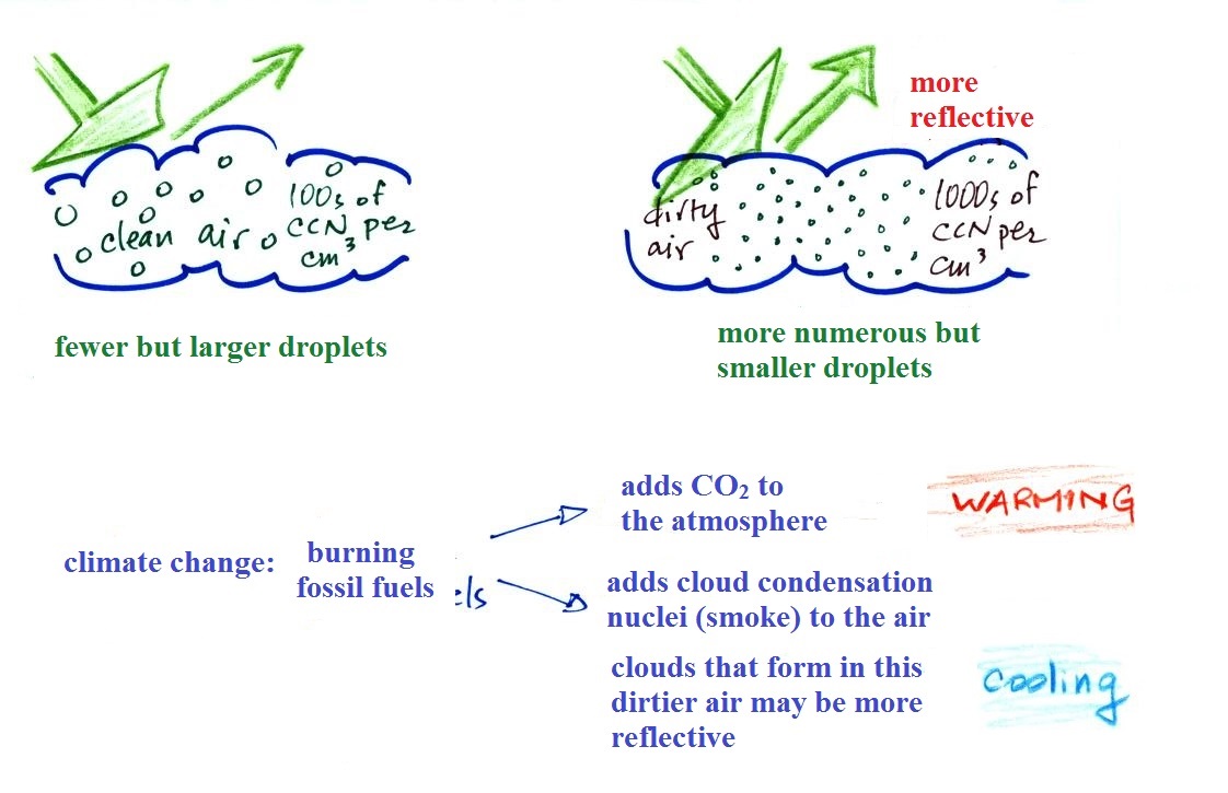
This effect has some implications for climate change.
A cloud that forms in dirty air is composed of a large number
of small droplets (right figure above). This cloud is more
reflective than a cloud that forms in clean air, that is composed
of a smaller number of larger droplets (left figure).
Combustion of fossil fuels adds carbon dioxide to the
atmosphere. There is concern that increasing carbon
dioxide concentrations (and other greenhouse gases) will enhance
the greenhouse effect and cause global warming. Combustion
also adds condensation nuclei to the atmosphere (just like the
burning match added smoke to the air in the flask). More
condensation nuclei might make it easier for clouds to form,
might make the clouds more reflective, and might cause
cooling. There is still quite a bit of uncertainty about
how clouds might change and how this might affect climate.
Remember that clouds are good absorbers of far IR radiation and
also emit IR radiation. Clouds often raise nighttime low
temperatures.
Clouds are one of the best ways of cleaning the
atmosphere. This is something we mentioned earlier in the
semester and you're now in a position to understand it better.
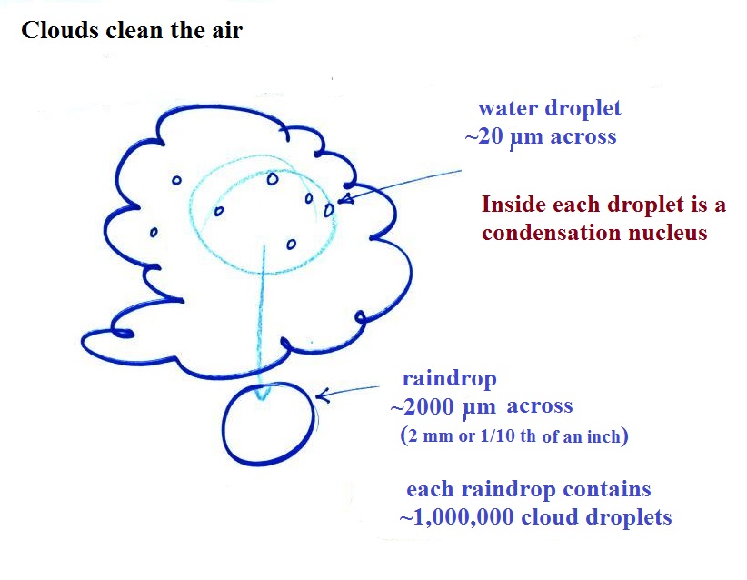
A cloud is composed of small
water droplets (diameters of 10 or 20 micrometers) that form on
particles ( diameters of perhaps 0.1 or 0.2 micrometers). The
droplets "clump" together to form a raindrop (diameters of 1000
or 2000 micrometers which is 1 or 2 millimeters), and the
raindrop carries the particles to the ground. A typical
raindrop can contain 1 million cloud droplets so a single
raindrop can remove a lot of particles from the air. You
may have noticed how clear the air seems the day after a
rainstorm; distant mountains are crystal clear and the sky has a
deep blue color. Gaseous pollutants can dissolve in the
water droplets and be carried to the ground by rainfall
also. We'll be looking at the formation of precipitation
in more detail later this week.
We should be able to get
well into this next topic in class today. You'll find the
following on page
95 in the ClassNotes.
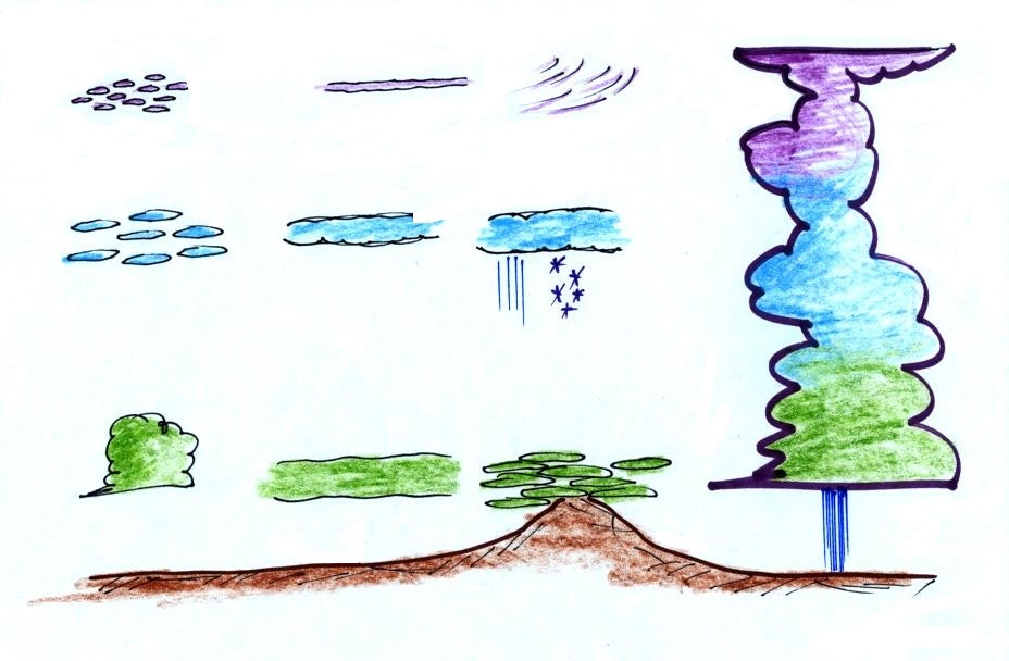
Identifying and naming clouds - 10 main cloud
types
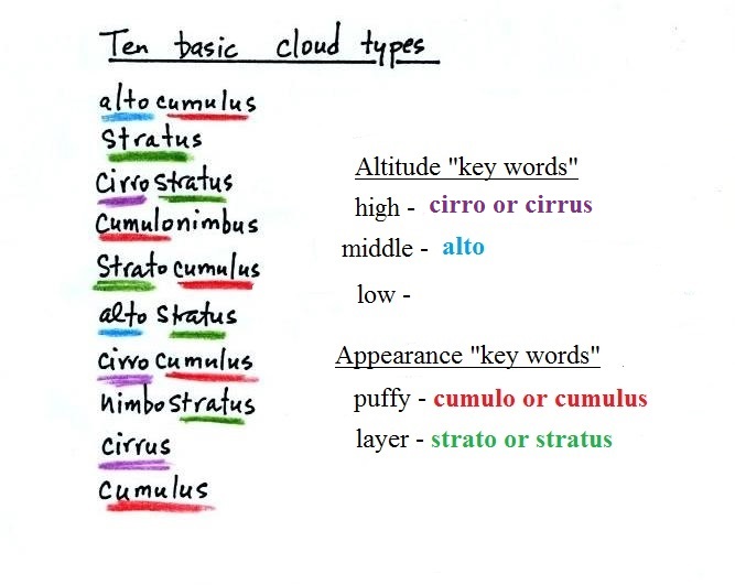
I'm hoping you'll try to learn
these 10 cloud names. There is a smart and a
not-so-smart way of learning these names. The
not-so-smart way is to just memorize them. The
names all sound alike and you will inevitably get them
mixed up.
A better way is to
recognize that all the cloud names are made up of a few
key words. Try to learn the key words and what
they tell you about clouds. In
addition to learning the names, I'm hoping you'll be
able to sketch each of the clouds and describe them in
words. The key words will help with that also.
***
Clouds are classified using just two criteria:
altitude and appearance ***
There are 2 key words that tell you something about the
cloud's altitude and 2 more for cloud appearance
(there's a 5th key word for clouds that are producing
precipitation). In many cases you'll be able to construct
a cloud name by taking key words from both the altitude
and appearance groups and combining them.
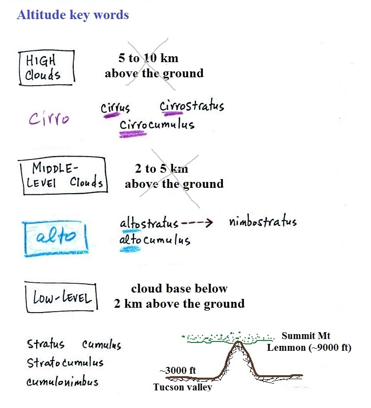
Cloud Altitude
Clouds are grouped into one of three altitude
categories: high, middle level, and low. It is very hard to just look up
in the sky and determine a cloud's altitude (that's
why the 2 to 5km and 5 to 10 km altitude ranges are
X'd out). You will need to look for other clues
to distinguish between
high and middle altitude clouds. We'll learn
about some of the clues when we look at cloud
pictures.
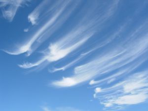
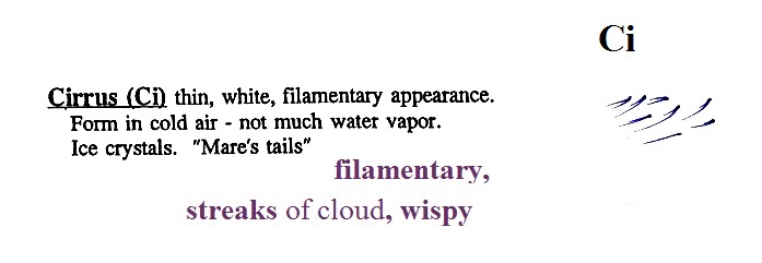
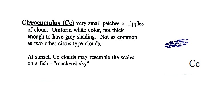
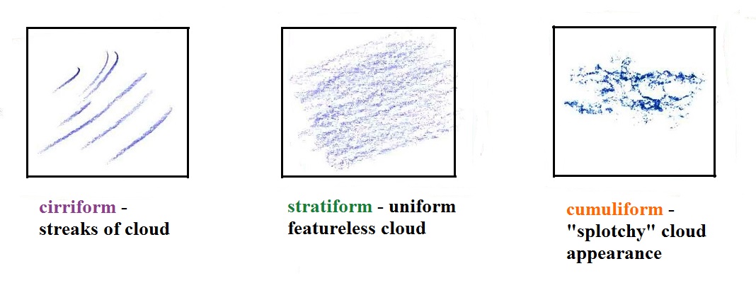
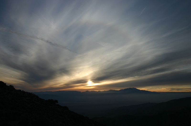
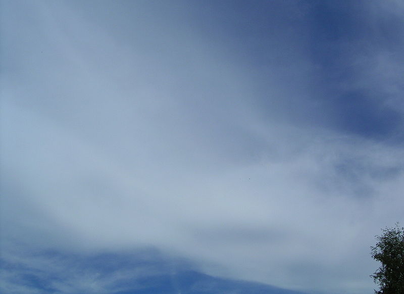
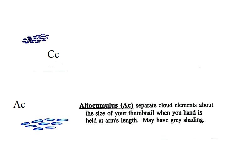
Cirrus
or cirro
identifies a high altitude cloud. There are three
types of clouds found in the high altitude category..
Alto
in a cloud name means the cloud is found at
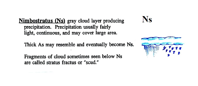
middle altitude. The arrow connecting altostratus
and nimbostratus indicates that they are basically the
same kind of cloud. When an altostratus cloud
begins to produce rain or snow its name is changed to
nimbostratus. A nimbostratus cloud may become
somewhat thicker and lower than an altostratus
cloud. Sometimes it might sneak into the low
altitude category.
There is no key word for low altitude clouds. Low
altitude clouds have bases that form 2 km or less above
the ground. The summit of Mt. Lemmon in the Santa Catalina mountains
north of Tucson is about 2 km above the valley
floor. Low altitude clouds
will have bases that form at or below the summit of Mt. Lemmon.
Examples of puffy
patchy (cumuliform) clouds found at different
altitudes
 |
high altitude cloud
the patches of cloud are small because they are far
away.
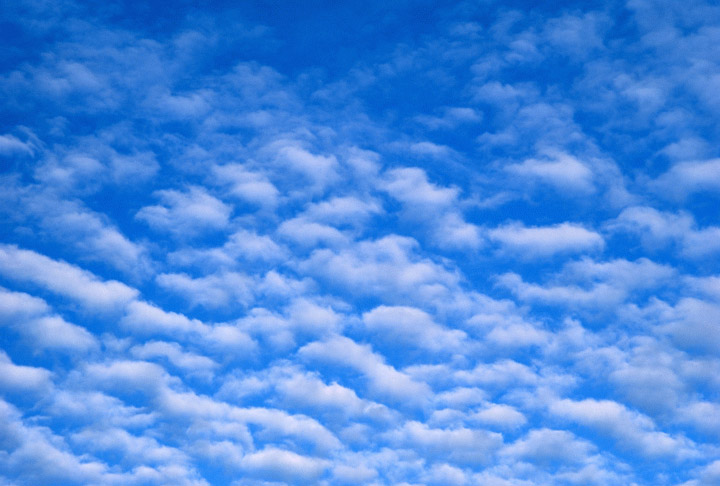
This is a cirrocumulus cloud,
cirro means high altitude, cumulus means "patchy".
The air is cold at high altitude and doesn't contain
much water vapor. High altitude clouds are thin,
there's not much raw material available to make the
cloud. |
 |
middle altitude cloud
the patches of cloud are bigger because they closer to
the ground.
This is an altocumulus cloud.
|
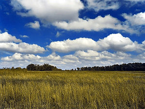 |
low altitude cloud
cumulus
clouds
(there is no key word for low altitude) |
Cloud Appearance
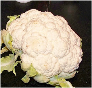
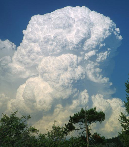
Cumulus clouds are often described
as resembling a head of cauliflower. Clouds can have
a patchy of puffy (or lumpy, wavy, splotchy or ripply)
appearance. These are cumuliform clouds and will
have cumulo
or cumulus in their name. These
clouds are as tall or taller than they are across, in an
unstable atmosphere cumuliform clouds will grow vertically
and turn into thunderstorms. Strong thunderstorms
can produce dangerous weather.
Here
are some examples of the different textures or features that
characterize cumuliform clouds:
|
|
Head of cauliflower
source
|
|
|
|
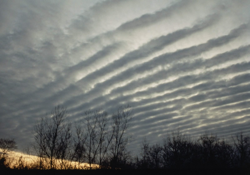
ripples or waves
note the size, this is probably a middle or low
level cloud
source
|
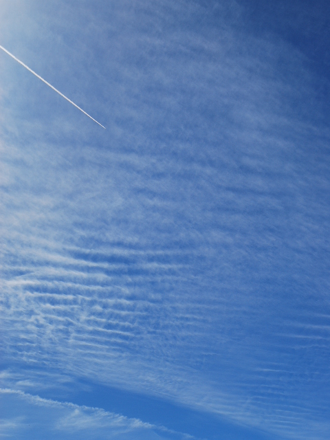
This is probably a
middle or high level cloud because the ripples are
smaller (higher and further away)
source
|
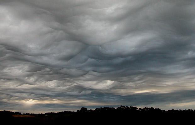
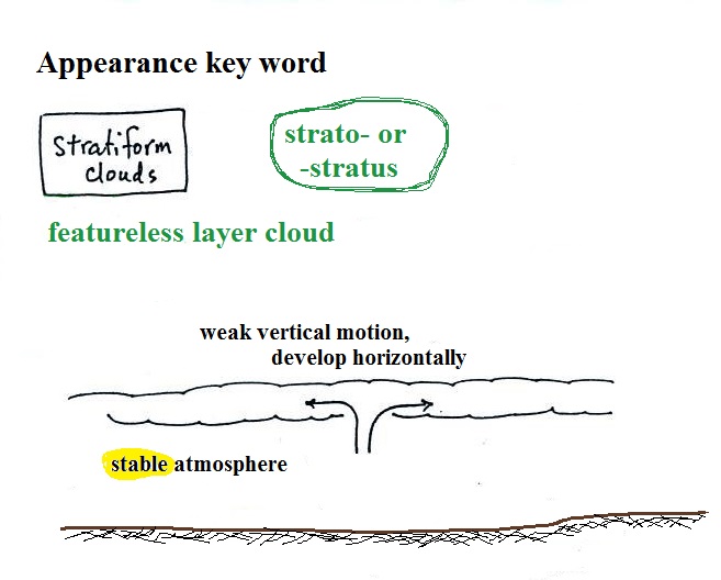
Stratiform clouds grow
horizontally and form layers. They form when the
atmosphere is stable.
You'll find strato or stratus in the cloud
name. Stratiform
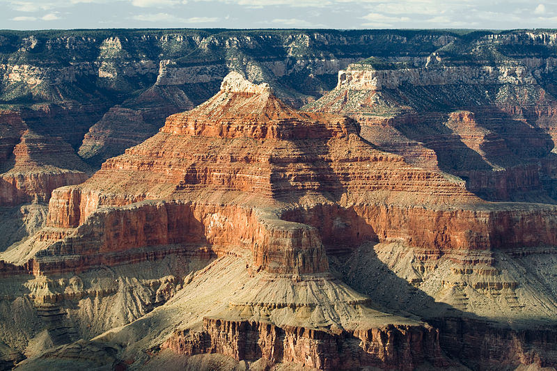
- as in rock strata, or stratosphere.
rock strata at the
Grand Canyon
source
|
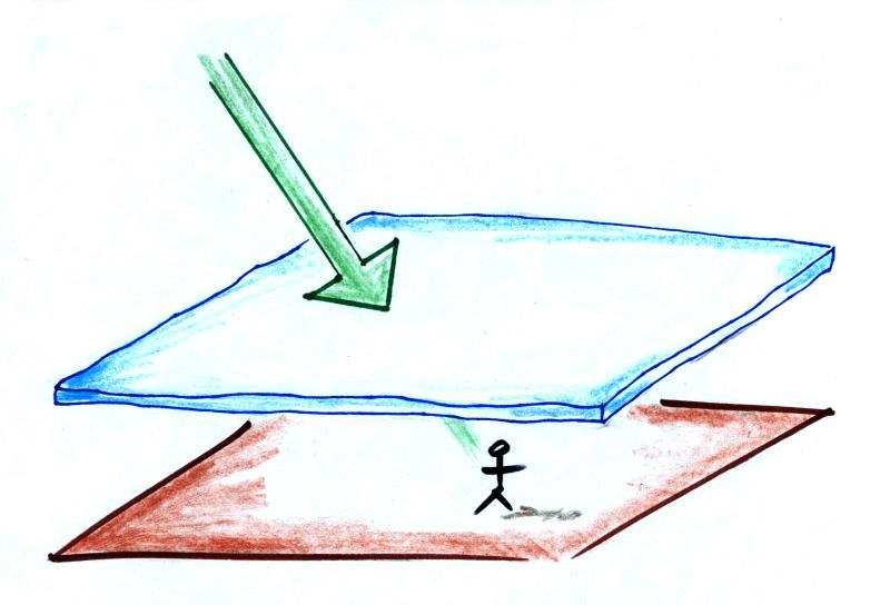
A side view of a layer cloud. How much
sunlight is able to shine through the cloud depends on
how thick the cloud is (and a clue about the cloud's
altitude). A person on the ground may or may not
cast a shadow.
|
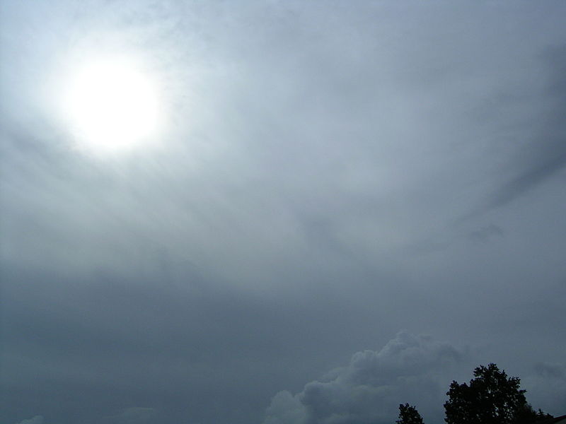
A view from the ground looking up
at the sun through a middle level layer cloud.
The sun is visible but blurred. (source)
|
Cloud appearance comparison
You'll become more familiar with different
types of cloud appearances by looking at clouds and
cloud photographs.
 |
 |
|
featureless Stratiform
cloud
(layer cloud)
an altostratus cloud
|
an
in-between case,
a "lumpy layer cloud"
this is named stratocumulus
|
patchy, puffy
Cumuliform cloud
cumulus
clouds
|
|
cirriform is sometimes used
as an appearance key word
a cirrus
cloud
source
of this image
|
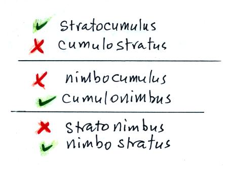
Note the stratocumulus cloud name is formed by combining the
two key words for appearance which is a little unusual.
Trying to draw the different clouds will help you to
visualize the differences in appearance.
To draw the cirriform cloud you could use the sharp end of a
pencil. Using the side of a pencil as you would if you
were shading in or coloring in a picture was used in the center
picture. To make the right picture I put a bunch of ink on
the side of a sponge and pressed it against the paper.
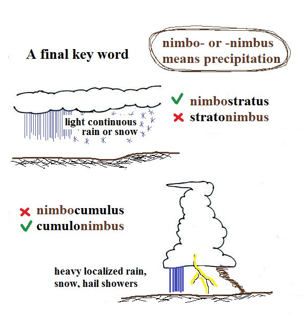
There's a 5th key word that I have been neglecting to
mention.
Nimbo or
nimbus, means precipitation (it is also the name of a local brewing company).
Only two of the 10 cloud types are able to produce
(significant amounts of) precipitation. It's not as
easy as you might think to make precipitation. We'll
start to look at precipitation producing processes in the
next class.
Nimbostratus clouds tend to
produce fairly light precipitation over a large area.
Cumulonimbus clouds produce heavy showers over more localized
areas. Thunderstorm clouds can also produce hail,
lightning, and tornadoes. Hail would never fall from a Ns cloud.
While you are still learning the cloud names you might put the
correct key words together in the wrong order (stratonimbus instead of nimbostratus,
for example). You won't be penalized for those kinds of
errors in this class because you are putting together the
right two key words.
No penalty for putting the key words together
in the wrong order
Sketches, photographs, and
written descriptions of the 6 main high and middle altitude
cloud types
We've already learned about the basic strategy used
to identify and name clouds; next we're going to be looking at
a lot of cloud pictures. We probably won't have time to
look at all 10 cloud types today, so I've included just high
and middle altitude clouds.
It's always a good idea to o organize new material is a clear
compact way. Here's something that may help.
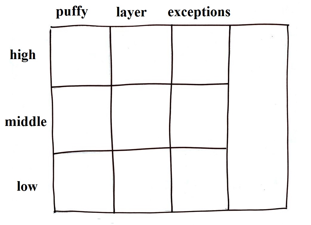
|
|
I would recommend taking out a blank sheet of paper and drawing
a chart like shown above at left. There are 10 boxes, one
for each of the cloud types. The three altitude categories
run along the vertical side of the chart and the two appearance
categories run along the top (note the exceptions column).
This will force you to remember the key words. Then you
should be able to put a name in each box, sketch each of the
clouds (as done above at right), and maybe even include a short
written description of each cloud.
Something that I often forget to mention in class - the
colors used on the clouds at right. Green is indicating
clouds that are warmer than freezing and made up of only water
droplets. Purple or violet indicates very cold high altitude
clouds composed of only ice crystals. The middle level
clouds shaded blue are colder than freezing and contain both
unfrozen water droplets and ice crystals. That's a little
surprising but turns out to be a very important part of
precipitation-producing (and lightning-producing) clouds.
We'll come back to this again next week.
We'll be looking at pictures of most of the 10 main cloud
types today. I'm hoping you'll go outside and have a look at
clouds when and if they're in the sky. But also a warning,
real world examples are often much complex than what we'll be
looking at here. You'll often find many different cloud
types mixed together.
Something else I may forget to mention in class.
If you get a particularly good photograph of a cloud or if you are
an artist and are able to draw some really nice cloud pictures,
I'd like to see them (and include them in the class notes).
So send them in.
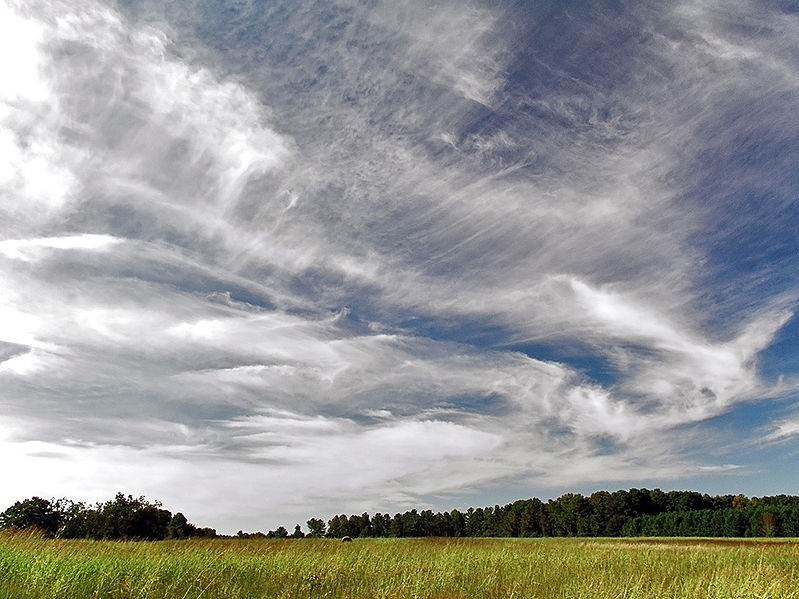
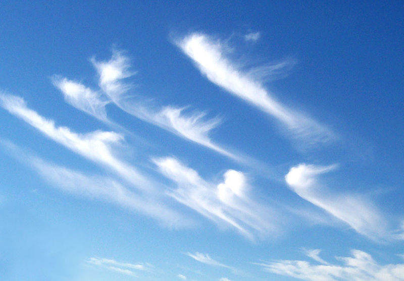
High altitude clouds
High altitude clouds
are thin because the air at high altitudes is very
cold and cold air can't contain much moisture,
the raw material needed to make clouds (the saturation
mixing ratio for cold air is very small). These clouds are also often blown
around by fast high altitude winds.
Filamentary means "stringy" or "streaky". If you
imagine trying to paint a Ci
cloud you might dip a small pointed brush in white paint
brush it quickly and lightly across a blue colored
canvas. Here are some pretty good photographs of
cirrus clouds (they are all from a Wikipedia
article on Cirrus Clouds)
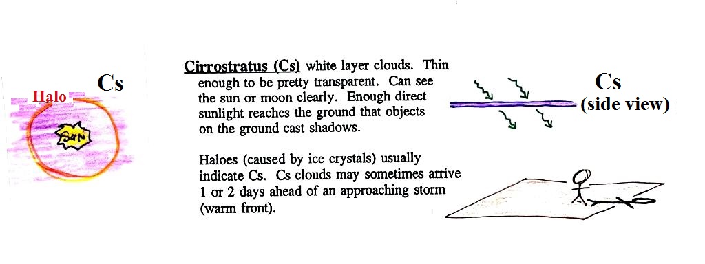
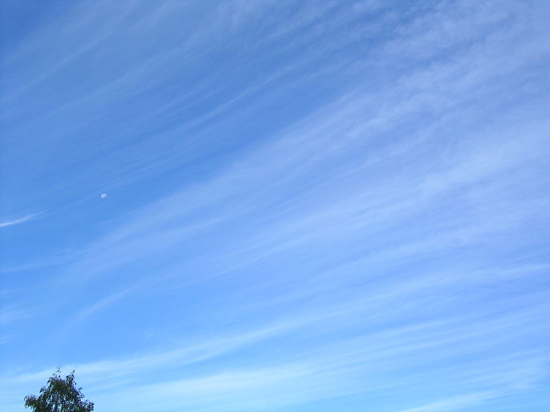
A
cirrostratus cloud is a thin uniform white layer cloud (not
purple as shown in the figure) covering part or all of the
sky. They're so thin you can sometimes see blue sky
through the cloud layer. Haloes are a pretty sure
indication that a cirrostratus cloud is overhead.
If you were painting Cs clouds you could dip a broad brush
in watered down white paint and then paint back and forth
across the canvas. Cirrostratus
clouds are so thin that you should be able to look
down at your feet and see your shadow.
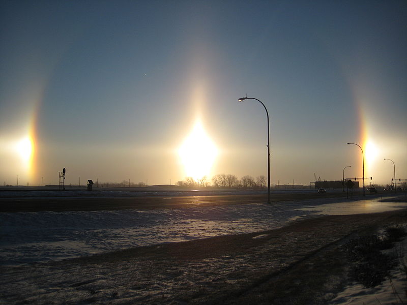
Haloes and sundogs
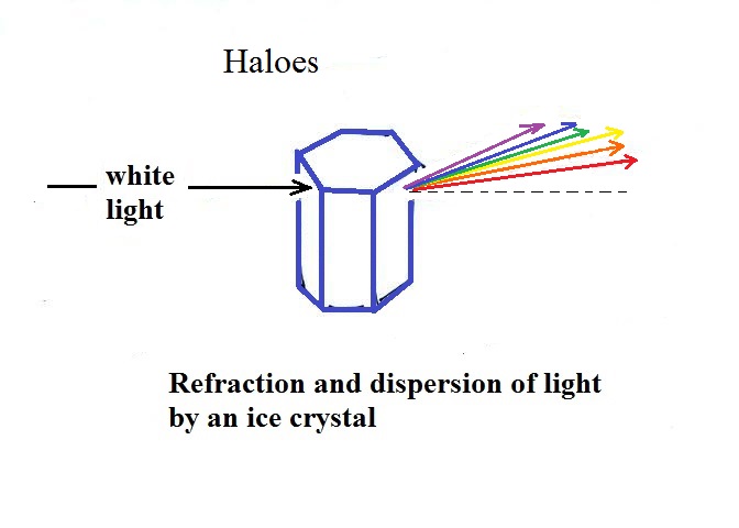
Haloes are produced when white light (sunlight or moonlight)
enters a 6 sided ice crystal. The light is bent
(refraction). The amount of bending depends on the
color (wavelength) of the light. The white light is
split into colors (dispersion) just as when light passes
through a glass prism. Crystals like
this (called columns) tend to be randomly oriented in the
air. That is why a halo forms a complete ring around
the sun or moon. You don't usually see all the colors,
usually just a hint of red or orange on the inner edge of
the halo.
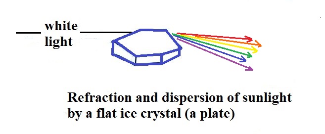
This is a flatter ice crystal and is called a plate.
These crystals tend to all be horizontally oriented and
produce sundogs which are only a couple of small sections of
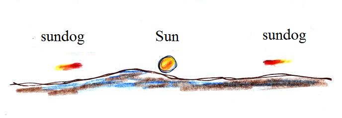
a complete halo. A sketch of a sundog is shown below.
Sundogs are pretty common. Keep an eye out for
them whenever you see high thin clouds in the sky at sunrise or
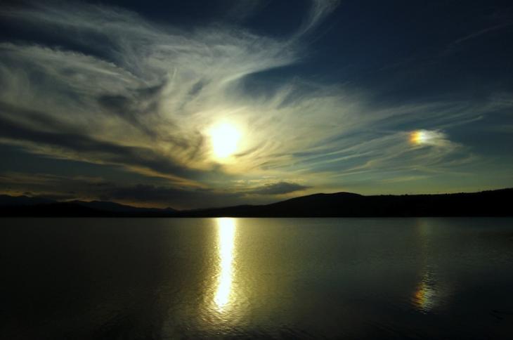
sunset. The photograph above (source)
is like what you might see in Tucson (except perhaps for the
lake in the foreground). The sun is in the center of the
photograph and the sundog is send at right. The photograph
also illustrates how thin
cirriform clouds will often appear thicker at sunrise or
sunset because the rays of sunlight shine through them
at an angle.
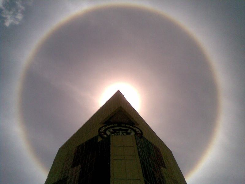
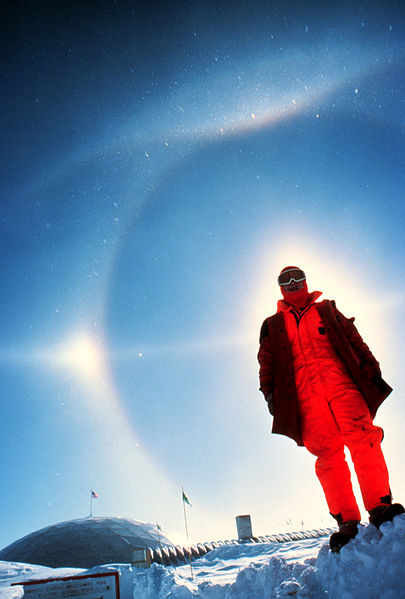
A very bright halo is shown at upper
left with the sun partially blocked by a building
(the cloud is very thin and most of the sunlight is
able to shine straight through). A halo like
this might cause a crowd to gather. Note the
sky inside the halo is darker than the sky outside
the halo. The halo at upper right is more
typical of what you might see in Tucson. Very
bright sundogs (also known as parhelia) are shown in
the photograph at bottom left. The sun in the
photograph at right is behind the person. You
can see both a halo and a sundog (to the left of the
sun) in this photograph. Sources
of these photographs: upper
left, upper
right, bottom
row.
If you spend enough time
outdoors looking up at the sky you will eventually see
all 10 cloud types.
Cirrus and cirrostratus clouds are fairly
common. Cirrocumulus clouds are a little more
unusual.
The same is true with animals,
some are more commonly seen in the
desert around Tucson (and even in town) than others. If you click on the link you'll
see pictures of some of the wild animals that live in and
around Tucson. With the exception of a skunk I've seen
all of them in my neighborhood in central Tucson (often in my
backyard).
To
paint a Cc cloud you could dip a sponge in white paint
and press it gently against the canvas (as I tried to do
earlier). You would leave a patchy, splotchy
appearing cloud (sometimes you might see small
ripples). It is the patchy (or wavy) appearance
that makes it a cumuliform cloud.
The table below compares
cirrostratus (the cloud on the left without texture)
with a good example of a cirrocumulus cloud (the
"splotchy" appearing cloud on the right). Both
photographs are from the Wikipedia article mentioned
earlier.
Cirrostratus - Cirrocumulus comparison
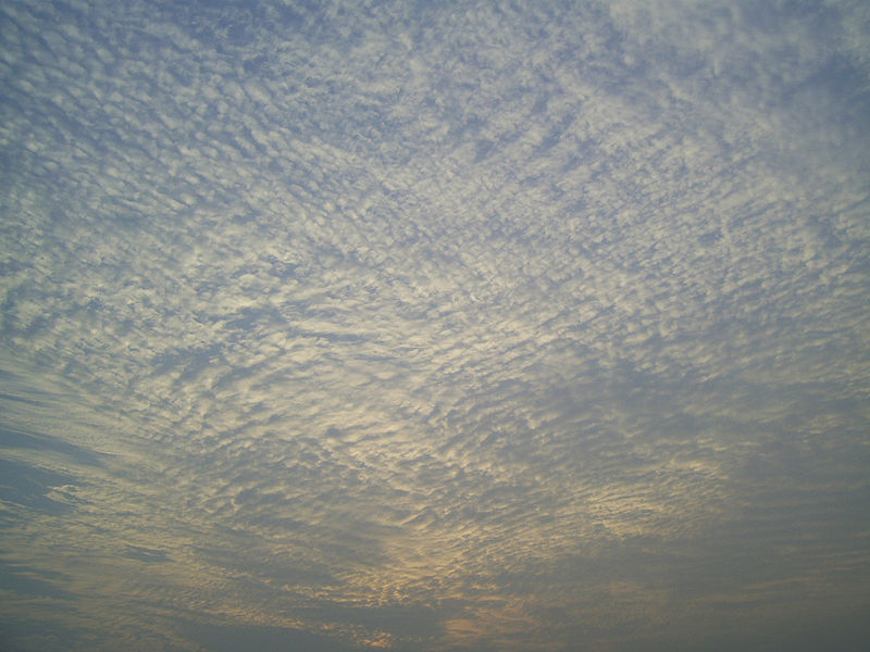
Middle altitude clouds
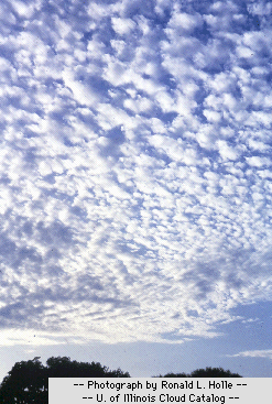
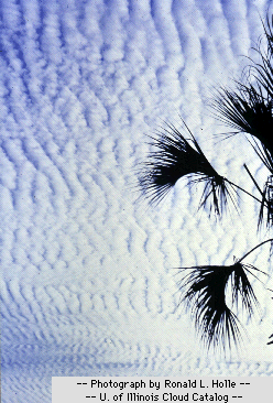
Altocumulus clouds are pretty
common. Note since it is hard to accurately judge
altitude, you must rely on cloud element size (thumbnail size
in the case of Ac) to determine whether a cloud belongs in the
high or middle altitude category. The cloud
elements in Ac clouds appear larger than in Cc because the cloud
is closer to the ground. A couple of photographs are shown
below (source: Ron Holle for WW2010 Department of
Atmospheric Sciences, the University of Illinois at
Urbana-Champaign)
There's a much larger collection in this gallery
of images. The fact that there are so many examples
is an indication of how common this particular type of cloud is.
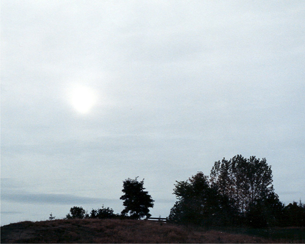
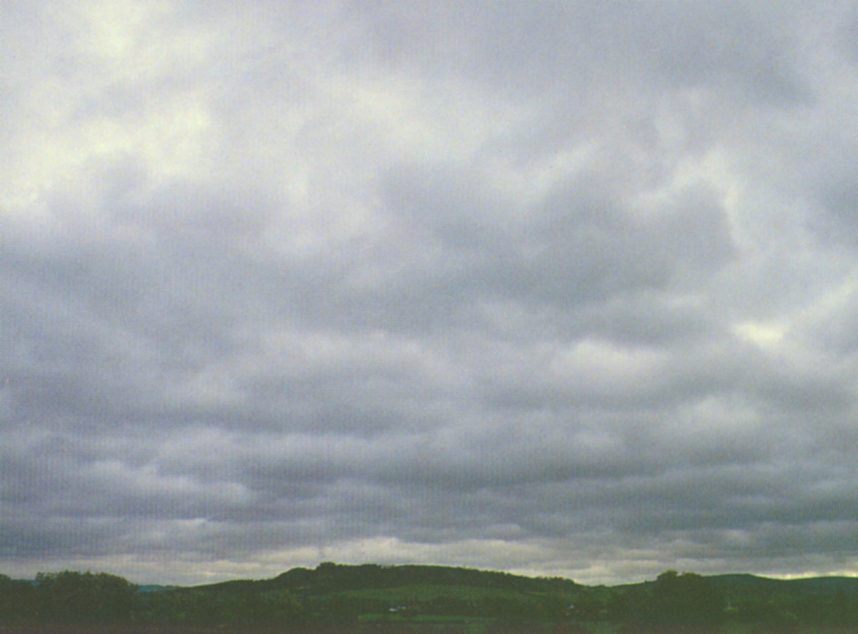
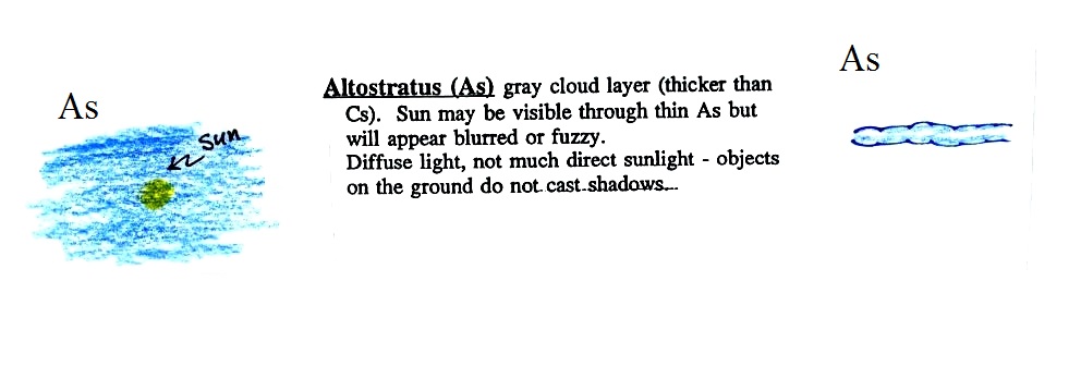
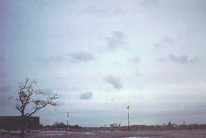
Altostratus clouds are
thick enough that you probably
won't see a shadow if you look down at your
feet. The sun may or may not
be visible through the cloud.
Three examples are shown below (the first is from a
Wikipedia article, the
middle and right photograph are from an Environment
Canada web page)
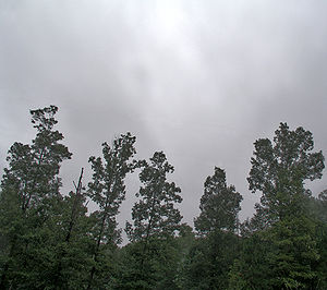
When (if) an
altostratus cloud begins to produce precipitation,
its name is changed to nimbostratus.
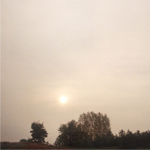
Without being there, it
is hard to tell whether this is an altrostratus, a
nimbostratus, or a stratus cloud.
The smaller darker cloud fragments that are below the
main layer cloud are "scud" (stratus fractus) clouds (source
of this image).
