What do you get when you combine a November
outbreak of Arctic air and lake water that is only beginning
to lose its summer heat? In the snow belt region
northeast of Lake Erie you can get record setting amounts of
snow. Parts of the city of Buffalo and nearby
regions in New York have received 5 feet of snow this
week. This brought the area to a standstill for much of
the past week.
The snowfall has mostly stopped falling but a major concern now in Buffalo is rooftop collapse due to the weight of the snow. Warmer temperatures are expected in the region and there is also worry that melting snow may cause flooding. Several feet of snow is equivalent to several inches of rain. This weekend's NFL football game has been moved to Monday night and will be played in Detroit.
Large snowfall amounts like this are the result of a phenomenon known as the lake effect that occurs when cold air blows across a large body of relatively warm water such as the Great Lakes. Two things happen as the air travels across the water.
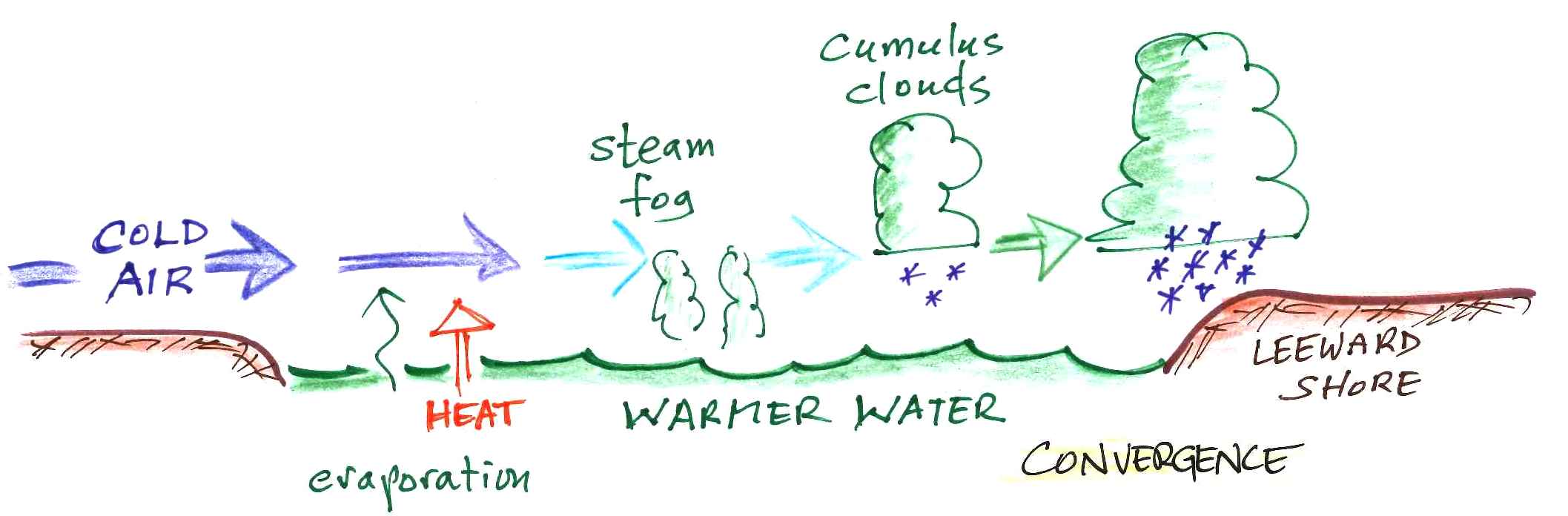
First evaporation from the warm water adds moisture to the air. The rate of evaporation depends on the water's temperature and the cold air can quickly become saturated. The bottom portion of the cold air warms as it travels across the lake water. This makes the air buoyant and destabilizes the atmosphere. Once the air reaches the leeway shore and encounters land the wind slows slightly due to an increase in friction. This is a form of convergence and causes additional rising air motions. If you were to follow an air parcel as it moves across the lake you might first notice small clouds of evaporation or steam fog. Then cumulus clouds would appear. The clouds would then grow vertically and might even develop into thunderstorms. Lightning and thunder were apparently observed during this week's snow storm.
Here is some time lapse video of clouds moving onshore in the Buffalo area with commentary from Ari Sarsalari, a meteorologist at the Weather Channel.
Essentially the same process occurs when cold air moves out over warmer ocean water.
Note the cold front that has moved off the northeastern coast of the US (you might click on the image and make it big enough to read some of the temperature values). The ocean water isn't warm, but it's warmer than the air moving out over it. On the satellite image there is a very thin strip of cloud free skies just off the northeastern coast. But then "patchy" clouds appear further offshore. Those are cumulus clouds that begins to form once the ocean water adds moisture, warms, and destabilizes the air.
Maps of the Great Lake region and a plot of average annual
snowfall amounts are shown below.
The large snowfall amounts found east, south, and southeast of the Great Lakes are largely due to the lake effect.
The longer the path over the water, the greater the potential for large snowfall amounts. This past week air was sometimes able to travel nearly the entire length of Lake Erie. Snowfall amounts can also be very localized. In an article written by Dr. Jeff Masters at Weather Underground parts of the east side of the city of Buffalo received 60 inches of snow in 24 hours while only 4 inches fell at the Buffalo Airport, located only 6 miles away. The Weather Underground article also has an interesting discussion of the storm and a radar images showing the intense snow band that hit Buffalo.
 |
 |
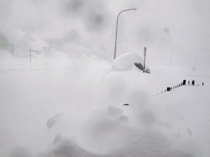
| Tuesday, Nov. 18, 2014. A 4
foot fence and an SUV are buried in snow Credit: AP/Carolyn Thompson |
Wednesday, Nov. 19, 2014 Credit: Derek Gee The Buffalo News |
 |
 |
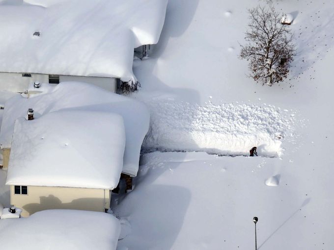
| A bulldozer clears a path for an
ambulance. As of Friday morning (Nov. 21) the
Buffalo News was reporting 13 storm related deaths. Credit: Derek Gee The Buffalo News |
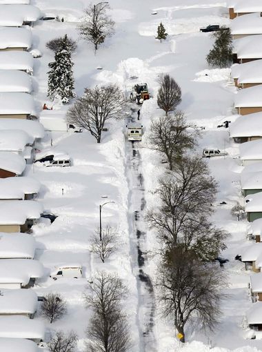
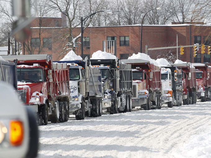
The snow removal effort in
Buffalo. As of Thursday, Nov. 20, 24000 tons of
snow had been removed. Credit: Sharon Cantillon
The Buffalo News |
All of the above are from a gallery of
images on a Detroit
Free Press site
The snowfall has mostly stopped falling but a major concern now in Buffalo is rooftop collapse due to the weight of the snow. Warmer temperatures are expected in the region and there is also worry that melting snow may cause flooding. Several feet of snow is equivalent to several inches of rain. This weekend's NFL football game has been moved to Monday night and will be played in Detroit.
Large snowfall amounts like this are the result of a phenomenon known as the lake effect that occurs when cold air blows across a large body of relatively warm water such as the Great Lakes. Two things happen as the air travels across the water.
First evaporation from the warm water adds moisture to the air. The rate of evaporation depends on the water's temperature and the cold air can quickly become saturated. The bottom portion of the cold air warms as it travels across the lake water. This makes the air buoyant and destabilizes the atmosphere. Once the air reaches the leeway shore and encounters land the wind slows slightly due to an increase in friction. This is a form of convergence and causes additional rising air motions. If you were to follow an air parcel as it moves across the lake you might first notice small clouds of evaporation or steam fog. Then cumulus clouds would appear. The clouds would then grow vertically and might even develop into thunderstorms. Lightning and thunder were apparently observed during this week's snow storm.
Here is some time lapse video of clouds moving onshore in the Buffalo area with commentary from Ari Sarsalari, a meteorologist at the Weather Channel.
Essentially the same process occurs when cold air moves out over warmer ocean water.
 |
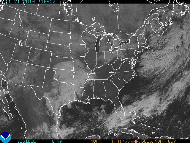 |
| Surface weather map Friday morning Nov. 21, 2014 (source of this image). | Visible satellite photograph taken at about the same time. (source of the image) |
Note the cold front that has moved off the northeastern coast of the US (you might click on the image and make it big enough to read some of the temperature values). The ocean water isn't warm, but it's warmer than the air moving out over it. On the satellite image there is a very thin strip of cloud free skies just off the northeastern coast. But then "patchy" clouds appear further offshore. Those are cumulus clouds that begins to form once the ocean water adds moisture, warms, and destabilizes the air.
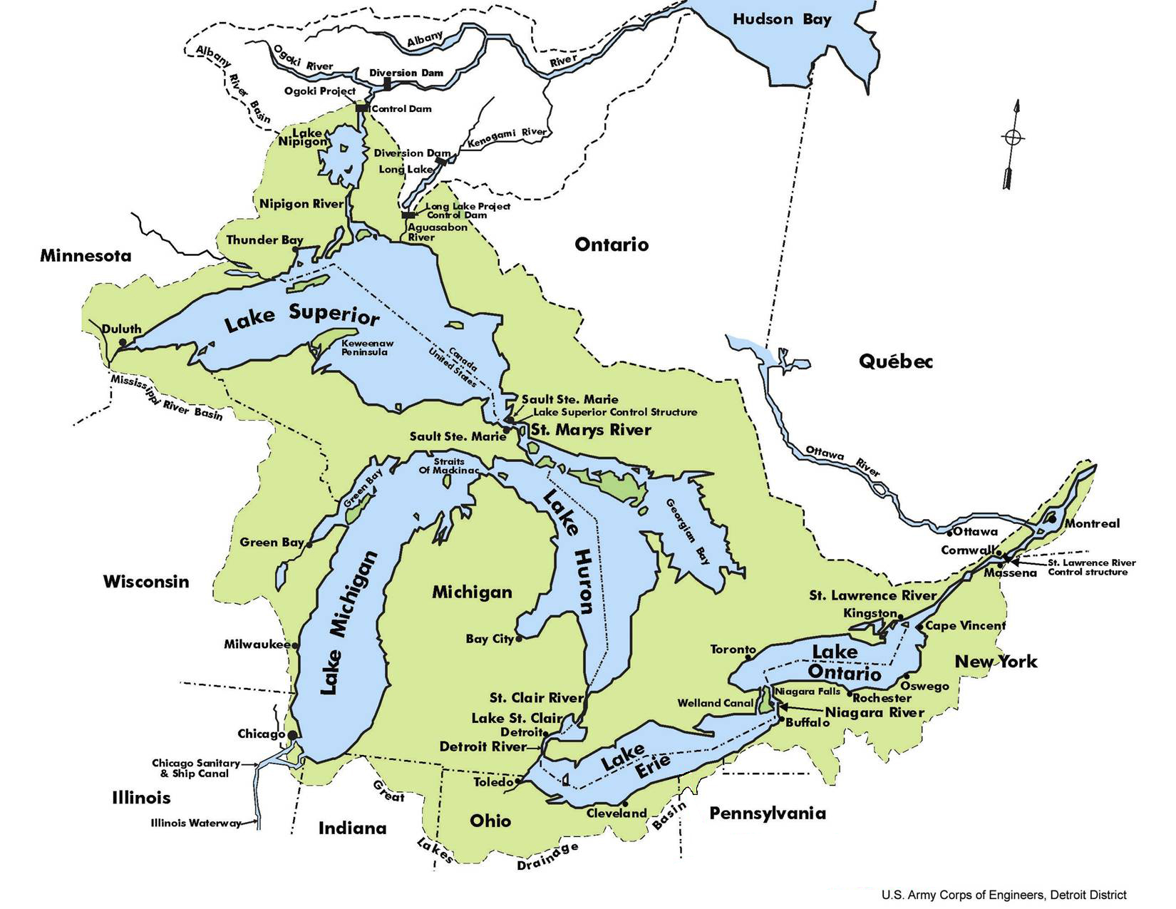 |
| A map of the Great Lakes. Note
the location of Buffalo at the NE end of Lake Erie. (source of this image) |
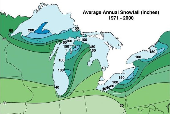 |
| Snow belts on the leeward shores of
the Great Lakes. (image from the Cleveland Museum of Natural History) |
The large snowfall amounts found east, south, and southeast of the Great Lakes are largely due to the lake effect.
The longer the path over the water, the greater the potential for large snowfall amounts. This past week air was sometimes able to travel nearly the entire length of Lake Erie. Snowfall amounts can also be very localized. In an article written by Dr. Jeff Masters at Weather Underground parts of the east side of the city of Buffalo received 60 inches of snow in 24 hours while only 4 inches fell at the Buffalo Airport, located only 6 miles away. The Weather Underground article also has an interesting discussion of the storm and a radar images showing the intense snow band that hit Buffalo.