The images that global warming most often brings to mind, perhaps, are melting of ice and snow, rising sea level, and flooding of coastal communities. The figure below shows how the Pedersen Glacier has shrunk during the past 85 years or so.
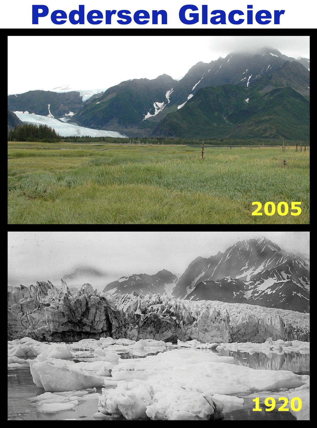
Pederson Glacier is in the Kenai Fjords National Park, Alaska (this is an image created by Robert A. Rohde for Global Warming Art). For more photographs and time lapse videos of shrinking glaciers have a look at the Extreme Ice Survey - Art Meets Science page.
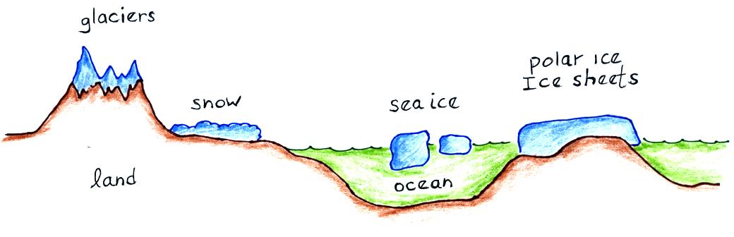
Ice (found mostly in Antarctica and Greenland) covers about 10% of the earth's land surface and about 7% of the earth's oceans (much of this is at the N. Pole). Snow covers almost half of North America in the winter.
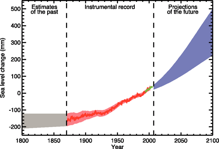
Observations do indicate that the amounts of ice and snow on earth have been decreasing, especially since about 1980. During the 1993-2003 time period, melting of ice and snow were increasing sea level by 0.6 to 1.8 millimeters (mm) per year. Past, present, and predicted sea levels are shown in the next figure (source).