| F0 |
|
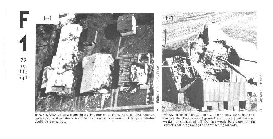
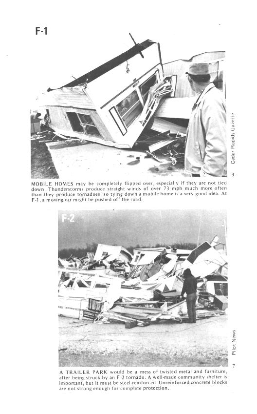
| F1 |
roof
damage, mobile home tipped over |
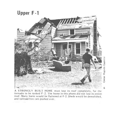
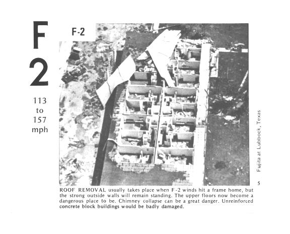
| F2 |
roof
gone, outside walls still standing |
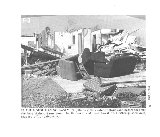
| F3 |
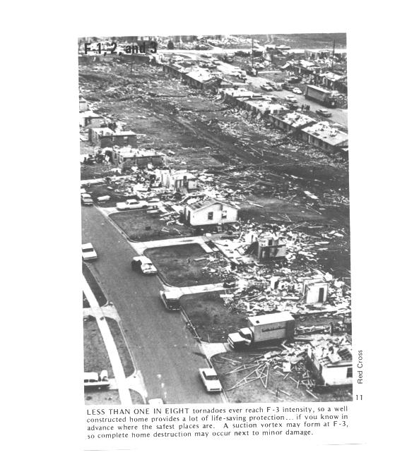
outside
walls gone, inside walls intact |
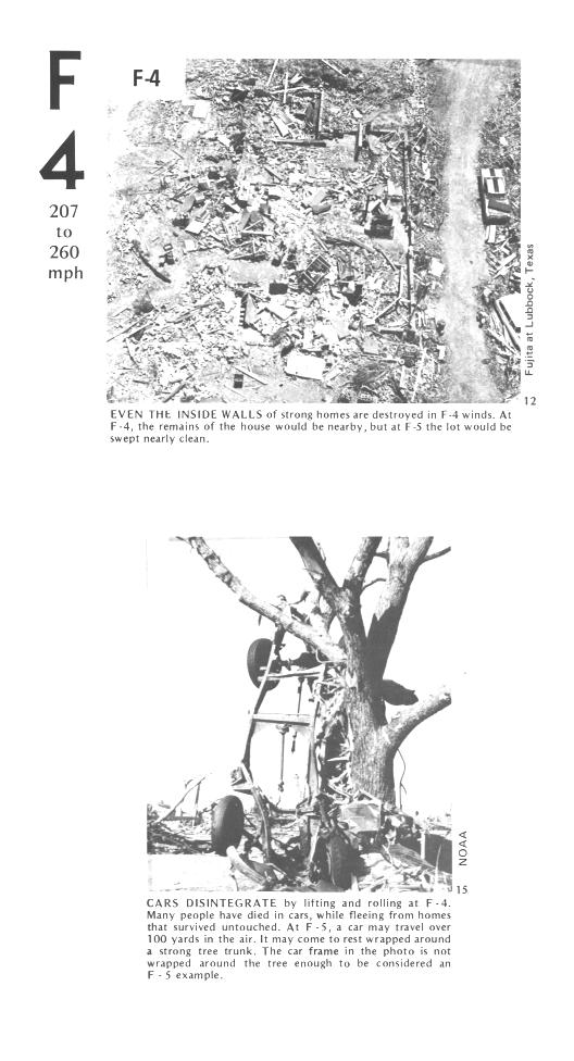
| F4 |
home
destroyed, debris nearby |
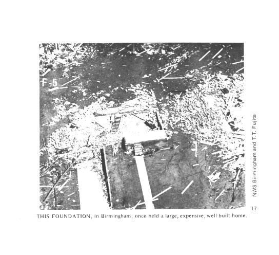
| F5 |
home
destroyed, debris carried away |
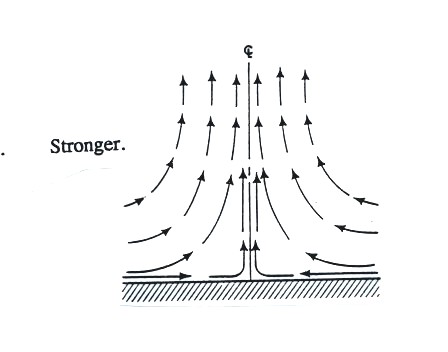
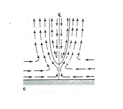

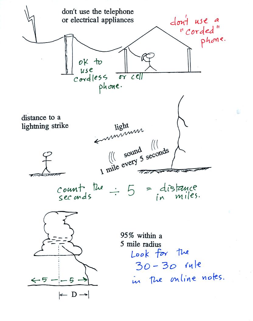
 Any
lightning safety plan should incorporate the 30/30 Rule. The 30/30 Rule
states that people should seek shelter if the "Flash-To-Bang" delay
(length of time in seconds between a lightning flash and its subsequent
thunder), is 30 seconds or less, and that they remain under cover until
30 minutes after the final clap of thunder.
Any
lightning safety plan should incorporate the 30/30 Rule. The 30/30 Rule
states that people should seek shelter if the "Flash-To-Bang" delay
(length of time in seconds between a lightning flash and its subsequent
thunder), is 30 seconds or less, and that they remain under cover until
30 minutes after the final clap of thunder.