Wednesday Mar. 29, 2006
The optional assignments were returned in class.
Please check to see whether your name is on the "you shouldn't be on this list".
These are people that haven't yet turned in reports or don't appear to
be working on a report. A book or experiment report is an
important part of your writing grade. The deadline for turning in
a first draft of a report is Fri., April 14, so you should get working
on a book or experiment as soon as possible.
The Quiz 3 Study Guide is now available
online.
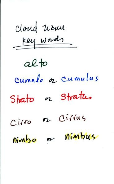
You'll find one or two of these key words in each of of the 10
cloud types.
Clouds are classified according to altitude and the appearance.
The key words alto and cirro tell you something about cloud altitude.
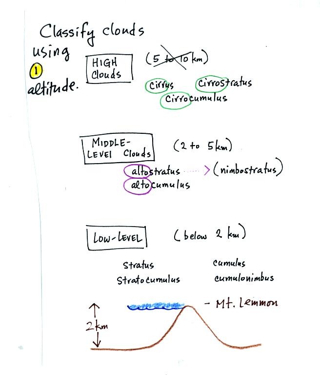
Cirrus or cirro
identifies a high altitude cloud. Alto in a cloud name means the
cloud is found at middle altitude. It is very hard to just look
up in the sky and determine a cloud's altitude. You will need to
look for other clues to distinquish between high and middle altitude
clouds. We'll learn about some of the clues you can look for
later in class.
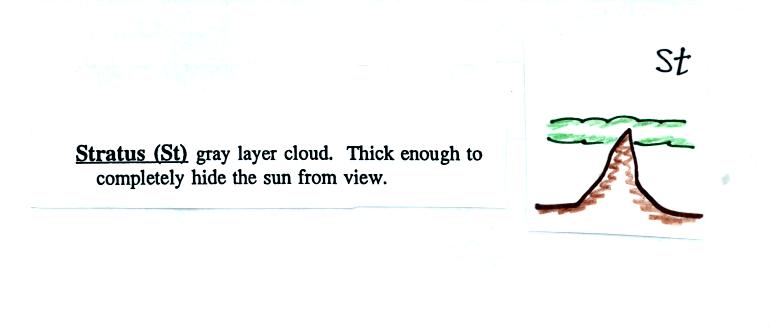
There is no key word for low altitude clouds. Low
altitude clouds
have bases that form 2 km or less above the ground. The summit of
Mt. Lemmon in the Santa Catalina mountains north of Tucson is about 2
km above the valley floor. So low altitude clouds will have bases
that form at or below the summit of Mt. Lemmon.
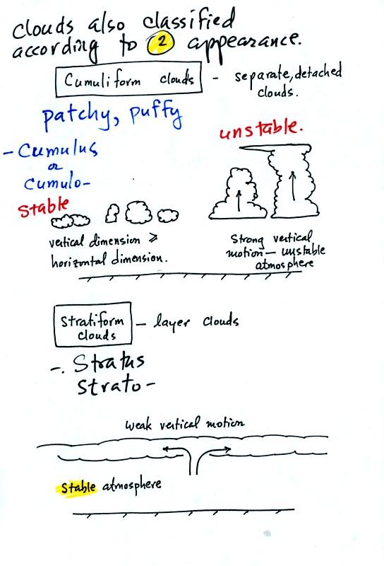
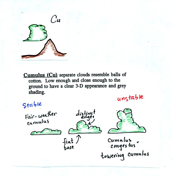
Clouds can have a patchy of puffy (or lumpy or wavy)
appearance.
These are cumuliform clouds and will have cumulo or cumulus in their
name. In an unstable atmosphere cumuliform clouds will grow
vertically.
Stratiform clouds grow horizontally and form layers. They form
when the atmosphere is stable.
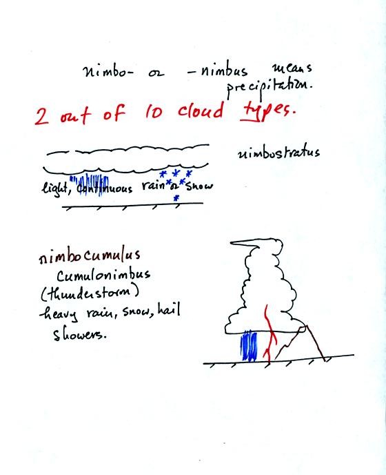
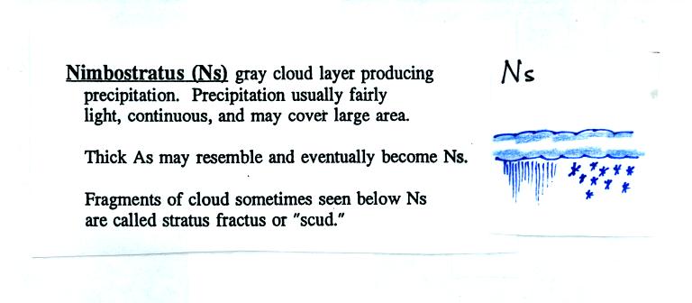
Nimbo or nimbus in a cloud name means the cloud is or is capable of
producing significant precipitation. Note that only 2 out of the
10 cloud types is capable of producing appreciable amnount of
precipitation.
Next we
looked at photographs of most of the 10 main cloud types. You'll
find the written descriptions of the cloud types on pps 97-98 in the
photocopied notes.
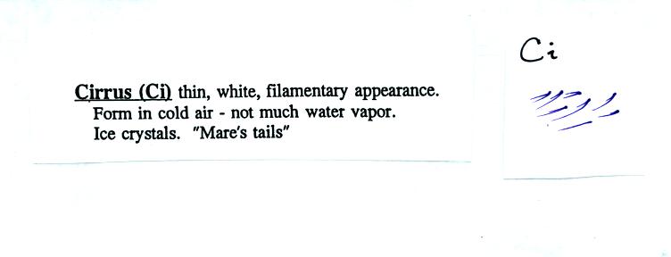
High altitude clouds are thin because the air at high altitudes is
very cold and cold air can't contain much moisture (the saturation
mixing ratio for cold air is very small). If you imagine trying
to paint a Ci cloud you would dip a stiff
brush in white paint brush it quickly and lightly across a blue colored
canvas.
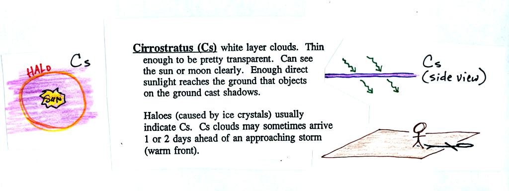
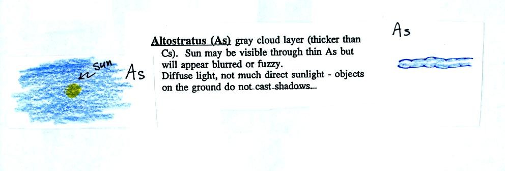
A cirrostratus cloud is a thin uniform white layer cloud covering
part or all of the sky. Here you might first dilute your white
paint with water and then
brush back and forth across the canvas. The thin white paint
might not be thick enough to hide the blue canvas but the white coating
on the canvas would be uniform not streaky like with a cirrus cloud.
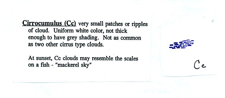
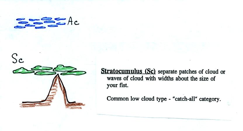
To paint a Cc cloud you would dip a sponge in white paint and
press it gently against the canvas. You would leave a patchy
appearing cloud. It is the patchy (or wavy) appearance that makes
it a cumuliform cloud.
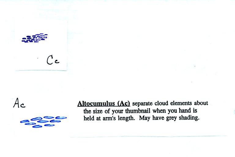
Note since it is hard to accurately judge altitude, you must rely
on cloud element size to determine whether a cloud belongs in the high
or middle altitude category. The cloud elements in Ac clouds
appear larger than in Cc because the cloud is closer to the ground.
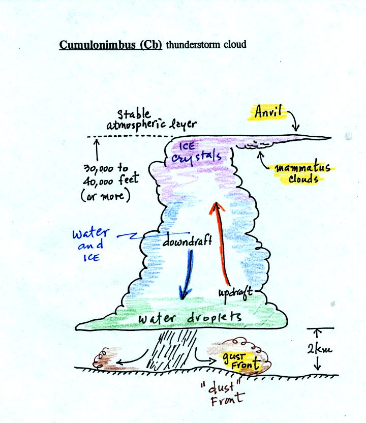
Lots of distinctive features on cumulonimbus clouds.
Horizontal winds behind the gust front can reach 100 MPH or more, most
tornadoes have winds of less than that. Note that both water
droplets and ice crystals exist together in the middle of thunderstorm
clouds (also in nimbostratus clouds) at temperatures below freezing
(the water droplets have a hard time freezing).
Here's one final feature to look for at the bottom of a
thunderstorm. The figure
below wasn't shown in class.
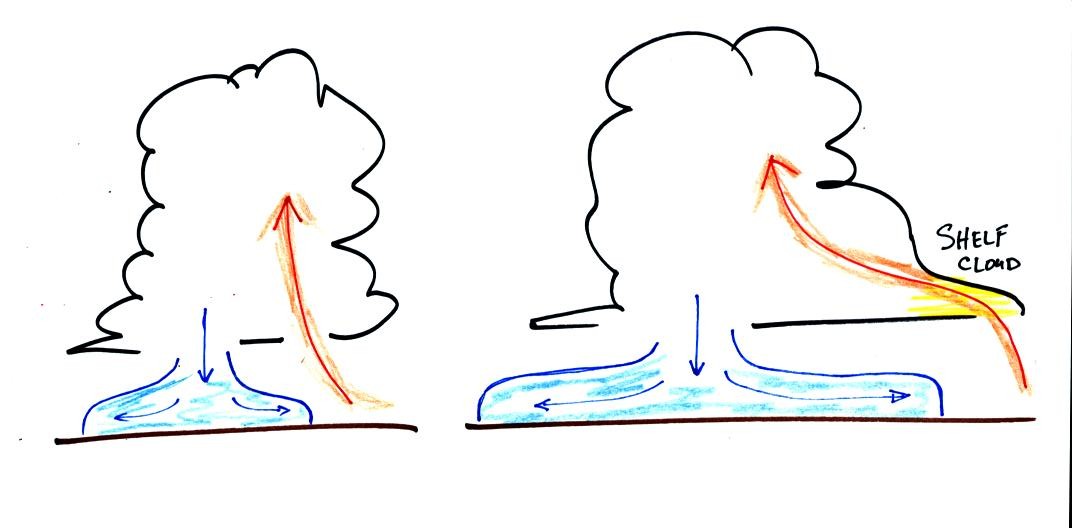
Cold air spilling out of the base of a thunderstorm is just beginning
to move outward from the bottom center of the storm in the picture at
left. In the picture at right the cold air has moved further
outward and has begun to get in the way of the updraft. The
updraft is forced to rise earlier and a little ways away from the
center of the thunderstorm. Note how this rising air has formed
an extra lip of cloud. This is called a shelf cloud. You'll
find a good photograph of a shelf cloud in Fig. 10.7 in the text.
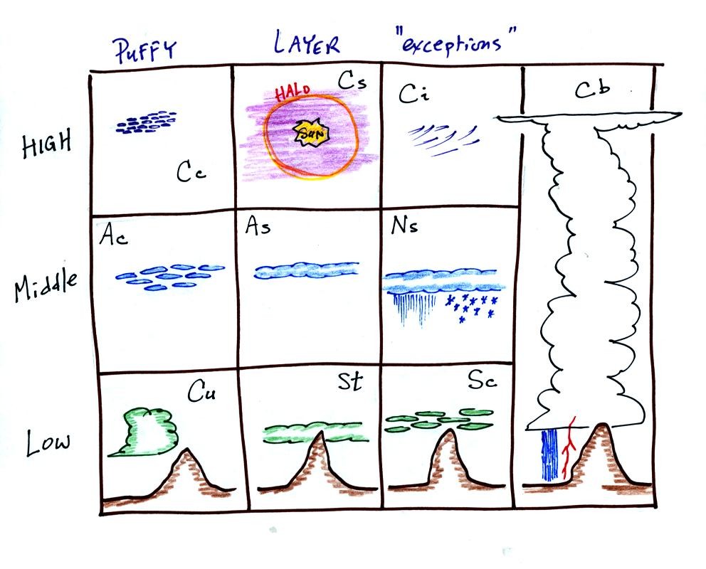
Here's a
good way to learn the 10 basic cloud type names. Draw a table
like the one shown below.
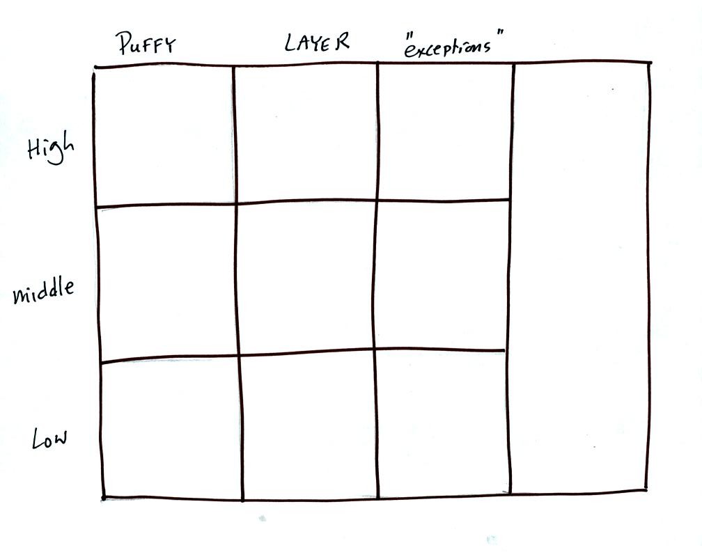
Then fill in each square with an appropriate cloud name and a
sketch of the cloud. You should also be able to describe each
cloud type in words.
Here is an example of a completed cloud chart.