|
|
|
|
| Similarities |
| both types of storms have
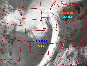
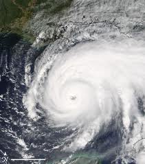
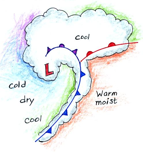
low pressure centers (the term cyclone refers to winds blowing around low pressure) |
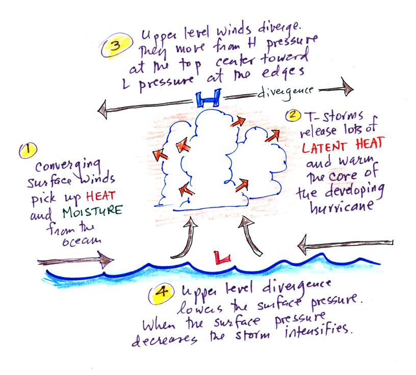
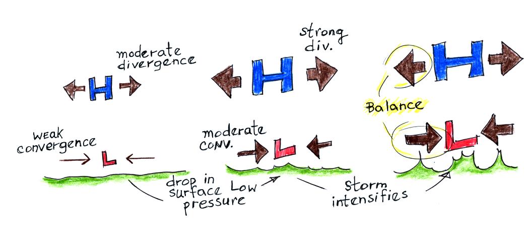
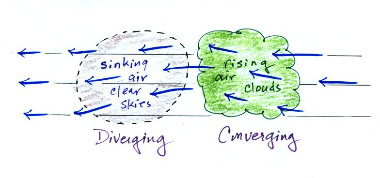
| upper level divergence is
what causes both types of storms to intensify (intensification means the surface low pressure gets even lower) |
| Differences |
|
| 1. Middle latitude storms
are bigger, perhaps 1000 miles in diameter (half the US) |
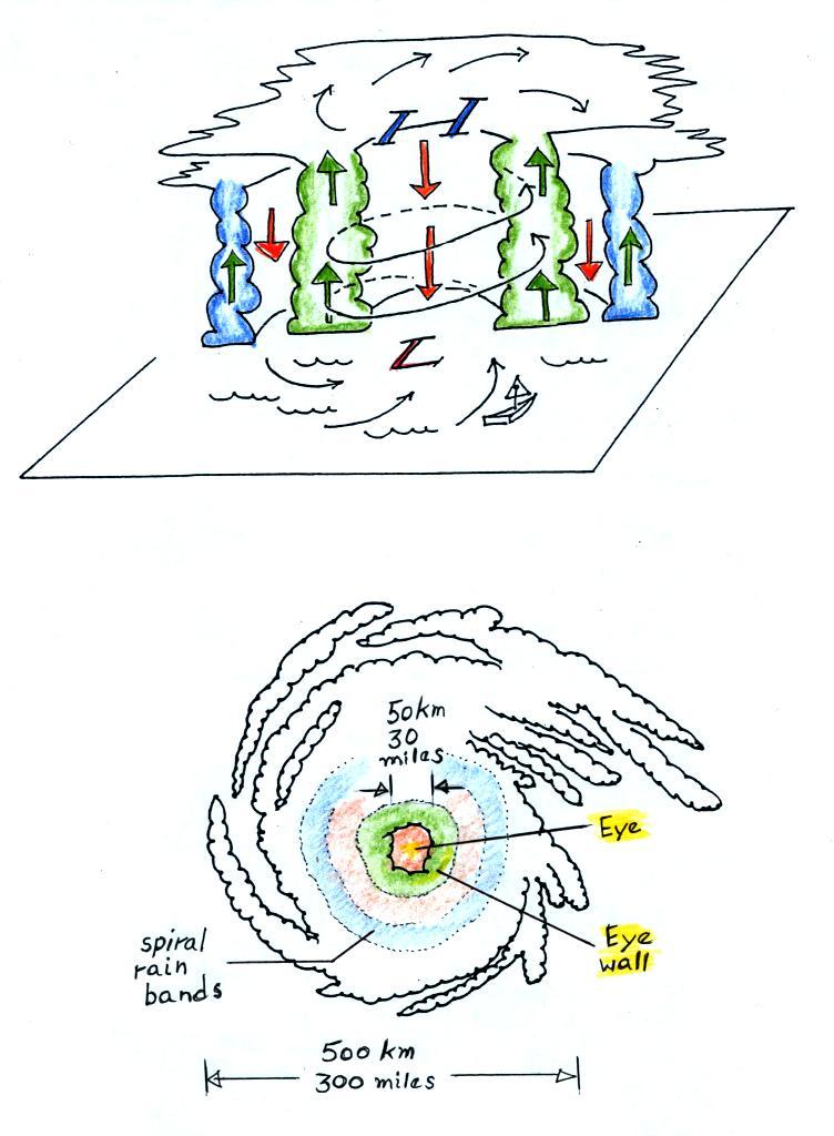
1. Hurricanes are smaller, 100s of miles in diameter (fill the Gulf of Mexico) |
| 2. Formation can occur over
land or water |
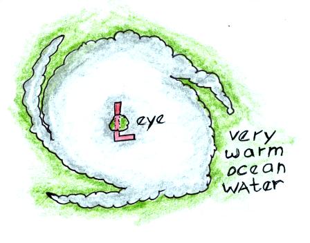
2. Can only form over warm
ocean water weaken rapidly when they move over land or cold water |
| 3. Form at middle (30o
to 60o) latitudes |
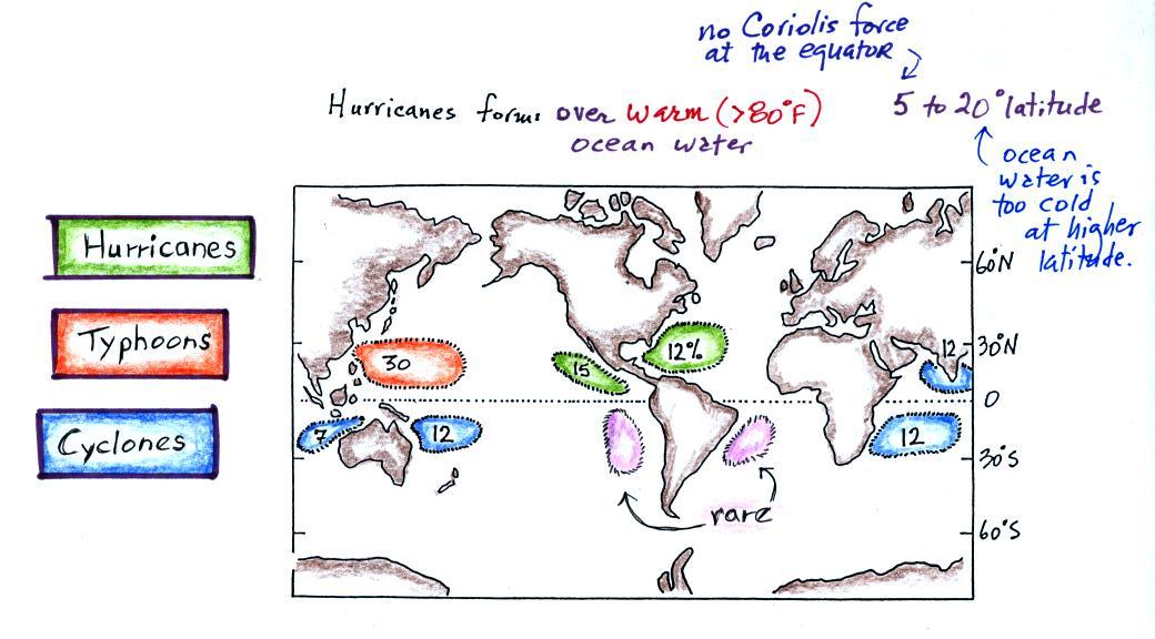
3. Form in the sub tropics,
5o
to 20o latitude |
| 4. Prevailing westerlies
move these storms from west to east |
4. Trade winds move
hurricanes from east to west |
| 5. Storm season: winter to
early spring |
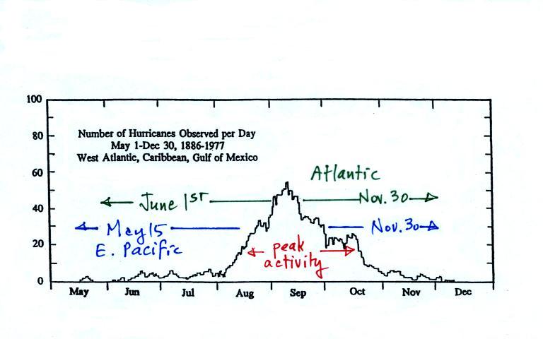
5. Storm season: late
summer
to fall (when ocean water is warmest) |
| 6. Air masses of different
temperatures collide along fronts |
6. Single warm moist air
mass |
| 7. All types of
precipitation: rain, snow, sleet freezing rain |
7. Mostly just lots (a foot
or more) of rain |
| 8. Only an occasional storm
gets a name ("The Perfect Storm", "Storm of the Century", etc.) |
8. Tropical storms &
hurricanes gets names |
| Normal hurricane activity in the Pacific | Normal hurricane activity in the Atlantic |
| 16
tropical storms per year 8 reach hurricane strength 0 hit the US coastline |
10
tropical storms per year 6 reach hurricane strength 2 hit the US coastline |