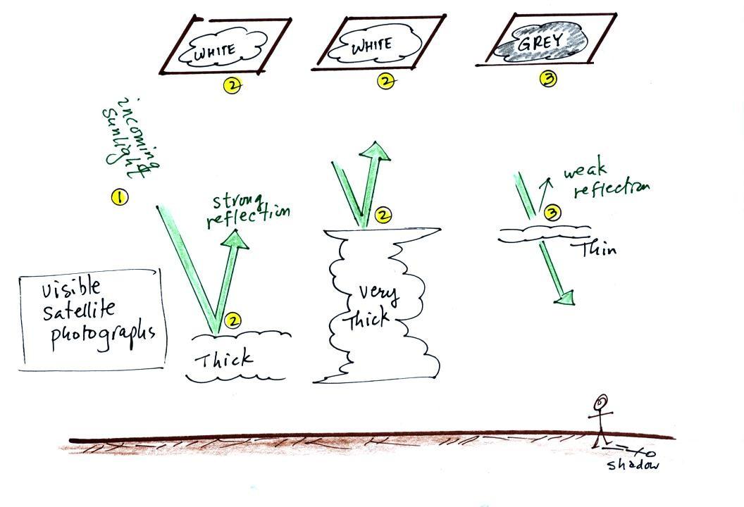
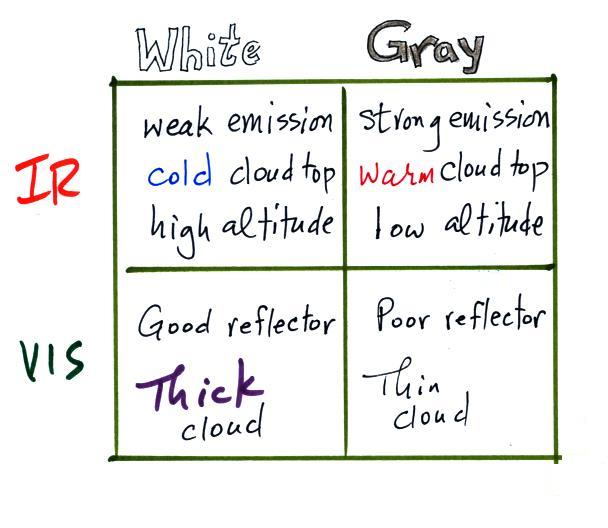
1. A visible satellite photograph photographs sunlight that
is reflected by clouds. It shows what you would see if you
were out in space looking down at the earth. You won't see
clouds on a visible satellite photograph at night.
2. Thick clouds are good reflectors and appear white. The
low altitude layer cloud and the thunderstorm would both appear
white on this photograph and would be difficult to distinguish.
3. Thinner clouds don't reflect as much light and appear
grey.
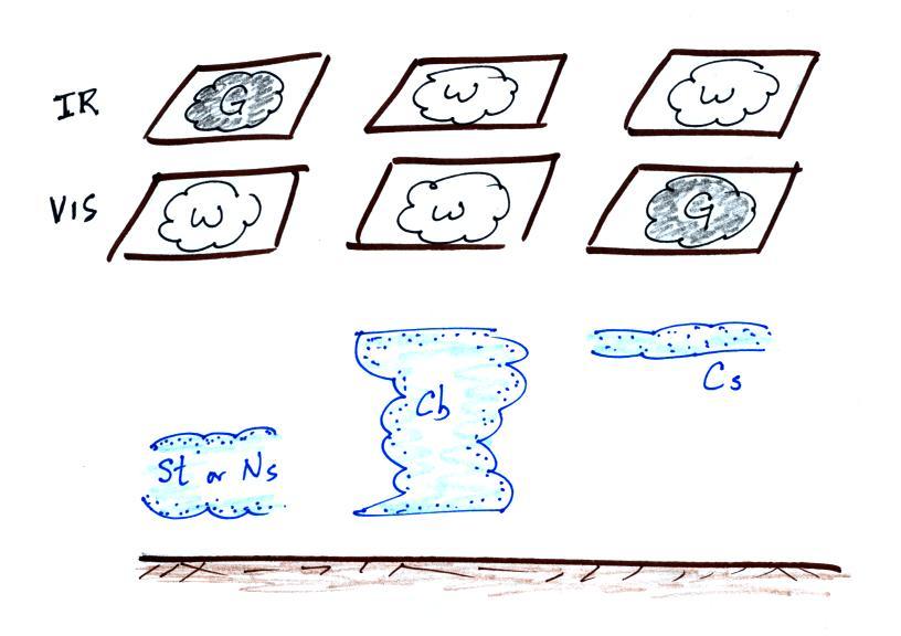
Here's a summary
The figure below shows how if you
combine both visible and IR photographs you can begin to
distinguish between different types of clouds.