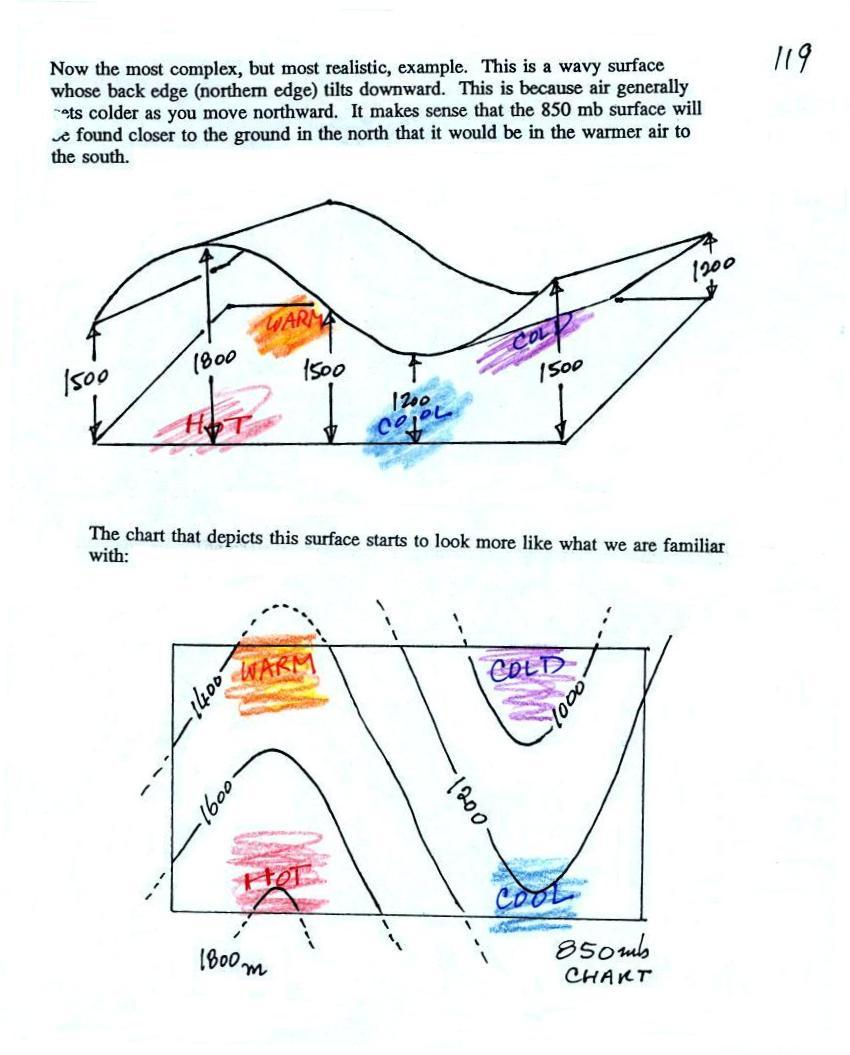
It's the wavy surface that we had in the previous example (where
there was just a west to east temperature change) with the northern
edge tilted downward because there is colder air in the
north. That's not much of a change. But look at how
the map has changed. We now see an "n" shaped ridge and a "u"
shaped trough.
The highest point on the 850 mb surface (1800 meters or so) is found
above the hot air near the SW corner of the picture. The lowest
point (a little less than 1000 meters) is found in the coldest air near
the NE corner of the picture.