Wednesday, Oct. 24, 2012
A couple of songs from Alison Krauss and Union Station: "Ghost in This House"
and
"Miles to Go".
The 1S1P Assignment #2 Topic 3 reports on the 1983 Flood were collected
today. You should expect to get them back fairly quickly,
hopefully early next week. We're also making good progress on the
Ozone reports. You should get them at the same time.
The Humidity Problems Optional Assignment was also collected
today. Here are answers
to those questions.
Today's class was devoted entirely to
learning
how to identify
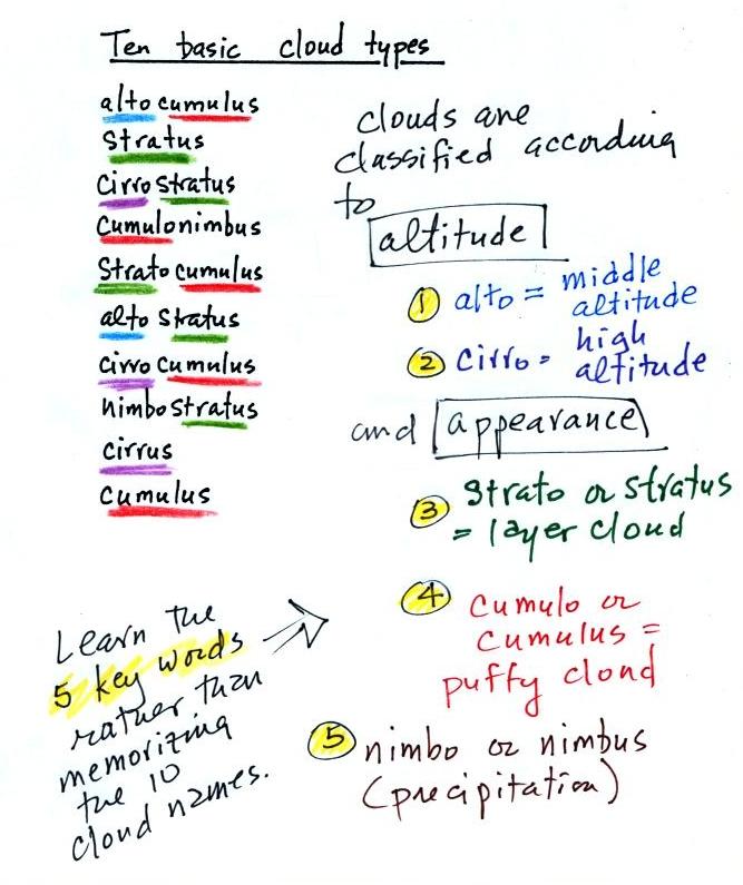
and name clouds. The ten main cloud types are listed below
(you'll find this list on p.
95 in
the photocopied class notes).
I'm hoping you'll try to learn these 10 cloud
names. There is a smart and a not-so-smart way of
learning
these names. The not-so-smart way is to just memorize them.
Because they all sound alike you
will inevitably get them mixed up. A better way is to recognize
that all
the cloud names are made up of key words. The 5 key words tell
you something about the cloud's altitude and appearance. My
recommendation is to learn the key words.
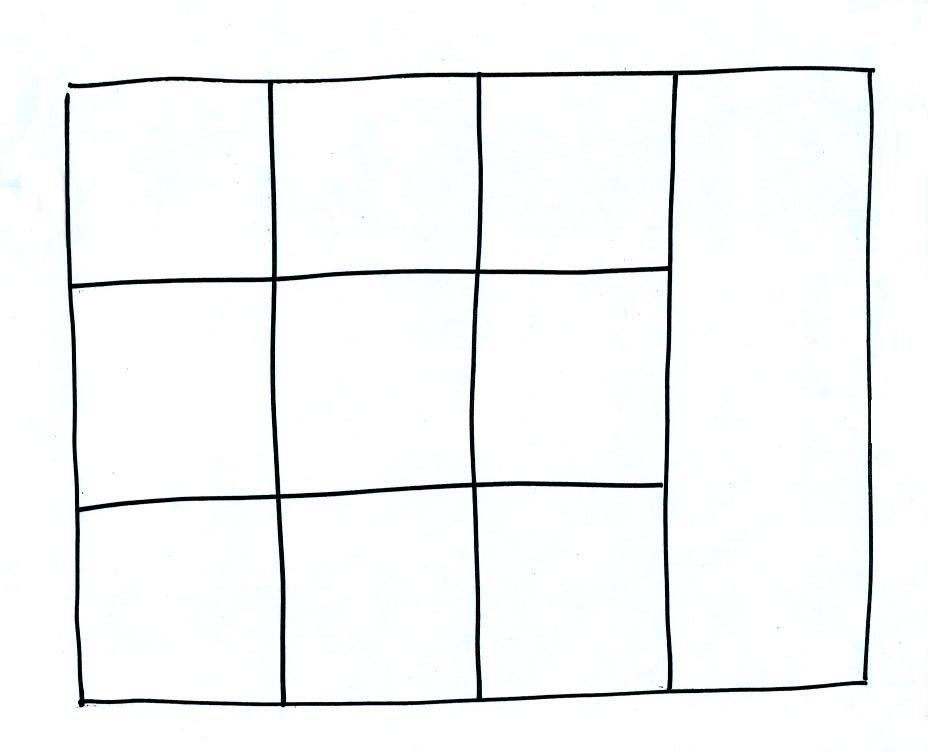
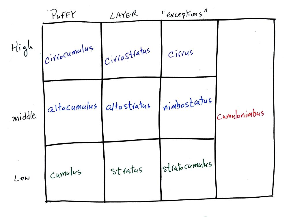
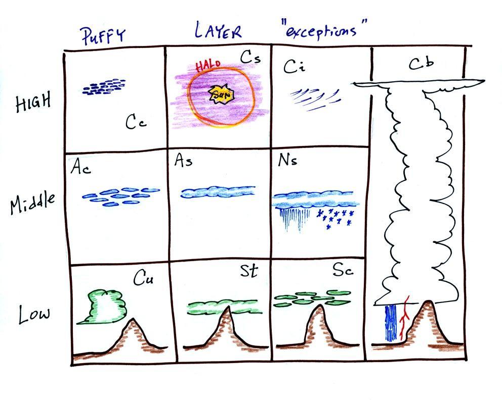
Drawing a chart like this on a blank
sheet of
paper is a good way to
review
cloud identification and classification.
There are 10 boxes in this chart, one
for each of the 10 main cloud types. Eventually, you should be
able to
put a cloud name, a sketch, and a short written description in each
square.
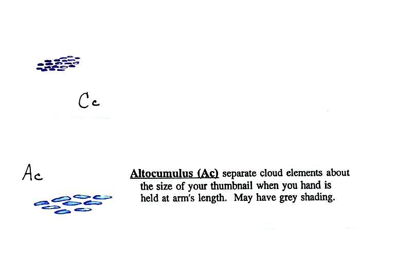
Clouds are classified
according to the altitude at which they form and
the
appearance of the cloud. There are two key words for altitude and
two key
words for appearance.
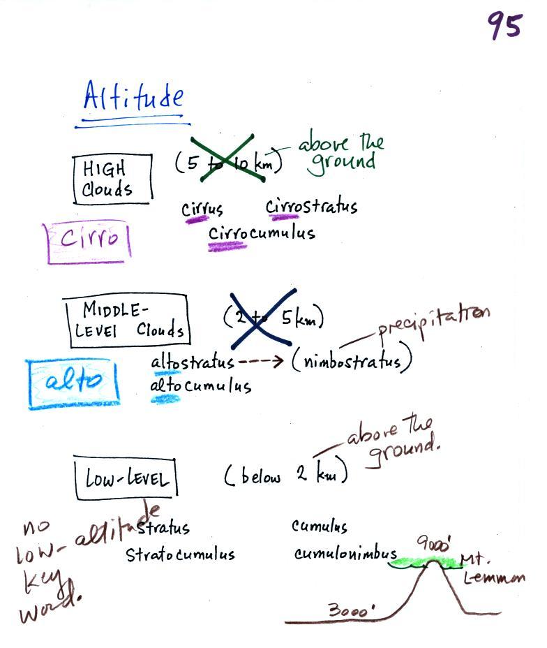
Clouds are grouped into one of three altitude
categories: high, middle
level,
and low. It is
very hard to just look up in the sky and determine a cloud's
altitude. You will need to look for other clues to distinquish
between high and middle altitude clouds. We'll learn about some
of the
clues when we look at cloud pictures later in the class.
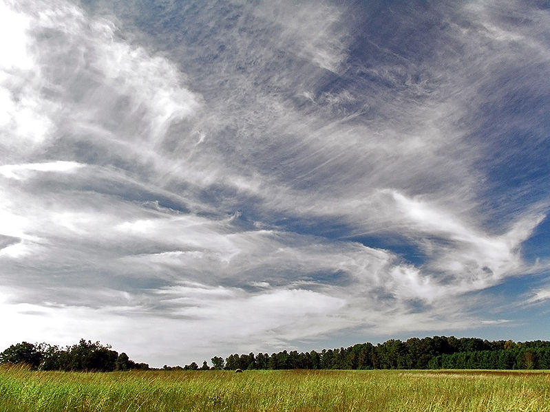
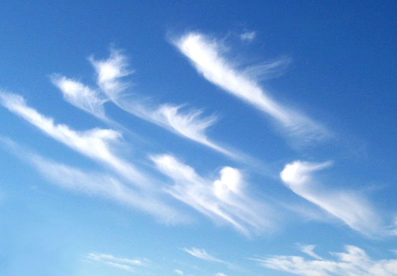
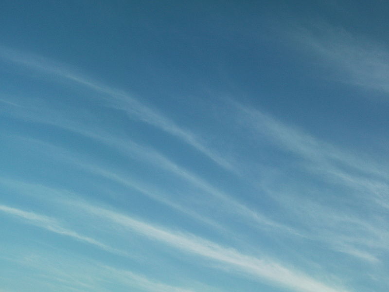
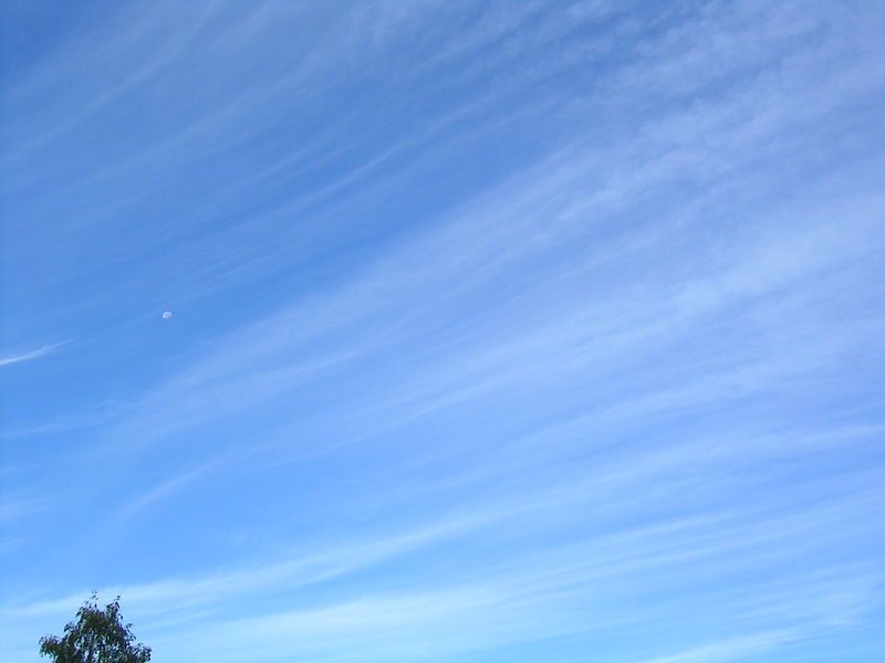
Cirrus or cirro
identifies a high altitude
cloud. There are three types of clouds found in the high altitude
category..
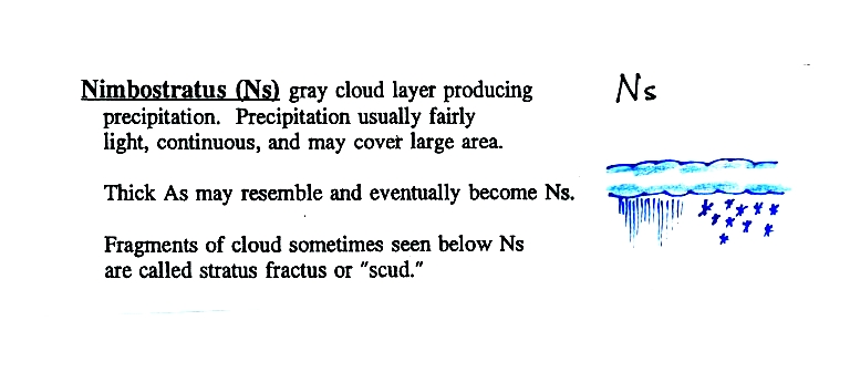
Alto in a cloud name means the cloud is found at middle altitude.
The
arrow connecting altostratus and nimbostratus indicates that they are
basically the same kind of cloud. When an altostratus cloud
begins to produce rain or snow
its
name is changed to nimbostratus. A nimbostratus cloud may become
somewhat thicker and lower than an altostratus cloud. Sometimes
it might
sneak into the low altitude category.
There is no key word for low altitude clouds. Low altitude clouds
have
bases that form 2 km or less above the ground. The summit of Mt. Lemmon in the Santa Catalina mountains
north of Tucson is about 2 km above the valley floor. Low altitude clouds will have bases that form at or
below the
summit of Mt. Lemmon.
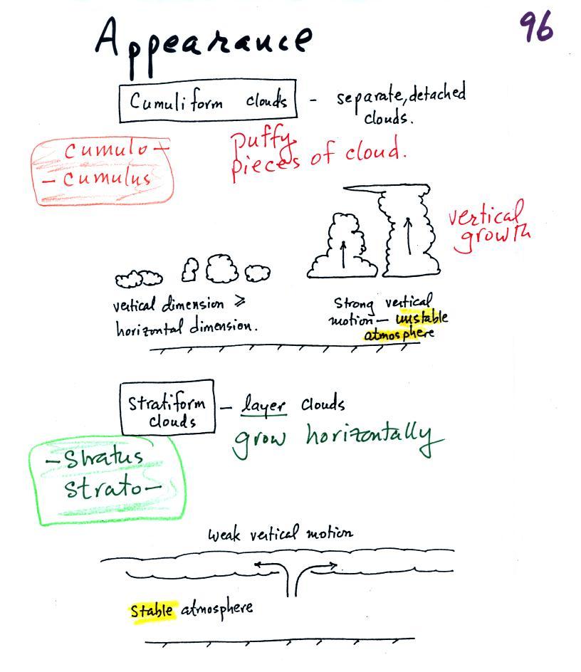
Clouds can have a patchy of puffy (or lumpy,
wavy, splotchy or ripply) appearance.
These
are cumuliform clouds and will have cumulo
or cumulus
in their name. In an unstable atmosphere cumuliform clouds will
grow vertically.
Strong thunderstorms can produce dangerous severe weather.
Stratiform clouds grow horizontally and
form
layers. They form when the atmosphere is stable.
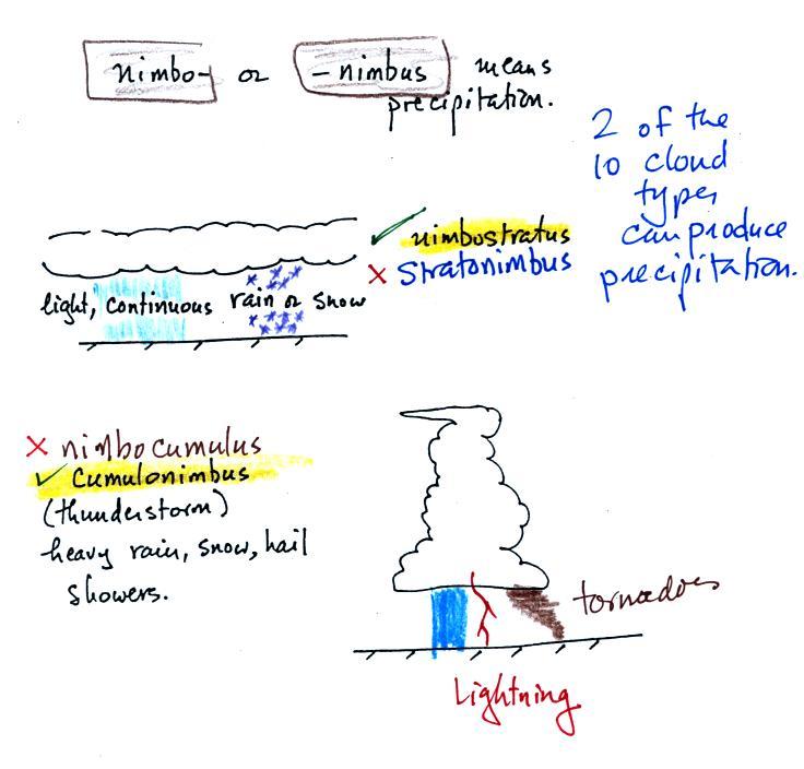
The last key word, nimbo
or nimbus, means
precipitation (it is also the name of a local brewing company). Only
two of the 10 cloud types are able to produce
(significant
amounts of) precipitation. It's not as easy as you might think to
make precipitation. We'll start to look at precipitation
producing processes in class starting on Friday.
Nimbostratus clouds tend to produce
fairly light precipitation over a
large
area. Cumulonimbus clouds produce heavy showers over localized
areas. Thunderstorm clouds can also produce hail, lightning, and
tornadoes. Hail would never fall from a
Ns
cloud.
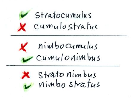
While you are still learning the cloud names you might put the correct
key
words together in the wrong order (stratonimbus
instead of nimbostratus, for example). You won't be penalized for
those kinds of errors
in this
class because you are putting together the right two key words.
Here's
the cloud chart from earlier. We've added the three altitude
categories
along the vertical side of the figure and the two appearance categories
along
the top. By the end of the class we will add a picture to each of
the
boxes.
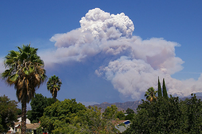
On Monday we cooled some moist air and created a cloud in a
bottle. We were able to make the cloud more visible by adding
smoke from a burning match to the demonstration. The smoke
particles acted as condensation nuclei.
Something like this
occurs in nature. A brush fire in this picture is
heating up air and causing it to rise. Combustion also adds some
moisture and lots of smoke particles to the air. You can see that
initially the rising air doesn't form a cold. A little higher
Once the rising air has cooled enough (to the dew point) a cloud does
form. And notice the cloud's appearance - puffy and not a layer
cloud. Cumulus should be in the cloud name. These kinds of
fire caused clouds are called pyrocumulus clouds. Here's a pretty
nice example from a Wikipedia
article about these kinds of clouds.
The fire in this case was the "Station Fire"
burning near Los Angeles in August 2009.
Next
we looked at photographs of most of the 10 cloud types. You'll find the
written
descriptions of the cloud types in the images below on pps
97-98 in the ClassNotes.
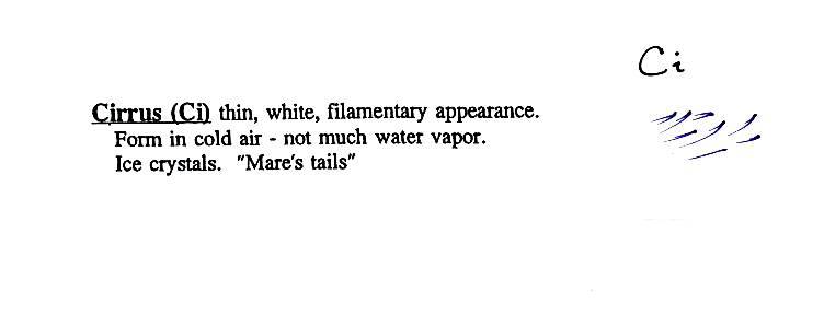
HIGH ALTITUDE CLOUDS
High altitude
clouds
are thin
because the air at high altitudes is very cold and cold air can't
contain much
moisture (the saturation mixing ratio for cold air is very
small). These
clouds are also often blown around by fast high altitude winds.
Filamentary means "stringy" or "streaky". If you
imagine trying to paint a Ci cloud you
would dip a
small pointed brush in white paint brush it quickly and lightly across
a blue
colored canvas. Here are some pretty good photographs of cirrus
clouds (they are all from a Wikipedia article on
Cirrus Clouds)
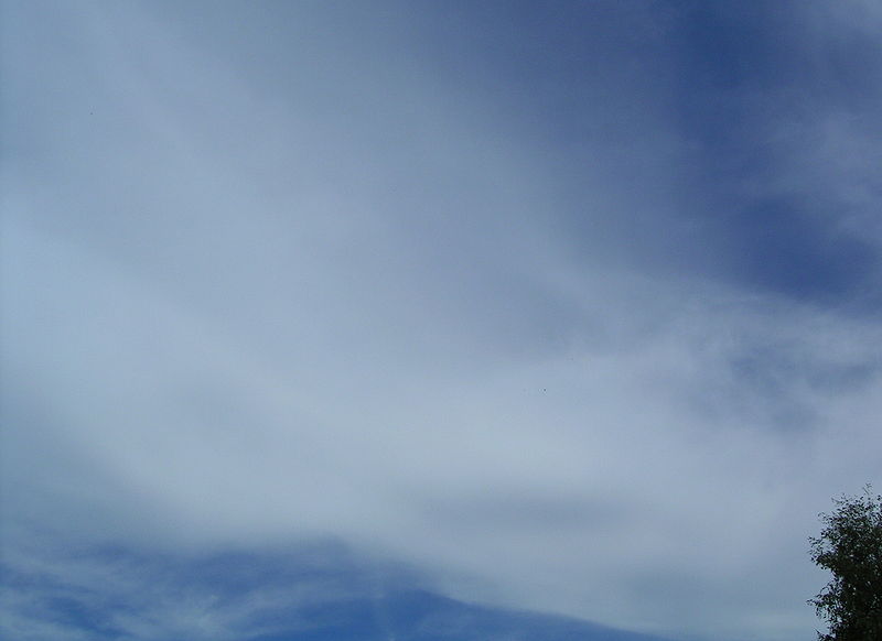
A
cirrostratus cloud is a thin uniform white layer cloud (not purple as
shown in
the figure) covering part or all of the sky. They're so thin you
can
sometimes see blue sky through the cloud layer. Haloes are a
pretty sure
indication that a cirrostratus cloud is overhead. If you were
painting Cs
clouds you could dip a broad brush in watered down white paint and then
paint back and forth across the canvas.
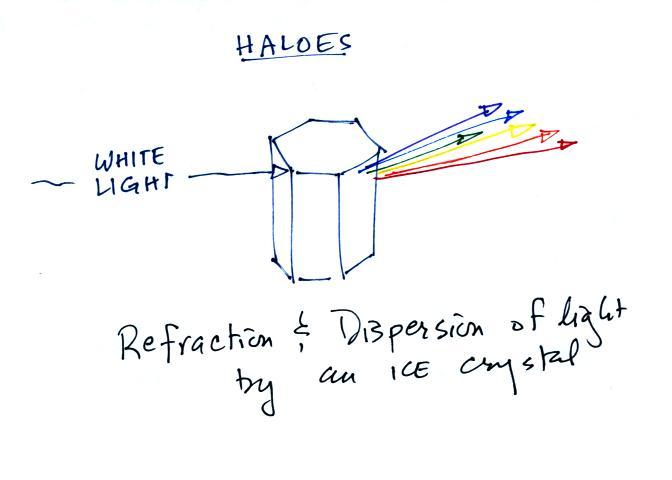
Now a detour to
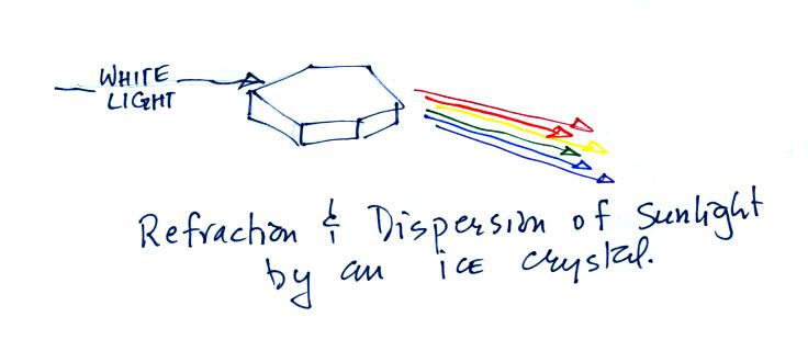
briefly discuss haloes and sundogs.
Haloes
are
produced when white light
(sunlight or moonlight) enters a 6 sided ice crystal. The light
is refracted (bent). The amount
of
bending depends on the color (wavelength) of the light
(dispersion). The
white light is split into colors just as light passing through a glass
prism. Crystals like this (called columns) tend to be randomly
oriented in the air. That is why a halo forms a complete ring
around
the sun or moon.
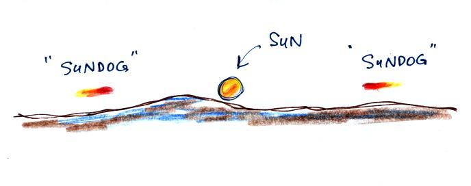
This is a flatter crystal and is
called a plate. These crystals
tend to
all be horizontally oriented and produce sundogs which are only a
couple of small sections of a complete halo. A sketch of a
sundog is
shown below.
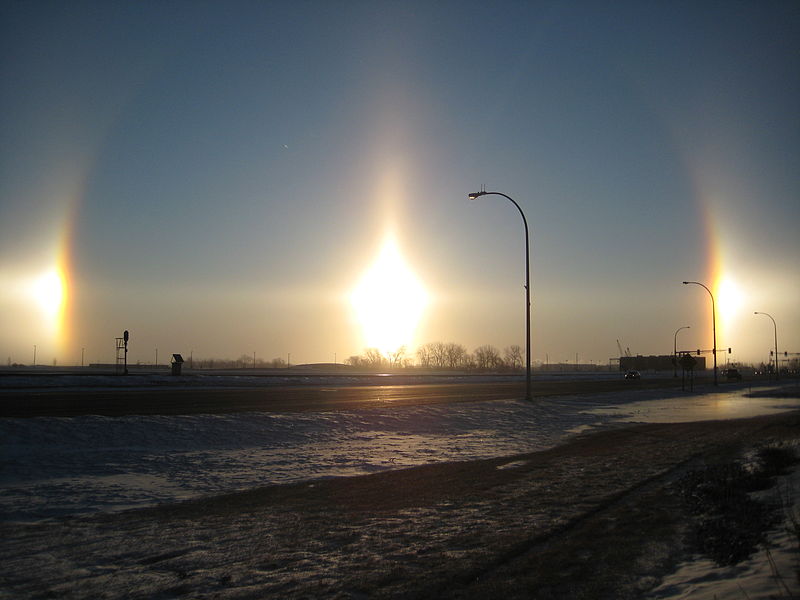
Sundogs are
pretty
common and are
just patches of light seen to the right and left of the rising or
setting sun.
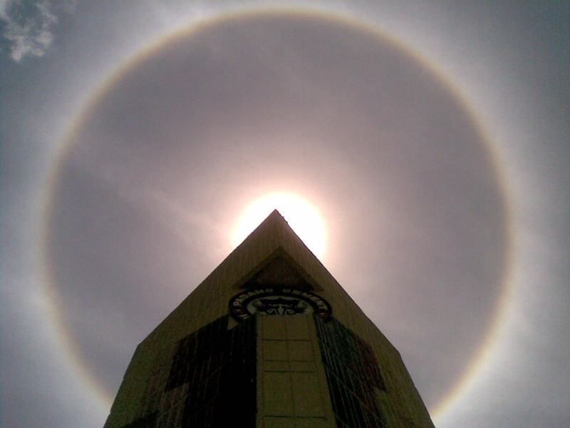
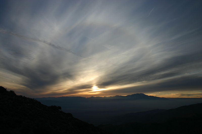
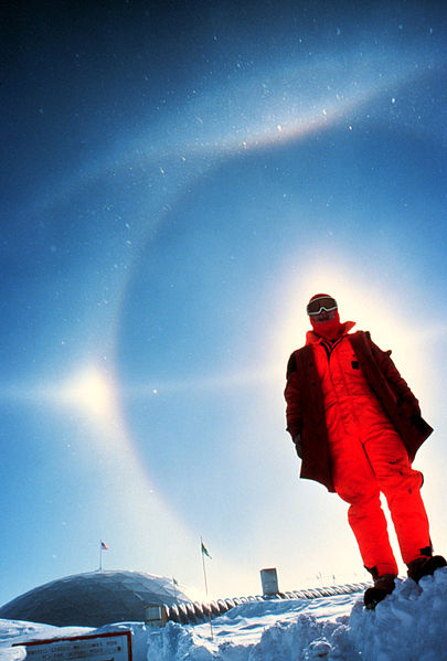
A very bright halo is shown at upper left
with the sun partially
blocked by a building. Note the sky inside the halo is darker
than the sky outside the halo. The halo at upper right is more
typical of what you might see in Tucson. Thin cirrus clouds may
appear thicker at sunrise or sunset because the sun is shining through
the cloud at a steeper angle. Very bright sundogs (also known as
parhelia) are shown in the photograph at bottom left. The sun in
the photograph at right is behind the person. You can see both a
halo and a sundog (the the left of the sun) in this photograph. Sources
of
these
photographs:
upper
left, upper
right, bottom row.
If you spend
enough time outdoors looking up at the sky you will
eventually see all 10 cloud types. Cirrus and cirrostratus clouds
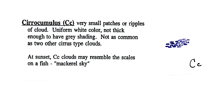
are fairly common. Cirrocumulus
clouds are
a little more unusual. The same is true with animals,
some
are
more
commonly
seen
in the desert around Tucson (and even in town) than others.
To
paint a Cc cloud you would dip a sponge in white paint and press it
gently
against the canvas. You would leave a patchy, splotchy appearing
cloud
(sometimes you might see small ripples). It is the patchy (or
wavy)
appearance that makes it a cumuliform cloud.
The table below compares cirrostratus (the cloud on the left
without texture) with a good example of a cirrocumulus cloud (the
"splotchy" appearing cloud on the right). Both photographs are
from the Wikipedia article mentioned earlier.
MIDDLE ALTITUDE
CLOUDS
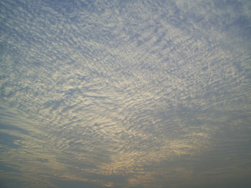
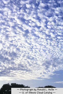
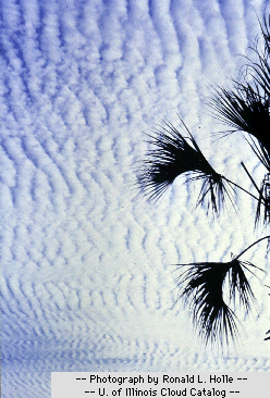
Altocumulus
clouds
are
pretty
common.
Note since it is
hard to
accurately judge altitude, you must rely on cloud element size
(thumbnail size
in the case of Ac) to determine whether a cloud belongs in the high or
middle
altitude category. The cloud elements in Ac clouds appear
larger
than in Cc because the cloud is closer to the ground. A couple of
photographs are shown below (source: Ron Holle for WW2010 Department of
Atmospheric Sciences, the University of Illinois at Urband-Champaign)
There's a much larger collection in this gallery
of
images. The fact that there are so many examples is an
indication of how common this particular type of cloud is.
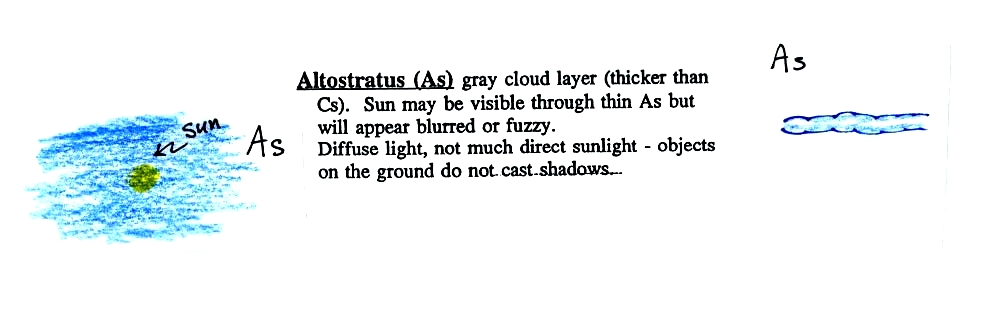
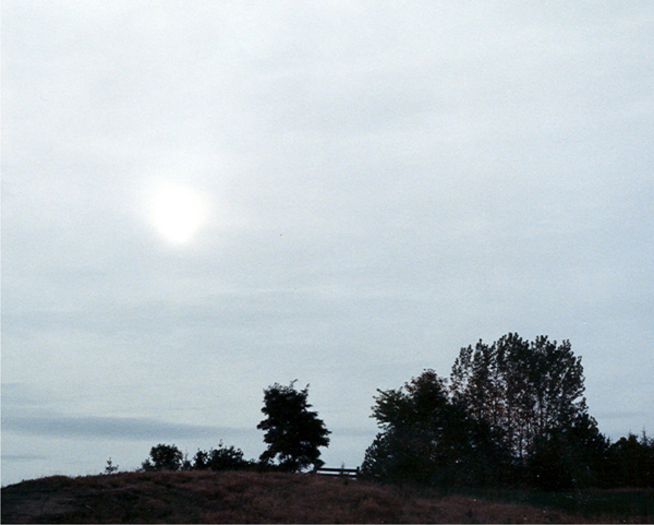
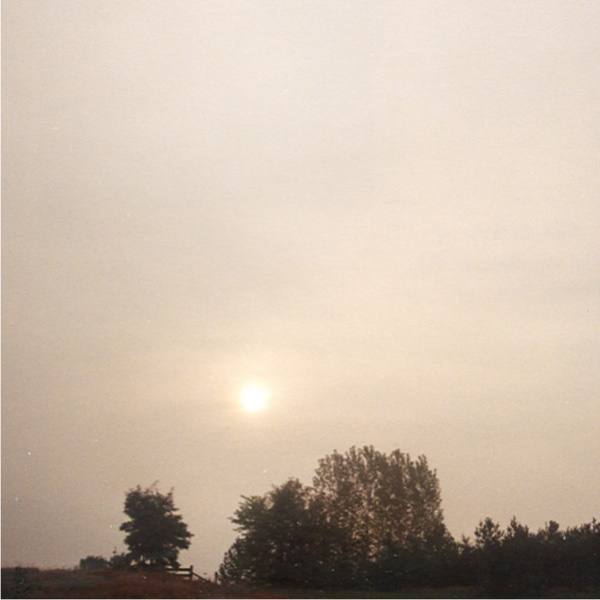
Altostratus
clouds are
thick
enough that you probably won't see a shadow if you look down at your
feet. The sun may or may not be visible through the cloud.
Three examples are shown below (the first is from a
Wikipedia article, the middle and right
photograph are from an Environment
Canada web page)
When (if) an
altostratus cloud begins to produce
precipitation, its
name is changed to nimbostratus.
Unless you were there and could see if it was raining or snowing
you might call this an altostratus or even a stratus cloud. The
smaller darker cloud fragments that are below the main layer cloud are
"scud" (stratus fractus) clouds (source
of this image).
LOW
ALTITUDE
CLOUDS
This cloud name
is a
little
unusual because the two key words for cloud appearance have been
combined, but that's a good description of this cloud type - a "lumpy
layer cloud". Remember there isn't a key word for low altitude
clouds.

|
|
Because they are closer to the ground, the
separate
patches of
Sc are about fist size. The patches of Ac, remember, were about
thumb
nail size.(sources of the photographs:
left photo, right
photo ). If the cloud fragments in the photo at right are
clearly separate from each other (and you would need to be underneath
the clouds so that you could look to make this determination) these
clouds would probably be
"fair weather" cumulus. If the patches of cloud are touching each
other then
stratocumlus would be the correct designation.

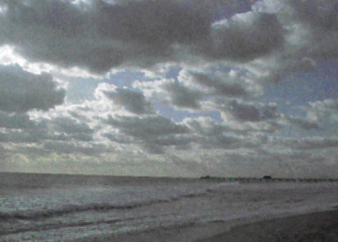
I didn't show any photos of stratus
clouds in class. Other than being closer to the ground it really
isn't much different from altostratus or nimbostratus.
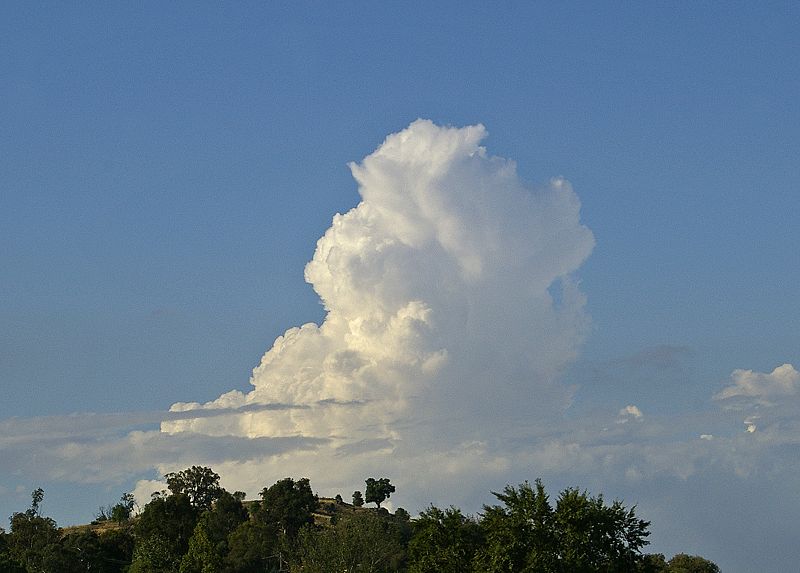
A photograph of "fair weather" cumulus
on the left (source)
and
cumulus
congestus
or
towering
cumulus
on
the
right (source)
THUNDERSTORMS
FIT
INTO
ALL
3 ALTITUDE CATEGORIES
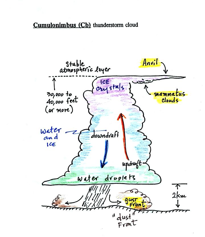
There are lots of
distinctive
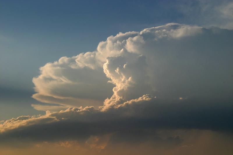
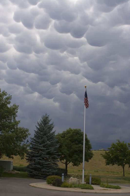
features on cumulonimbus clouds including the flat anvil top and the
lumpy mammatus clouds sometimes found on
the underside of the
anvil.
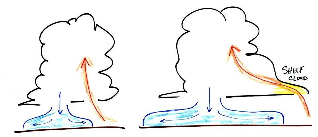
Cold dense
downdraft winds hit the ground below a
thunderstorm and
spread out horizontally underneath the cloud. The leading edge of
these
winds produces a gust front (dust front might be a little more
descriptive).
Winds at the ground below a thunderstorm can exceed 100 MPH, stronger
than many
tornadoes.
The top of a
thunderstorm (violet in the sketch) is cold enough that it will
be
composed of just ice crystals. The bottom (green) is composed of
water
droplets. In the middle of the cloud (blue) both water droplets
and ice
crystals
exist together at temperatures below freezing (the water droplets have
a hard
time freezing). Water and ice can also be found together in
nimbostratus
clouds. We will see that this mixed phase region of the cloud is
important
for precipitation formation. It is also where the electricity
that
produces lightning is generated.
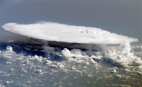
The top left
photo shows a thunderstorm viewed from space (source: NASA Earth Observatory).
The
flat
anvil
top
is
the dominant feature. The remaining three
photographs are from the UCAR
Digital
Image
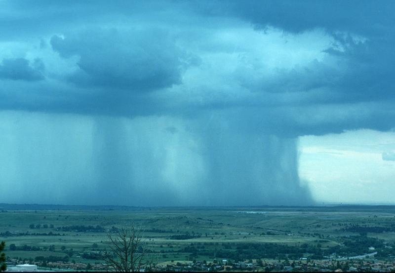
Library. The bottom left photograph shows heavy
by localized rain falling from a thunderstorm. At bottom right is
a photograph of mammatus clouds found on the underside of the flat
anvil cloud.
Cold air spilling
out
of the base
of a thunderstorm is just beginning to move outward from the bottom
center of the
storm in the picture at left. In the picture at right the
cold air
has moved further outward and has begun to get in the way of the
updraft.
The updraft is forced to rise earlier and a little ways away from the
center of
the thunderstorm. Note how this rising air has formed an extra
lip of
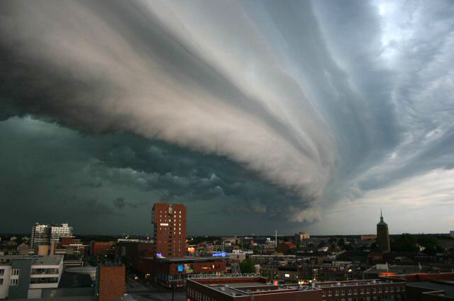
cloud. This is called a shelf cloud.
Shelf clouds can sometimes be quite
impressive (the picture above is from a Wikipedia article on
arcus clouds)
Here's the completed cloud chart - it will appear on a ATMO 170 T-shirt
one day.
And here's a link to a cloud
chart on a National Weather Service webpage. It has
photographs of all the main cloud types we have discussed.


