You should try to learn these 10 cloud
names. Not just because
they might
be on a quiz but because you will be able to spot them and name them
when you see these different kinds of clouds outdoors.
There is a smart and a not-so-smart way of
learning
these names. The not-so-smart way is to just memorize them.
You
will inevitably get them mixed up. A better way is to recognize
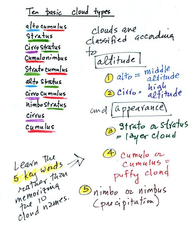
that all
the cloud names are made up of key words. The 5 key words
mostly tell you something about the cloud altitude and appearance.
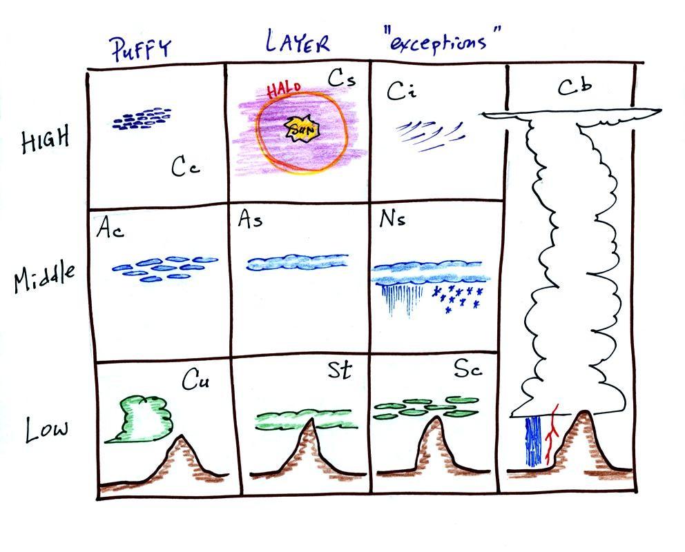
Drawing a figure like this on a blank sheet of
paper is a good way to
review
cloud identification and classification.
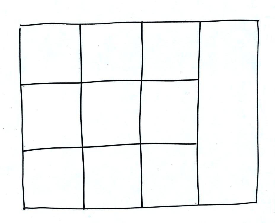
Each of the clouds above has a box reserved for
it in the figure. You should be able eventually to fill each box
with a name, a sketch, and a short description of each cloud type.
Clouds are classified according to the altitude at which they form and
the
appearance of the cloud. There are two key words for altitude and
two key
words for appearance.
Clouds are grouped into one of three altitude
categories: high, middle
level,
and low.
Cirrus or cirro
identifies a high altitude
cloud. There are three types of clouds found in the high altitude
category..
Alto in a cloud name means the cloud is found at middle altitude.
The
arrow connecting altostratus and nimbostratus indicates that they are
very
similar. When an altostratus cloud begins to produce rain or snow
its
name is changed to nimbostratus. A nimbostratus cloud is also
often somewhat
thicker and lower than an altostratus cloud. Sometimes it might
sneak into the low altitude category.
It is very hard to just look up at the sky and directly determine a
cloud's
altitude. You will need to look for other clues to distinquish
between high and middle altitude clouds. We'll learn about some
of the
clues when we look at cloud pictures and discuss individual cloud types
later in this lecture.
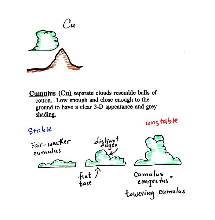
There is no key word for low altitude clouds. Low altitude clouds
have
bases that form 2 km or less above the ground. The summit of
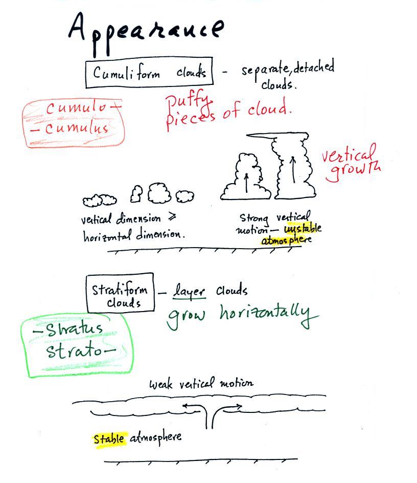
Clouds can have a patchy of puffy (or lumpy,
wavy, or ripply) appearance.
These
are cumuliform clouds and will have cumulo or cumulus
in
their
name.
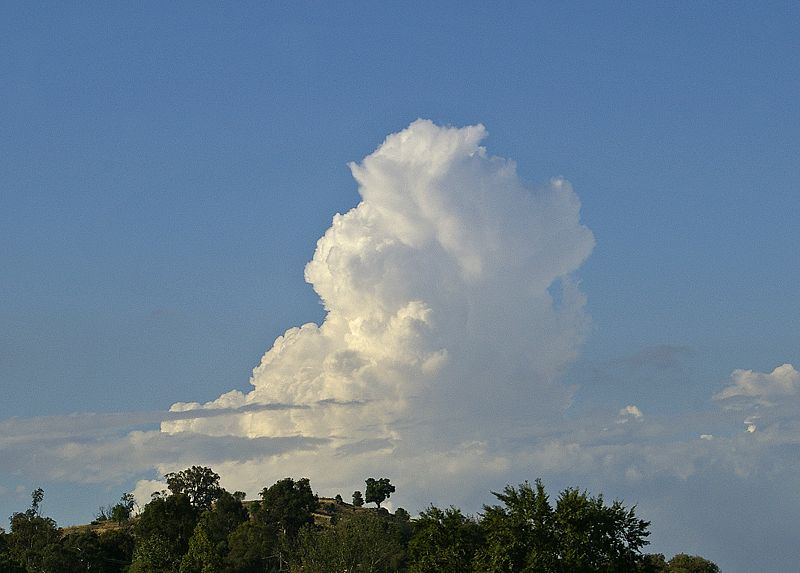
In an unstable atmosphere cumuliform clouds will
grow vertically.
Strong thunderstorms, cumulonimbus clouds, can produce severe and
dangerous weather conditions.
Stratiform clouds grow horizontally and
form
layers. They form when the atmosphere is stable. You'll
find strato or stratus in the cloud name.
Cirrus clouds
are sometimes considered to be a third type of cloud appearance.
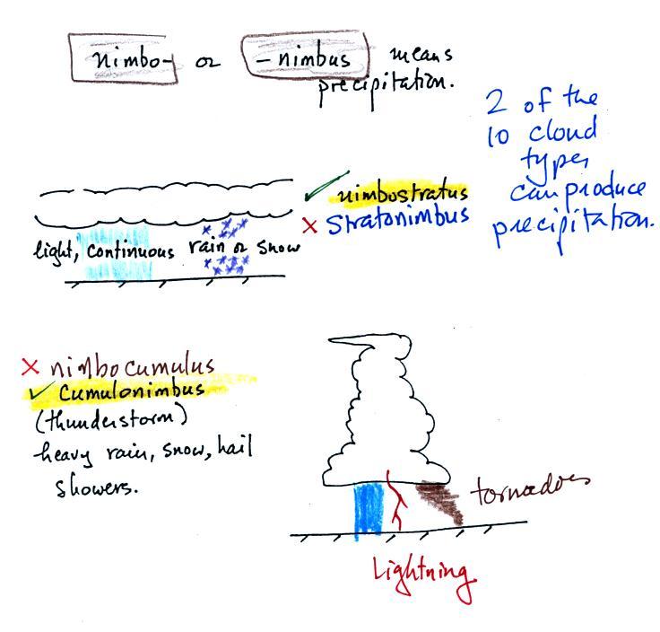
The last key word, nimbo
or nimbus, means
precipitation. Only two of the 10 cloud types are able to produce
(significant
amounts of) precipitation. It's not as easy as you might think to
make precipitation.
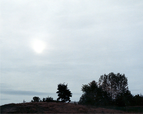
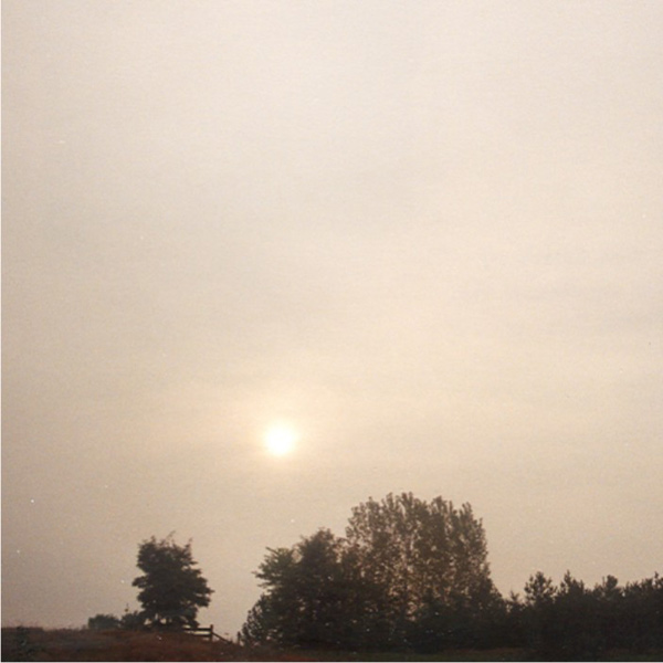
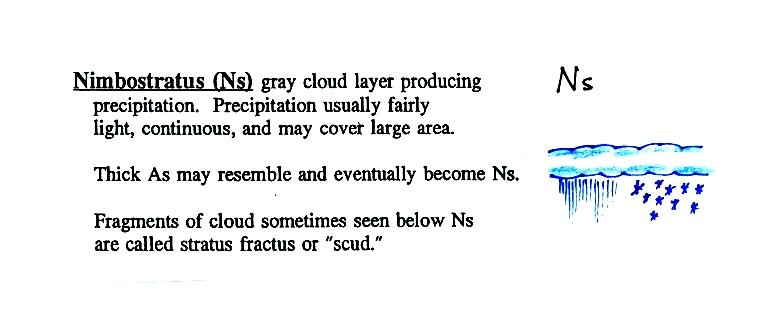
Nimbostratus (Ns) clouds tend to produce fairly light precipitation
over a
large
area. Cumulonimbus (Cb) clouds produce heavy showers over
smaller and more localized
areas. Thunderstorm clouds can also produce hail, lightning, and
tornadoes. Hail would never fall from a
Ns
cloud.
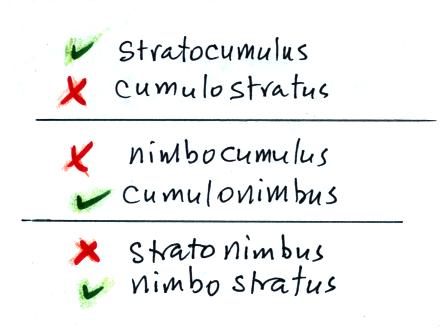
While you are still learning the cloud names you might put the correct
key
words together in the wrong order (stratonimbus
instead of nimbostratus or nimbocumulus
instead of
cumulonimbus).
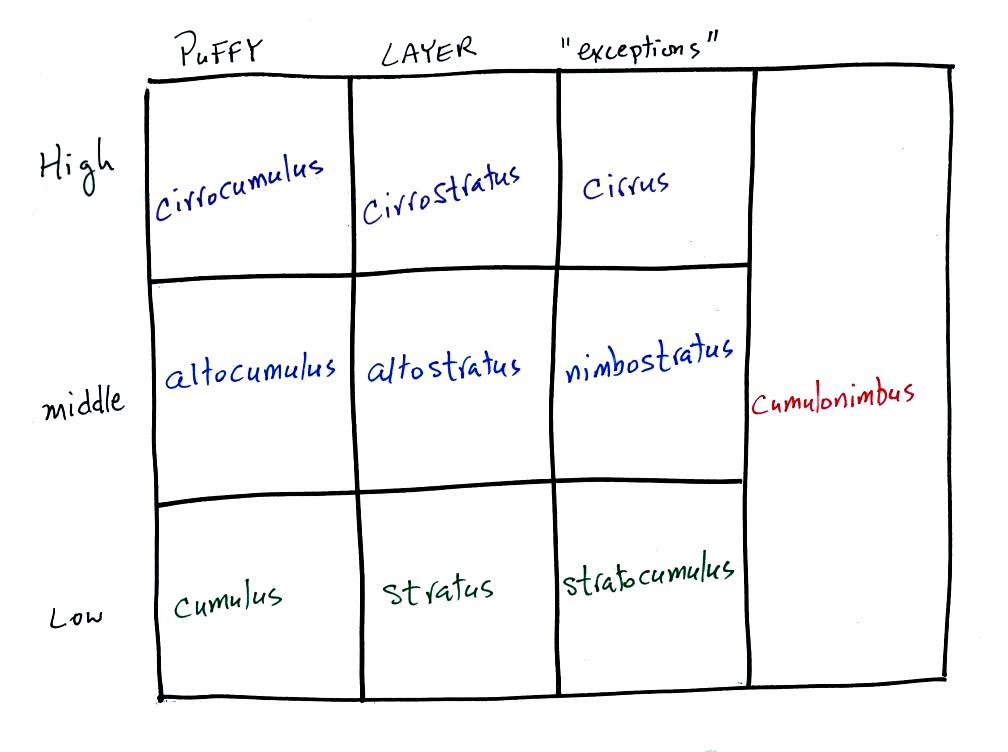
Here's
the cloud chart from earlier. We've added the three altitude
categories
along the vertical side of the figure and the two appearance categories
along
the top. By the end of the class we will add a picture to each of
the
boxes.
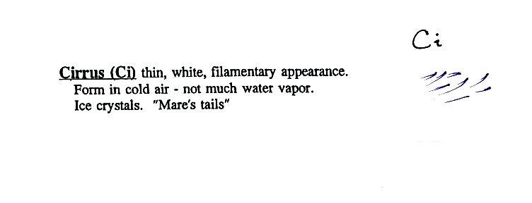
High altitude
clouds
are thin
because the air at high altitudes is very cold and cold air can't
contain much
moisture (the saturation mixing ratio for cold air is very
small). These
clouds are also often blown around by fast high altitude winds.
Filamentary means "stringy" or "streaky". If you
imagine trying to paint a Ci cloud you
would dip a
small pointed brush in white paint brush it quickly and lightly across
a blue
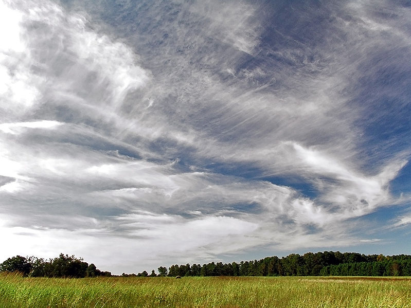
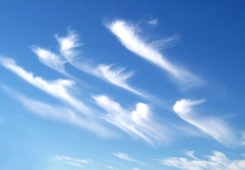
colored canvas. Here are
some pretty good photographs of cirrus
clouds (they are all from a Wikipedia article on
Cirrus Clouds)
 |
 |
 |
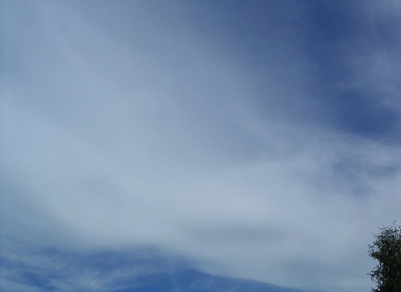 |
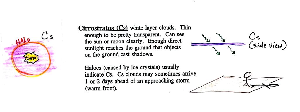
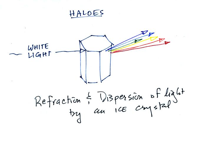
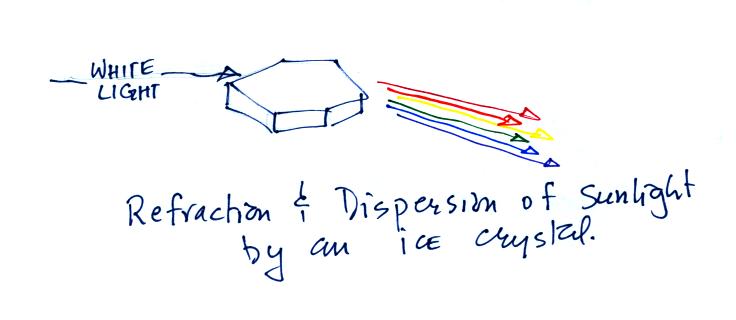
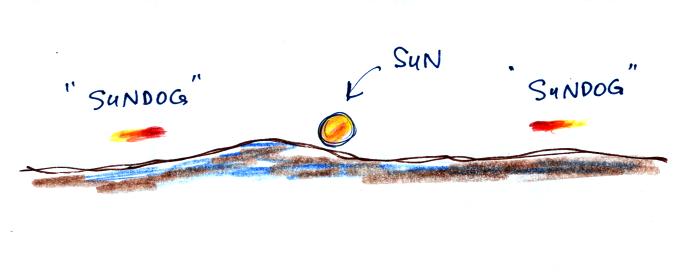
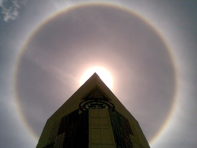
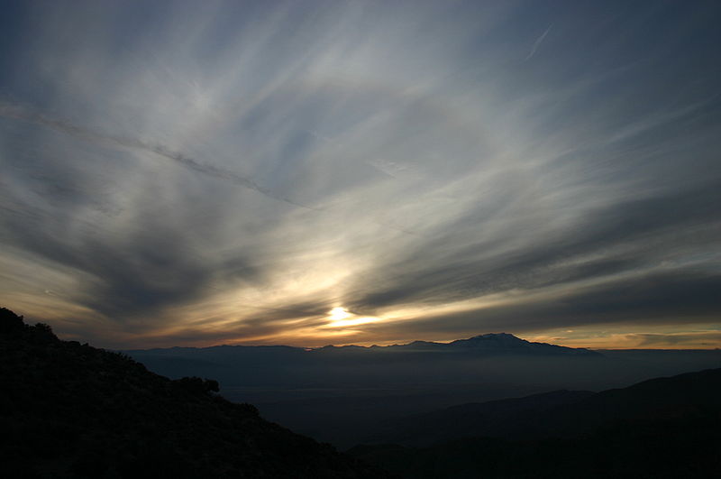
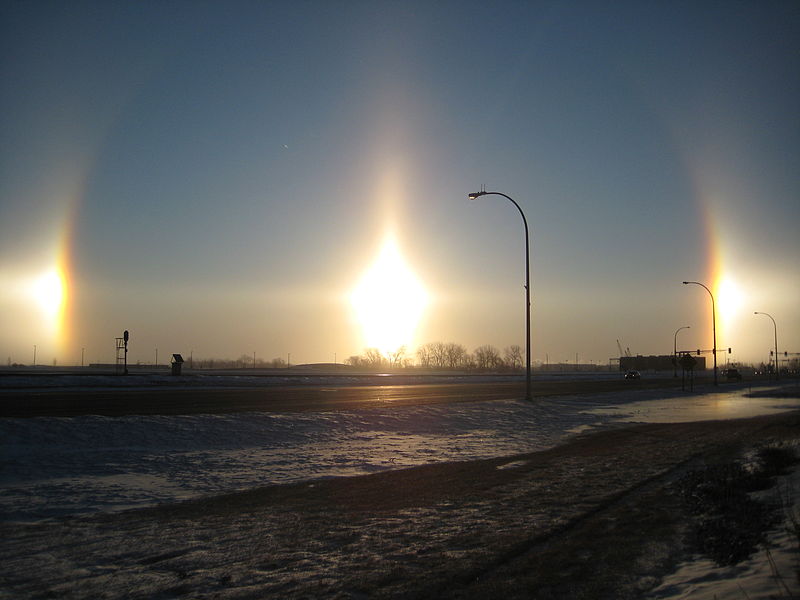
A cirrostratus cloud is a thin uniform white layer cloud (not purple as shown in the figure) covering part or all of the sky. They're so thin you can sometimes see blue sky through the cloud layer. Haloes are a pretty sure indication that a cirrostratus cloud is overhead. If you were painting Cs clouds you could dip a broad brush in white paint (diluted perhaps with water) and then paint back and forth across the canvas. Note the two views show you looking through the cloud at the sun (left) and from the side (right) to emphasize how thin these high altitude layer clouds are.
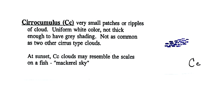
Cirrus and cirrostratus
clouds are fairly common. Cirrocumulus
clouds are
a little more unusual.
 |
 |
 |
 |
 |
 |
 |
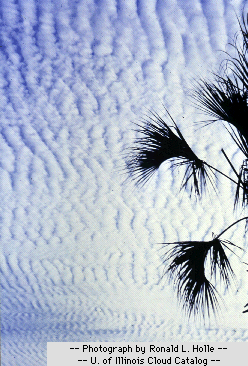 |
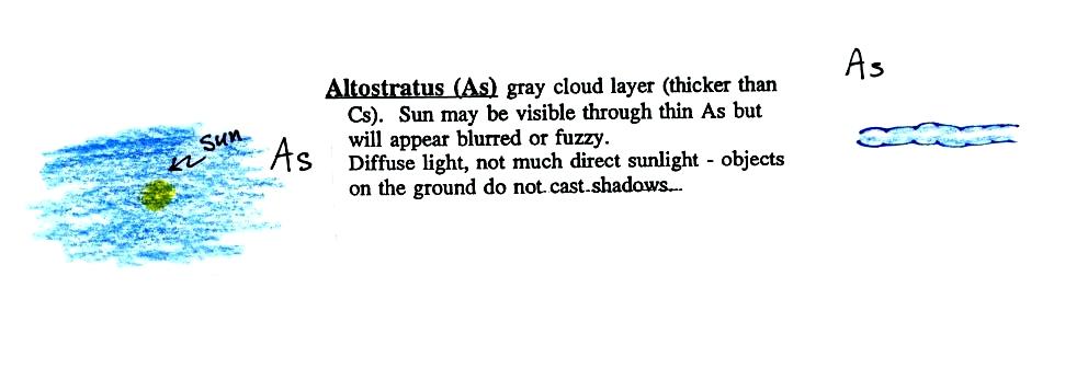
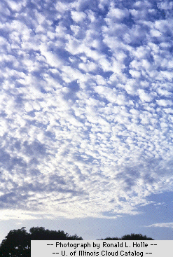
Altostratus
clouds are
thick
enough that you probably won't see a shadow if you look down at your
feet. The sun may or may not be visible through the cloud. When (if) an altostratus cloud begins to produce
precipitation, its
name is changed to nimbostratus. The figure shows you looking
through the cloud at left and viewing the cloud from the side at right.
Three examples
are shown below (the first is from a
Wikipedia article, the middle and right
photograph are from an Environment
Canada web page)
 |
 |
 |
 |
This cloud name
is a
little
unusual because the two key words for cloud appearance have been
combined, but that's a good description of this cloud type - a "lumpy
layer cloud".
 |
 |
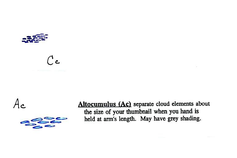
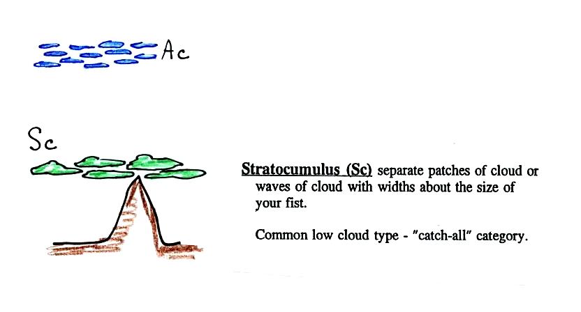
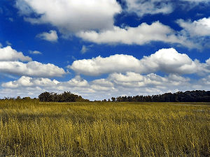
Because they are closer to the ground, the separate patches of Sc are about fist size. The patches of Ac, remember, were about thumb nail size (sources of the photographs: left photo, right photo ). If the cloud fragments in the photo at right are clearly separate from each other (and you would need to be underneath the clouds so that you could look up) these clouds would probably be "fair weather" cumulus. If the patches of cloud are touching then stratocumlus would be the correct designation.
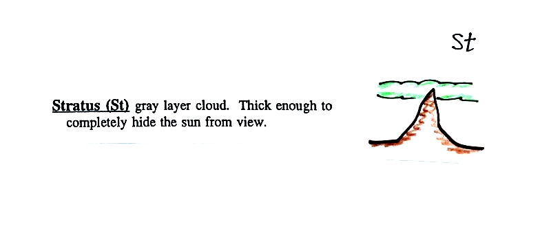
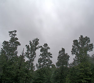
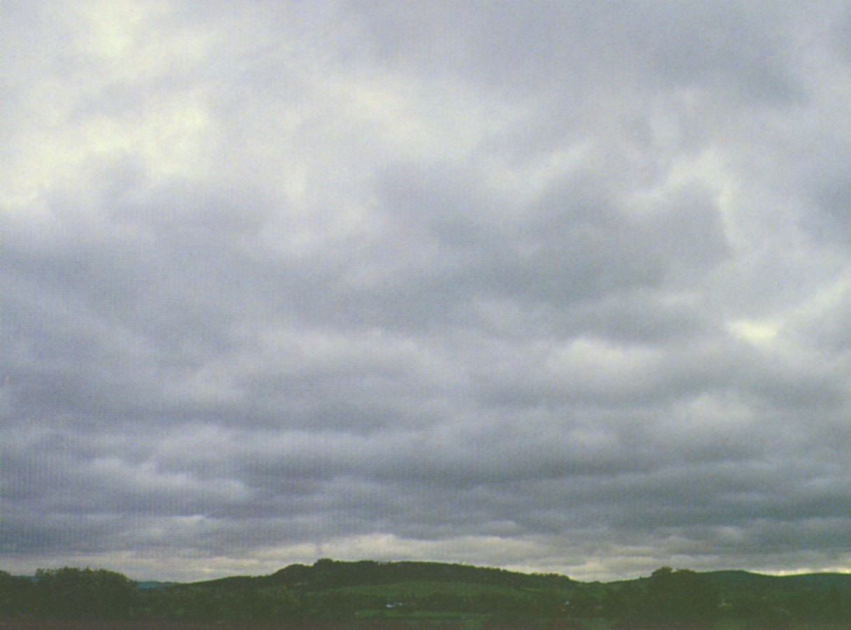
Stratus clouds
(here viewed from the side) are usually thick enough to completely hide
the sun.
 |
 |
There are lots of
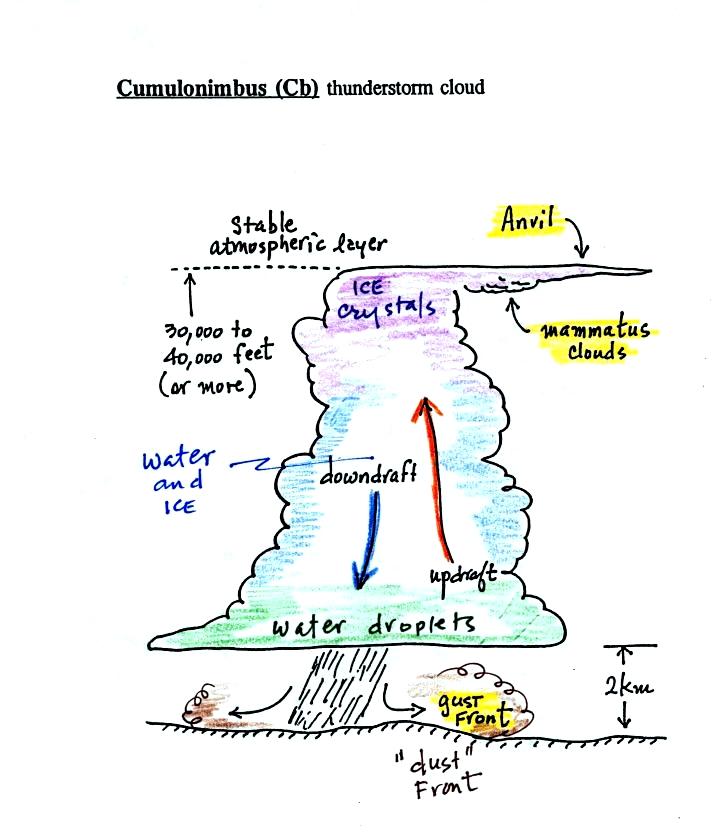
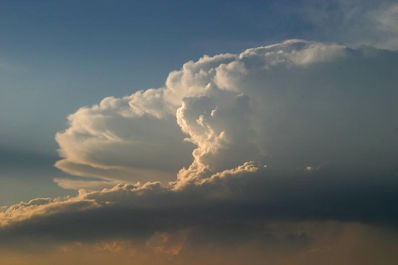
distinctive
features on cumulonimbus clouds including the flat anvil top and the
lumpy mammatus clouds sometimes found on
the underside of the
anvil.
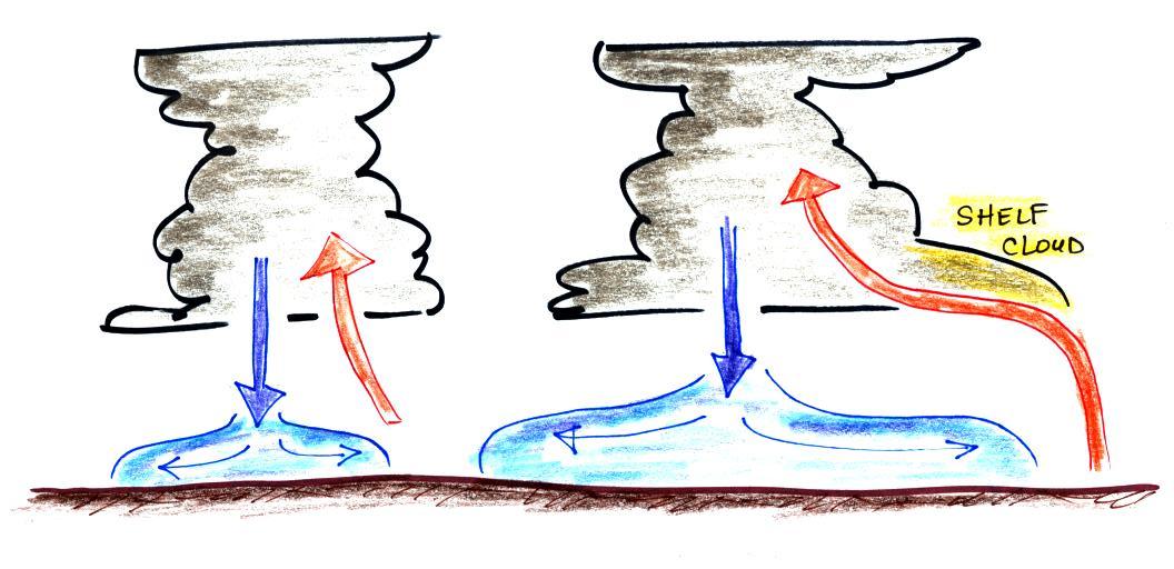
Cold dense
downdraft winds hit the ground below a
thunderstorm and
spread out horizontally underneath the cloud. The leading edge of
these
winds produces a gust front (dust front might be a little more
descriptive).
Winds at the ground below a thunderstorm can exceed 100 MPH, stronger
than many
tornadoes.
The top of a
thunderstorm (violet in the sketch) is cold enough that it will
be
composed of just ice crystals. The bottom (green) is composed of
water
droplets. In the middle of the cloud (blue) both water droplets
and ice
crystals
exist together at temperatures below freezing (the water droplets have
a hard
time freezing). Water and ice can also be found together in
nimbostratus
clouds. We will see that this mixed phase region of the cloud is
important
for precipitation formation. It is also where the electricity
that
produces lightning is generated.
 |
 |
 |
 |
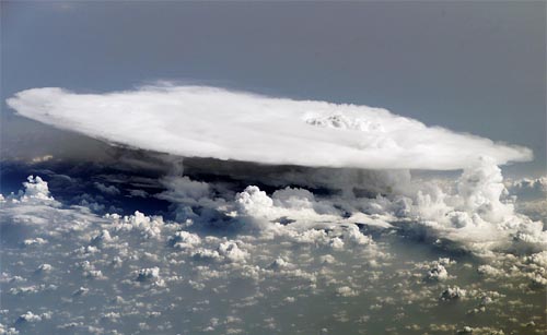
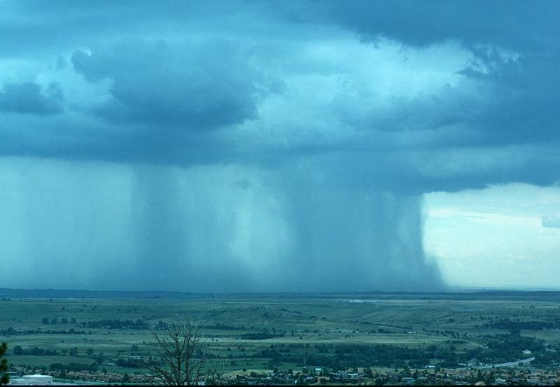
The top left photo shows a thunderstorm viewed from space (source: NASA Earth Observatory). The flat anvil top is the dominant feature. The remaining three photographs are from the UCAR Digital Image Library. The bottom left photograph shows heavy by localized rain falling from a thunderstorm. At bottom right is a photograph of mammatus clouds found on the underside of the flat anvil cloud.
Here's one final feature to look for at the bottom of a thunderstorm.